A Crag Guide gives an extensive view of all sub areas and climbs at a point in the index. It shows a snapshot of the index heirachy, up to 300 climbs (or areas) on a single web page. It shows selected comments climbers have made on a recently submitted ascent.
At a minor crag level this should be suitable for printing and taking with you on a climbing trip as an adjunct to your guidebook.
This guide was generated anonymously. Login to show your logged ascents against each route.
Warning
Rock climbing is extremely dangerous and can result in serious injury or death. Users acting on any information directly or indirectly available from this site do so at their own risk.
This guide is compiled from a community of users and is presented without verification that the information is accurate or complete and is subject to system errors. By using this guide you acknowledge that the material described in this document is extremely dangerous, and that the content may be misleading or wrong. In particular there may be misdescriptions of routes, incorrectly drawn topo lines, incorrect difficulty ratings or incorrect or missing protection ratings. This includes both errors from the content and system errors.
Nobody has checked this particlular guide so you cannot rely on it's accuracy like you would a store bought guide.
You should not depend on any information gleaned from this guide for your personal safety.
You must keep this warning with the guide. For more information refer to our:
Usage policy
Contributors
Thanks to the following people who have contributed to this crag guide:
Chris
Danger Innes
Alec Landstra
Chris McEwan
Bill Zhou
Ian
Alex Metcalfe
Alex Bowes
Kris Dhar
Luka Wheeler
The size of a person's name reflects their Crag Karma, which is their level of contribution. You can help contribute to your local crag by adding descriptions, photos, topos and more.
Table of contents
- 1.
Mulgoa lookout
40 in Area
- 1.1. Bolt Wall 0 in Cliff
- 1.2. Cookie cave 17 in Boulder
-
1.3.
Lookout Climbs 12 in Sector
- 1.3.1. Pogo Arete 1 in Area
- 1.4. Kick It 4 in Area
- 1.5. Dopest 7 in Area
- 2. Index by grade
1. Mulgoa lookout 40 routes in Area
- Summary:
-
Mostly Bouldering
Lat / Long: -33.815533, 150.622378
description
A few old sport routes with not much info and some new and old boulders scattered along the hillside.
access issues
Be sensible.
approach
Drive to end of Fairlight road, Mulgoa.
ethic
Although sport climbing is well entrenched as the most popular form of Blueys climbing, mixed-climbing on gear and bolts has generally been the rule over the long term. Please try to use available natural gear where possible, and do not bolt cracks or potential trad climbs. If you do the bolts may be removed.
Because of the softness of Blue Mountains sandstone, bolting should only be done by those with a solid knowledge of glue-in equipping. A recent fatality serves as a reminder that this is not an area to experiment with bolting.
If you do need to top rope, please do it through your own gear as the wear on the anchors is both difficult and expensive to maintain.
At many Blue Mountains crags, the somewhat close spacing of routes and prolific horizontal featuring means that it is easy to envisage literally hundreds of trivial linkups. By all means climb these to your hearts content but, unless it is an exceptional case due to some significant objective merit, please generally refrain from writing up linkups. A proliferation of descriptions of trivial linkups would only clutter up the guide and add confusion and will generally not add value to your fellow climbers. (If you still can't resist, consider adding a brief note to the parent route description, rather than cluttering up the guide with a whole new route entry).
If you have benefited from climbing infrastructure in NSW, please consider making a donation towards maintenance costs. The Sydney Rockclimbing Club Rebolting Fund finances the replacement of old bolts on existing climbs and the maintenance of other hardware such as fixed ropes and anchors. The SRC purchases hardware, such as bolts and glue, and distributes them to volunteer rebolters across the state of New South Wales. For more information, including donation details, visit https://sydneyrockies.org.au/rebolting/
It would be appreciated if brushing of holds and minimisation/removal of tick marks becomes part of your climbing routine. Consider bringing a water squirt bottle and mop-up rag to better remove chalk. Only use soft (hair/nylon) bristled brushes, never steel brushes.
The removal of vegetation - both from the cliff bases and the climbs - is not seen as beneficial to aesthetics of the environment nor to our access to it.
Remember, to maintain access our best approach is to 'Respect Native Habitat, Tread Softly and Leave No Trace'. Do not cut flora and keep any tracks and infrastructure as minimal as possible or risk possible closures.
For the latest access related information, or to report something of concern, visit the Australian Climbing Association NSW Blue Mountains page at https://acansw.org.au/blue-mountains/
history
Stu and Dan I think developed most of the cookie cave. Not sure about the old carrots on the lookout boulder. Dan and Todd threw some staino in round 09. New boulders found and climbed pre covid and during lockdowns
1.1. Bolt Wall 0 routes in Cliff
description
mixed and TR routes
approach
at the carpark. head back down the road and veer off right into the bush.
descent notes
head towards the water till it starts to decend the head SW. climb faces South
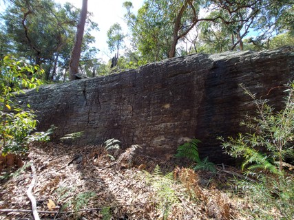
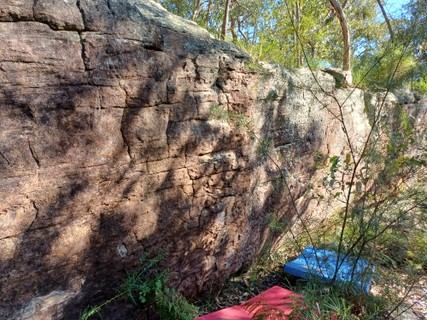
1.2. Cookie cave 17 routes in Boulder
- Summary:
-
All Bouldering
Lat / Long: -33.817769, 150.619249
description
Cool little cave with variety of problems. Just gave them cookie names after the cave, if the original setters want to change them go for it. Grades may be a little off going off memory from a few months ago. Plenty of other link ups and eliminates possible but don't want to clutter the page.
approach
walk straight down path (dont fang left like your going to the lookout) after bout 200 meters where the track goes right pull off left and follow obvious track heading down as it flattens out look left and you should be able to see the rock wall and cave. Map location approximate
history
stumbled onto it when scoping out the area. Dan was, and Stu still is Living in mulgoa. im pretty sure they know most about it.
  |
||||||||
| Route | Grade | Style | Selected ascents | |||||
|---|---|---|---|---|---|---|---|---|
| 1 |
★ Orange Slice
No hands slab | V0 | 3m | |||||
| 2 |
★ Vanilla Cream
No hands slab | V0 | 3m | |||||
| 3 |
Delta Cream
Sit start, up left then sidepull and pop to the top | V3 | 3m | |||||
| 4 |
★ Digestive
Probably the most obvious line on the wall. Has surely been done before. Sit start and climb up nice jugs | V0 | ||||||
| 5 |
Speculaas
Sit start at base of crescent feature and climb up nice edges | V2 | ||||||
  |
||||||||
| Route | Grade | Style | Selected ascents | |||||
| 6 |
Kingston
Up the weakness | V1 | 3m | |||||
| 7 |
★ Choc Chip
Up via edges | V2 | 3m | |||||
| 8 |
★ Anzac
Sit start left side of cave up and out on face | V1 | 3m | |||||
| 9 |
★★ Milk Coffee
Sit start as for Anzac then after the first move bust out right then head up through the harder top | V3 | 4m | |||||
| 10 |
★★ Oreo
Same as Milk Coffee but high jug traverse all the way to 4th top out spot | V4 | 4m | |||||
 |
||||||||
| Route | Grade | Style | Selected ascents | |||||
| 11 |
★★★ Tim Tam
Sart as for Oreo but take the lower line of holds to small edges and drop into the start of Iced Vovo finish as per Iced Vovo. Bottom shelf obviously off | V6 | 5m | |||||
| 12 |
★★ Choc Ripple
Sit start right of Anzac up to scoop via right sidepull undecling can be topped out in various spots as per the previous routes but the obvious is straight out | V3 | 4m | |||||
| 13 |
★★★ Nice
As per choc ripple but skip the right sidepull undercling and go from the sit to the scoop for a nice tension move | V4 | 4m | |||||
| 14 |
★★ Monte Carlo
Sit start on third start position bottom shelf is off, go up and left via edges and jugs finish up Nice exit | V4 | 4m | |||||
| 15 |
★★ Iced Vovo
Third start position but head up right with a throw to jug | V3 | 4m | |||||
| 16 |
★ Scotch Finger
Sit start on arete, go up and left to top | V1 | 4m | |||||
| 17 |
★ Teddy Bear
Sit start and up arete | V0 | 4m | |||||
 Alec Landstra
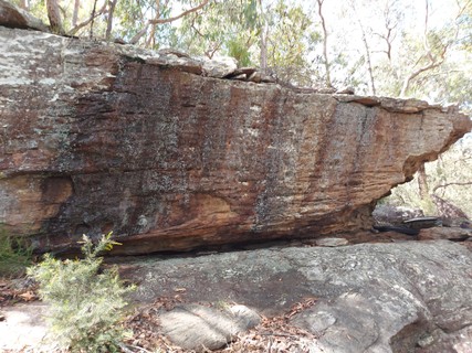
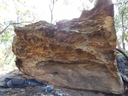
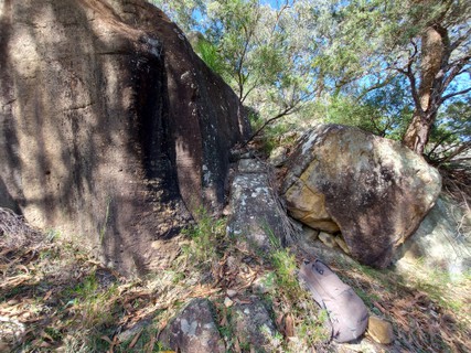
1.3. Lookout Climbs 12 routes in Sector
- Summary:
-
Mostly Bouldering
Lat / Long: -33.818304, 150.617772
description
Todds helm and a handful of boulders
approach
head to the lookout. lookout boulder has some old carrots and decent pro for top anchors.
descent notes
Walk to the lookout rock then go down the track on the right for Rapa Nui from there head down and left to get to Todds helm and further down to get to GG and Cube it is a hillside and can be slippery on the leaf litter. Might be worth while finding the boulders before trekking pads down should add gps locations at some point.
history
Carrots and lookout climbs unknown. Todd bolted the helm and is developing other mixed/sport routes in the area
/61/b9/61b995a9269986c0f27b35a66a74f557a041e379) 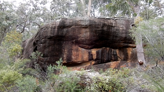 /00/90/009012ca4cd8103674d044e046b1337b7b2f6917) |
||||||||
| Route | Grade | Style | Selected ascents | |||||
|---|---|---|---|---|---|---|---|---|
| 1 |
★ Todds Helm
follow RBs. Tops Out. Tree for anchor. needs a clean after heavy rain. | 22 | 8m, 3 | |||||
| 2 |
★★★ Rapa Nui
Beautiful highball, head up on good holds FA: Chris, Sep 2020 | V4 | 6m | |||||
| 3 |
Sidepull up
To the right of Rapa Nui go up the flake, pretty average climbing. FA: Chris, Sep 2020 | V3 | 4m | |||||
| 4 |
★★ Golden Gaytime
Crouch start both hands in slot/pocket to begin, head up on pockets to a pad edge jump to the top. Aretes are off.Different heights will give different grades. FA: Chris, Aug 2021 | V8 | 4m | |||||
| 5 |
★ Righty O
Right arete of GG FA: Chris, Aug 2021 | V1 | 4m | |||||
| 6 |
★ Lefty No
Left arete of GG FA: Chris, Aug 2021 | V2 | 4m | |||||
| 7 |
★ GGRO
Start up GG then go into RO FA: Chris, Aug 2021 | V4 | 4m | |||||
| 8 |
Don't Punt Arete
left hand side of the arete below GG, punting not advised FA: Chris, Aug 2021 | V3 | ||||||
  |
||||||||
| Route | Grade | Style | Selected ascents | |||||
| 9 |
★ Cube
Sit start with double updercling one move wonder to lip FA: Chris, Aug 2021 | V5 | 2m | |||||
| 10 |
Chirpies Corner
Stand start in corner balance and head up, theres a hold around the right side to help FA: Chris, Aug 2021 | V4 | 4m | |||||
| 11 |
★ Crack Attack
Head up the crack FA: Chris, Aug 2021 | V2 | 4m | |||||
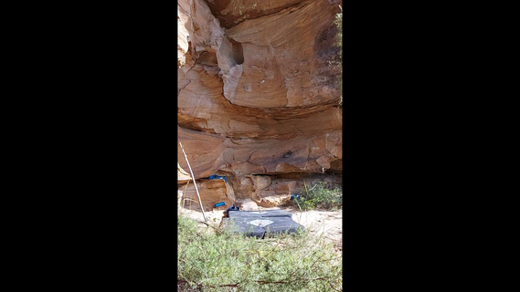
1.3.1. Pogo Arete 1 route in Area
- Summary:
-
All Bouldering
Lat / Long: -33.818685, 150.617333
summary
Spot not exactly where it is on the map only went there once but it was left of the lookout and down a bit
| Route | Grade | Style | Selected ascents | |||
|---|---|---|---|---|---|---|
| 1 |
★★★ Pogo Arete
Cool little arete sit start and up FA: Chris, Apr 2021 | V3 | 3m | |||
1.4. Kick It 4 routes in Area
- Summary:
-
All Bouldering
Lat / Long: -33.817100, 150.619486
summary
Head to Cookie Cave but instead of turning for the cave stay on the track and walk till you see a rusted out car, the cave is below this.
 /9d/51/9d51fe79af7162e48ad5c1914aba7e41dbcdc8ce) |
||||||||
| Route | Grade | Style | Selected ascents | |||||
|---|---|---|---|---|---|---|---|---|
| 1 |
★★★ Can I Kick It?
Up through some decent edges to a fairly average one and then gain the left bucket by kicking out to it, it can be done in different ways but this way gets the grade. FA: Chris, 8 Oct 2021 | V8 | 5m | |||||
| 2 |
★★ Can I Slope It?
As for kick it but up via a sloper FA: Chris, 8 Oct 2021 | V4 | 5m | |||||
| 3 |
★★ Old Chalk
An old route heading up juggy edges | V3 | 5m | |||||
| 4 |
★ Can I fit it
Up the finger crack only using the crack for hand holds, one for the thin fingers. Shame it is contrived. It's an awesome crack FA: Alec Landstra | V5 | 3m | |||||
1.5. Dopest 7 routes in Area
- Summary:
-
All Bouldering
Lat / Long: -33.813355, 150.627227
summary
Handfull of problems with potential for more
approach
Walk along rileys track for about 15-25 mins till you see Rawhide on the left of the track and Magnum Dopest on the right, you will see these from the road so no need to bush bash. If you are feeling coordinated the whole approach is on firetrail and it is relatively easy to ride it on a mountain bike with pads on your back. Makes the approach 10 min (mostly uphill) and the return 5 min (mostly downhill) well worth the effort to get to these boulders.
/30/de/30de1a774f2cc01f5410435011423ba0c3222fa9) 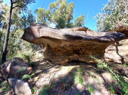   |
||||||||
| Route | Grade | Style | Selected ascents | |||||
|---|---|---|---|---|---|---|---|---|
| 1 |
★★★ Rawhide
From the back wall up the left side slapping some slopers FA: Chris, Jun 2021 | V7 | 4m | |||||
| 2 |
★★ Little Doggie
From the back wall up the right side FA: Chris, Jun 2021 | V3 | 4m | |||||
| 3 |
★★★ Magnum Dopest
In the mini cave from the back ledge head out the roof via pinch and blobby bulge Mega Classic FA: Chris, May 2021 | V7 | 3m | |||||
| 4 |
★ The 2
Up the obvious wall to the right of MD cave old chalk route | V2 | 4m | |||||
| 5 |
★★ Slice Of Life
From the finger jug edge up to the scoop and up to the right. Feels tricky till you get comfortable FA: Chris, Jul 2021 | V4 | 4m | |||||
/a4/51/a451abfd754c167cc1be955888a09cbfa9a29c45) /e3/ab/e3ab233627ad7af764c656f897e325025472378c) |
||||||||
| Route | Grade | Style | Selected ascents | |||||
| 6 |
★★ The Ramp
Old chalk route to the left of SOL go up the ramp | V1 | 4m | |||||
| 7 |
★★ Fat Burger
stand start in the jug crack and make a few moves to the fat pinch then over the bulge to top to get here go behind dopest down the left side and down the hill around to the right past slice FA: Chris, 10 Mar | V3 | ||||||