Seasonality
Description
A large area consisting of a large, tall cliff band; a smaller, short cliff band; an extensive boulder field and a long, fragmented band of boulders and short ledges; and a fragmented cliff band above the main cliff. Most of the climbing here is unbelievably good with tall, sustained climbing.
Enormous development potential exists. Dozens of new lines waiting to be developed. Some of these lines would likely be 2 pitches, a rarity in this area.
Access issues inherited from Calabogie
Fires are PROHIBITED. Under NO circumstances should you start a fire at Calabogie. Respect the new parking restrictions.
HEY CLIMBERS, YES THAT MEANS YOU! THE WAY YOU ACT AT THE CRAG CAN LEAD TO THE ACCESS BEING JEOPARDIZED! CLIFFS ARE BEING CLOSED AND THIS COULD HAPPEN HERE!
Don't play music, no one wants to hear it. Pick yours and others trash up and pack it out. Dig a hole to take a #2 in and burry it! Don't pee under boulders or overhangs because the rain can't wash it away. Fires are banned on Greater Madawaska Crown Land without permit or approved fire pit, of which there are none at any of these crags. Limit the size of your group. Brush your tick marks before you move on. Keep your dog on a leash and pick up after it. Don't smoke around people who don't want to be around it and pack out your butts. Park responsibly.
Here is a good article talking about access issues recently (Read it, it only takes a minute)
https://gripped.com/news/hey-climbers-your-behaviour-can-close-our-crags/
Main Cliff, Calabogie Boulders, and approach are on crown land in a "General Use Area", in particular in the " "Madawaska Highlands General Use Area".
Most of Lake Cliff is entirely on Calabogie Peeks land. They accept no liability for any use of the area, use at your own risk.
Skywalk is entirely on crown land.
The Hydro/High Falls section was closed in 2002 due to deaths from an unexpected opening of the Barrett Chute Dam overflow gates. The land is fenced off and owned by Ontario Hydro.
There are two very real threats to access at this crag that have come up in COVID times. We were a hairs breadth away from having all parking shut down in 2021. Fires and Parking are the only two things the people who have the power to shut down access have every talked about in the last 5 years.
Approach
The crag is just off the "Indian Pass" linking trail. Low Wall is easily visible from the hiking trail and from there it is not hard to find the base of the larger main cliff.
https://www.alltrails.com/explore/map/skywalk-approach-trail-0141a8a?u=m&sh=cryovv
Approx 25min hike with a moderate incline. Start at Manitou parking area on Barret Chute Road as if you were going to Lake Cliff. Follow main trail up a short incline to a large obvious boulder. Continue up the trail approximately 1 minute. Just as the trail takes a slight left and goes downhill take a hard right and follow red flagging tape though a saddle in the ridge line. This trail will put you on Wendigo Way - make note of a landmark or two to help you find the trail again on your way back out! Turn right and follow Wendigo Way until it joins Indian Pass. Follow this until you leave the large swamp and begin up hill. See sub-areas for specific access trails to each cliff location.
Retrace your steps to return. It's easy to miss the shortcut trail you took in. Keep an eye out for a boulder and obvious 3-log arrow on the left shortly after passing the beaver dam on your right and just as the main trail starts heading steeply downhill to find the shortcut back.
Plan your Trip
Did you know?
Did you know that you can create an account to record, track and share your climbing ascents? Thousands of climbers are already doing this.


Selected Guidebooks more Hide
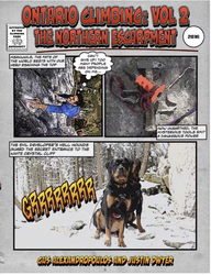
Author(s): Gus Alexandropoulos, Justin Dwyer
Date: 2016
ISBN: 9780995046610
A comprehensive guidebook to Southern Ontario’s famous climbing area, the Niagara Escarpment. This is the first complete guide to the region in almost 25 years. This volume covers the portion of the Escarpment north of Shelburne including the Beaver Valley area and the Bruce Peninsula. Includes an extensively researched history of climbing in the area, and detailed information on over 1000 rock-climbing routes.
ⓘ
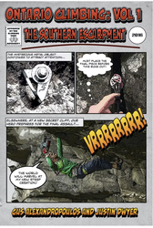
Author(s): Gus Alexandropoulos, Justin Dwyer
Date: 2016
ISBN: 9780995046603
A comprehensive guidebook to Southern Ontario’s famous climbing area, The Niagara Escarpment. This is the first complete guide to the region in almost 25 years. This volume covers areas close to Toronto, including the popular Milton crags. Includes extensively researched history of climbing in the area, and detailed information on over 1,000 rock climbing routes.
ⓘ
Accommodations nearby more Hide
Share this
Nearby Icons
| 5.11d | ★★★ Part Ways |
/35/6a/356a7e3d82f23896aa36a56de079d001fe987a72)
/ec/34/ec345c37336ef9c2b15c3153cd1e9c6869e93a51)
/84/03/840321e0ed11b0b1bba4f30594c3cce687b942d3)
/1d/74/1d74847cc9ab10793cb1631be18af399f6931d1c)
Thu 20 Apr
Check out what is happening in Skywalk.
Get a detailed insight with a timeline showing
- Ticks by climbers like you
- Discussions of the community
- Updates to the index by our users
- and many more things.
Login to see the timeline!