Seasonality
Description
On the right side of the Left Fork trail, the wall is located directly across from the left side of The Pipeline; beyond the fence-protected pictographs found just past the trail bridge.
The wall's right side is defined by a wide, black waterstreak that runs behind a tree, and the left side by a large, boulder-like outcropping up the slope on the left.
Access issues inherited from Maple Canyon
Lower Maple Canyon is on private land, the upper part and most of the climbing is located in Manti La Sal National Forest, please respect the rules posted there.
Ethic inherited from Maple Canyon
Guidebook: Maple Canyon by Darren Knezek and Christian Knight
Tags
Plan your Trip
Hello!
First time here?
theCrag.com is a free guide for rock climbing areas all over the world, collaboratively edited by keen rock climbers, boulderers and other nice folks.You can log all your routes, connect and chat with other climbers and much more...» go exploring, » learn more or » ask us a question


Selected Guidebooks more Hide
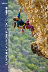
Author(s): Dave Pegg, Sibylle Hechtel and Josh Holmes
Date: 2012
ISBN: 9780982615492
- Wolverine:
- A comprehensive guide to the cobbly, conglomerate rock walls of Maple Canyon, Utah, Maple Canyon Rock Climbs highlights more than 400 routes ranging in grade from 5.4 to 5.14.
- Features detailed route descriptions to over 400 routes with 5.4 to 5.14 climbing grades, along with color photographs and maps to make route selection easier
ⓘ
Accommodations nearby more Hide
Share this

Wed 19 Apr
Check out what is happening in Pictograph Wall.
Get a detailed insight with a timeline showing
- Ticks by climbers like you
- Discussions of the community
- Updates to the index by our users
- and many more things.
Login to see the timeline!