Saisonalität
Übersicht
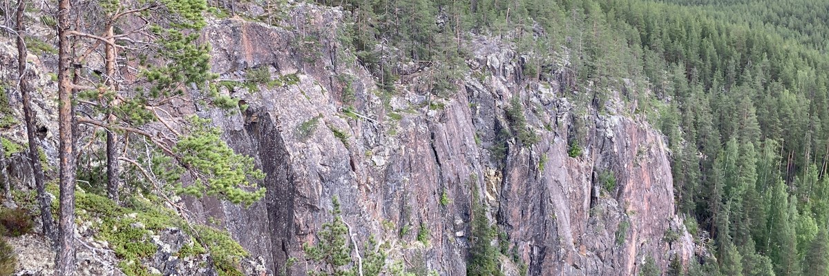
Mostly trad climbing with lots of easy-ish routes. Height 10-55 meters gives exposed/airy feeling. Beautiful landscape with forest and hills.
Beschreibung
Süd
Südost
Printed guidebook: http://borrbult.blogspot.com/p/webshop.html
PDF topo, 2013, in english: http://www.oulunkiipeilyseura.fi/wp-content/uploads/2014/06/TOPO-Dodlassberget_topo_2013english.pdf
27crags has no topos: https://27crags.com/crags/dodlarsberget
Old sverigeföraren https://nicemd.github.io/Sverigeforaren/html/D%C3%B6dlarsberget.html
Einschränk.
Note! Gravel road is wet before June. Do not drive and destroy the road if it is wet and loose. If so park (close) to main road and walk.
Zustieg
From Alvsbyn head north on road no 374 - on crossing signs "Vidsel 33", "Storfors" and "Jokkmokk", drive through Ruddahällen on the left there is a parkingbay, take right to gravel road marked with a sweskog sign- drive carefully past the house, and right up the hill, keep right at the top after few minutes there will be clear parking lot in a sand pit.
Parking ( 65.792994, 20.688415)
From parking walk 600m uphill to lean-to. Which is above the cliff. Go to the cliff and you will see most sectors on left - but not the first/leftmost sector (Peter Pan).
Anchors are not very easy to find. Rappel down some 55 meters, or walk down via south-east.
Übernachtung
Lean-to or tent.
Tags
Plane deinen Trip
Hallo!
Das erste Mal hier?
theCrag.com ist eine Plattform für Kletterer, die gratis Kletterführer und Informationen für Gebiete auf der ganzen Welt anbietet. Diese werden von Kletterern, Boulderern und anderen netten Personen erstellt und gepflegt.Du kannst deine Begehungen erfassen, dich mit anderen Kletterern austauschen und vieles mehr machen...» schnuppere hinein, » erfahre mehr oder » frag uns einfach


Unterkünfte in der Nähe mehr Verbergen
Inhalt teilen
Fotos Durchsuche alle Fotos
/21/e1/21e124ceb1e3c2109c08d399e115868830de6e2b)
Dödlarsberget - IMG_0477.JPG
/ad/07/ad07d8f6b69758b865514ceb6a748670e99577d9)
Dödlarsberget - IMG_0481.JPG

Dödlarsberget - IMG_0473.JPG
/55/b1/55b14ff2d195d5f16cee843ef22c142f54b5930a)
Dödlarsberget - IMG_0474.JPG
Mi 19 Apr
Finde heraus, was in Dödlarsberget passiert.
Erhalte einen detaillierten Einblick mit einer Zeitleiste, die zeigt
- Begehungen von Kletterern
- Diskussionen in der Community
- Aktualisierungen des Indexes durch unsere Benutzer
- und viele weitere Dinge.
Logge Dich ein, um die Zeitleiste zu sehen!