Seasonality
Description
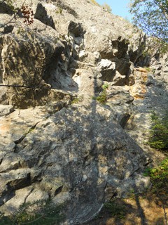
Mt. Helen is a 70m tall gneiss slab just off highway 11 about 2km north of where highway 11 and 17 split (the split is just east of Nipigon).
Mt Helen offers good beginner to intermediate multi-pitch climbing on generally solid rock, with a mix of trad and sport.
The cliff is generally fairly easy to spot from the highway -- the vertical white streaks of the cleaned upper routes are visible and characteristic.
Access issues inherited from Thunder Bay
Many of the crags on on private land or private land needs to be crossed to access the crag. Please respect the area, it is a privilege to be allowed to climb at these crags.
Leave no trace, respect other parties, and be mindful if you have music or dogs at the crag.
Approach
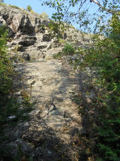
<5 min
Park on the side of highway 11, pulling as far off as you can -- lots of trucks pass along this section, often travelling quite quickly. Alternatively you can park across from St Sylvesters church about 600 meters before the cliff itself
Look for the fairly obvious, usually flagged, trail heading up. This climbs up a short (50m) way to the base of the cliff, arriving at the start of "Bowels in Transit".
Descent notes
"Bowels in Transit" and "Overdrive" can both be rappelled in two rappels on a single 60m (or longer) rope.
Or there may be a trail down (skiers) right from the top of the bluff.
Tags
Plan your Trip
Did you know?
Did you know that you can create an account to record, track and share your climbing ascents? Thousands of climbers are already doing this.


Selected Guidebooks more Hide
Author(s): Gus Alexandropoulos, Justin Dwyer
Date: 2016
ISBN: 9780995046610
A comprehensive guidebook to Southern Ontario’s famous climbing area, the Niagara Escarpment. This is the first complete guide to the region in almost 25 years. This volume covers the portion of the Escarpment north of Shelburne including the Beaver Valley area and the Bruce Peninsula. Includes an extensively researched history of climbing in the area, and detailed information on over 1000 rock-climbing routes.
ⓘ
Author(s): Gus Alexandropoulos, Justin Dwyer
Date: 2016
ISBN: 9780995046603
A comprehensive guidebook to Southern Ontario’s famous climbing area, The Niagara Escarpment. This is the first complete guide to the region in almost 25 years. This volume covers areas close to Toronto, including the popular Milton crags. Includes extensively researched history of climbing in the area, and detailed information on over 1,000 rock climbing routes.
ⓘ
Accommodations nearby more Hide
Share this
Photos Browse all photos

★★ Freitag's Dilemma 5.9 - Freitag's Dilemma start
★★★ This is Indian Land 5.7 - Start of This is Indian Land
★ The Standard Route 5.4 - Standard Route start
Wed 19 Apr
Check out what is happening in Mt. Helen.
Get a detailed insight with a timeline showing
- Ticks by climbers like you
- Discussions of the community
- Updates to the index by our users
- and many more things.
Login to see the timeline!