A Crag Guide gives an extensive view of all sub areas and climbs at a point in the index. It shows a snapshot of the index heirachy, up to 300 climbs (or areas) on a single web page. It shows selected comments climbers have made on a recently submitted ascent.
At a minor crag level this should be suitable for printing and taking with you on a climbing trip as an adjunct to your guidebook.
This guide was generated anonymously. Login to show your logged ascents against each route.
Warning
Rock climbing is extremely dangerous and can result in serious injury or death. Users acting on any information directly or indirectly available from this site do so at their own risk.
This guide is compiled from a community of users and is presented without verification that the information is accurate or complete and is subject to system errors. By using this guide you acknowledge that the material described in this document is extremely dangerous, and that the content may be misleading or wrong. In particular there may be misdescriptions of routes, incorrectly drawn topo lines, incorrect difficulty ratings or incorrect or missing protection ratings. This includes both errors from the content and system errors.
Nobody has checked this particlular guide so you cannot rely on it's accuracy like you would a store bought guide.
You should not depend on any information gleaned from this guide for your personal safety.
You must keep this warning with the guide. For more information refer to our:
Usage policy
Contributors
Thanks to the following people who have contributed to this crag guide:
Permaclimb
Milan Theis
Joost Henry Freye
Emma
F4bu
Alfonso Reveron
The size of a person's name reflects their Crag Karma, which is their level of contribution. You can help contribute to your local crag by adding descriptions, photos, topos and more.
Table of contents
- 1.
Valle Gran Rey
22 in Area
- 1.1. Taguluche 3 in Cliff
- 1.2. Mirador del Santo 4 in Cliff
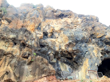
- 1.3. Gran Cueva de Cabras / Große Ziegenhöhle / Big Goat Cave 2 in Cliff
- 1.4. Túnel de Arure 0 in Crag
- 1.5. Túnel de Yorima 4 in Crag
- 1.6. VGR Upper Cliffs 0 in Crag
- 1.7. VGR Guardián 0 in Cliff
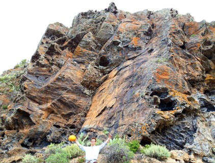
- 1.8. El Guro 8 in Cliff
- 1.9. Guerguenche 1 in Cliff
- 2. Index by grade
1. Valle Gran Rey 22 routes in Area
- Summary:
-
Mostly Sport climbing
Lat / Long: 28.107934, -17.320889
access issues
 Roque Cano y Agando necesitan oficialmente un permiso, que algunos escaladores ignoran.
 Roque Cano and Agando oficially needs a permit, which some climbers ignore.
ethic
Como en todas partes: mantenga el área limpia y proteja el medio ambiente.
As everywhere: Please keep the area clean and protect the environment.
1.1. Taguluche 3 routes in Cliff
- Summary:
-
All Sport climbing
Lat / Long: 28.135311, -17.324413
description
3 rutas (probablemente por encima de la 7a) en el camino del Mirador del Santo a Taguluche.
3 routes (probably above 7a) on the path from Mirador del Santo to Taguluche. Please specify location and grades here if you go there.
| Route | Grade | Style | Selected ascents | |||
|---|---|---|---|---|---|---|
| 1 | 1 | 7a | ||||
| 2 | 2 | 7a+ | ||||
| 3 | 3 | 7b | ||||
1.2. Mirador del Santo 4 routes in Cliff
- Summary:
-
All Sport climbing
Lat / Long: 28.132131, -17.323359
description
Peñón deportivo directamente en el Mirador, gran paisaje, vistas profundas, también a El Hierro y La Palma. ¡Cuidado con los desprendimientos de rocas y los turistas que pasan!
Sport crag directly at the Mirador, great scenery, deep views, also to El Hierro and La Palma. Take care with rockfall and passing tourists! Listed also here.
approach


Camine en 1min hasta el mirador.
Walk in 1min to the mirador.
 |
||||||||
| Route | Grade | Style | Selected ascents | |||||
|---|---|---|---|---|---|---|---|---|
| 1 |
Windelchen / Pañalito
FA: Mike Jäger | 6a+ | 18m, 7 | |||||
| 2 |
★★ Conchita / Shell
Warning Rock: Don't touch the big plate left of the 4. bolt! FA: Mike Jäger | 6b+ | 15m, 6 | |||||
| 3 | ★★ Gorfio | 5b | 16m, 5 | |||||
| 4 |
★ Route 4
FA: Falk Heinicke, X. Heinicke, D. Heinicke, G. Priebst, R. Steuer, S. Hausschild & and friends, 2010 | 6a+ | 16m, 7 | |||||
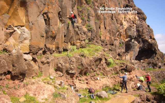
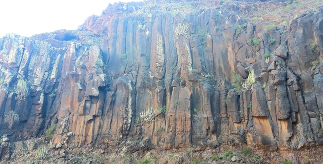
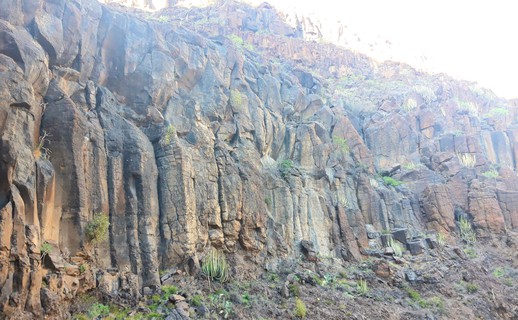
1.3. Gran Cueva de Cabras 2 routes in Cliff
- Summary:
-
All Sport climbing
Lat / Long: 28.116931, -17.335512
description
Bonito acantilado con vistas a Valle Gran Rey. Así que fay 2 rutas por escaladores sxon. Incluido en el sitio web de Rüdiger Steuer. También hay una imagen de la 1ª ruta.
Nice cliff overlooking Valle Gran Rey. So fay 2 routes by sxon climbers. Listed on Rüdiger Steuers website. There is also a picture of the 1st route.
approach
Estacione en el Mirador del Santo o conduzca la tierra hasta el estacionamiento. Siga la ruta de senderismo hacia el suroeste durante 800 m hasta que pase directamente debajo de las rutas.
Park at Mirador del Santo or drive the dirt to the parking. Follow the hiking path southwest for 800m until it goes directly below the routes.
   |
||||||||
| Route | Grade | Style | Selected ascents | |||||
|---|---|---|---|---|---|---|---|---|
| 1 |
Exenstiege / Quickdraw Route
FA: Falk Heinicke, D. Exner, H. Exner & D. Heinicke, 2010 | 5a - b | 3 | |||||
| 2 |
Route 2
At least 5 bolts to see. | 5 | ||||||
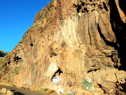
1.4. Túnel de Arure 0 routes in Crag
description
Una antigua curva de carretera abandonada con buen potencial de ascenso.
A former abandoned road bend with good climbing potential.
approach
Estacione en el extremo inferior de la antigua curva de la carretera y camine por la calle vieja. La mejor roca está ahí, la parte superior tiene varias rocas derrumbadas en el camino para trepar.
Park at the lower end of the former road bend and walk along the old street. The best rock is there, the upper part has several collapsed rocks on the road to scramble over.
   |
1.5. Túnel de Yorima 4 routes in Crag
- Summary:
-
Top roping and Sport climbing
Lat / Long: 28.115423, -17.319513
description
Acantilado de 1km con gran potencial para cientos de rutas en la antigua curva de la carretera en el túnel. El camino está bloqueado, por lo que es un escenario perfecto para escalar. Hasta ahora, solo hay unos pocos tornillos en la parte menos mejor en el extremo superior.
1km cliff with great potential for 100's of routes at the old road curve at the tunnel. The road is blocked (small collapse at the lower end), so it makes a perfect climbing setting. Until now there are only a few bolts at only the least best part at the upper end.
approach

Puede conducir desde el extremo superior 3/4 de la curva. Las rutas existentes están cerca del extremo superior.
You can drive from the upper end 3/4 of the bend. The existing routes are close to the upper end.
      |
||||||||
| Route | Grade | Style | Selected ascents | |||||
|---|---|---|---|---|---|---|---|---|
| 1 | 1 | 7m | ||||||
| 2 | 2 | 5c | 7m, 3 | |||||
| 3 | 3 | 7m | ||||||
| 4 | Potencial!! | |||||||
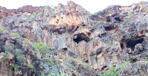
1.6. VGR Upper Cliffs 0 routes in Crag
description
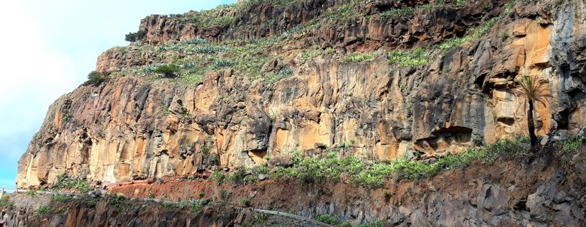
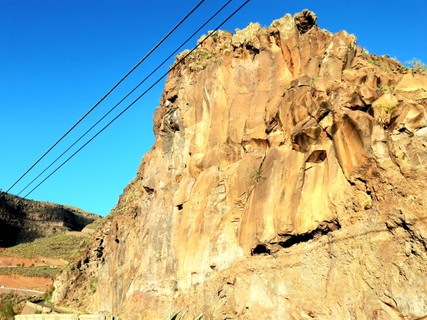
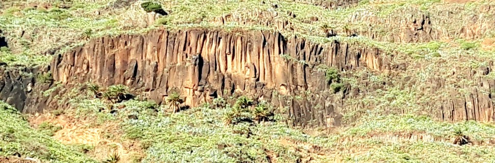
Acantilados bonitos en el extremo superior de Valle Gran Rey (Barranco del Agua).
Good looking cliffs at the upper end of Valle Gran Rey (Barranco del Agua).
   |
1.7. VGR Guardián 0 routes in Cliff
description
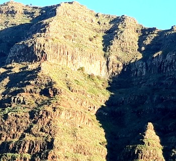
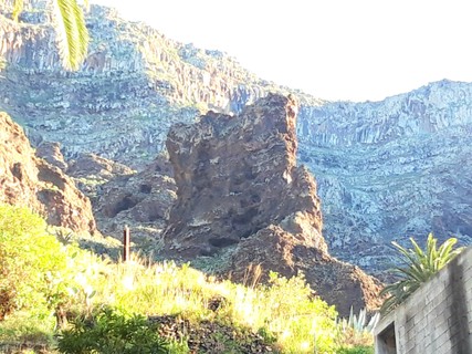
Gran torre con vistas al valle. ¿Probablemente sin escalar?
Big tower overlooking the valley. Probably unclimbed?
approach
 |
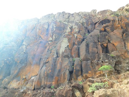
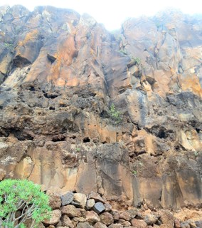
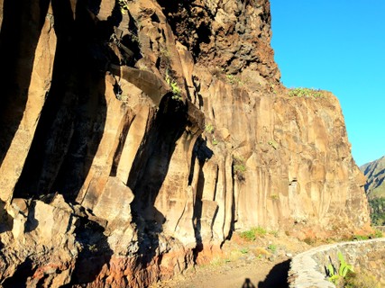
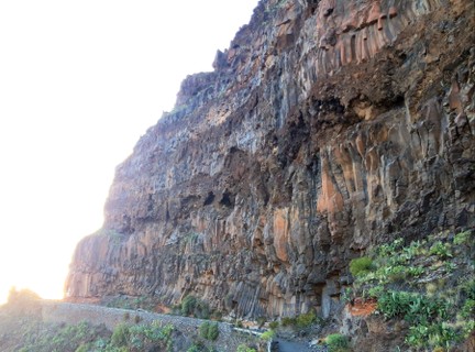
1.8. El Guro 8 routes in Cliff
- Summary:
-
All Sport climbing
Lat / Long: 28.108725, -17.327912
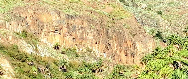
description
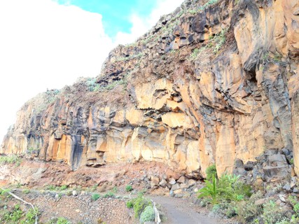
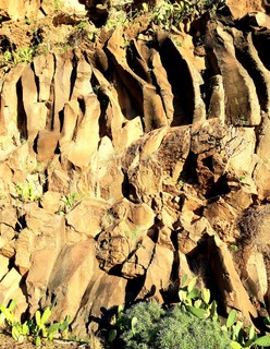
La zona de escalada oficial en VGR. Solo atornillaron la parte menos adecuada a la mitad de la altura. La parte izquierda haría mejores rutas más largas.
The official climbing area in VGR. They only bolted the least best right part to half height. The left part would make better longer routes.
approach

Desde El Guro, tome la ruta de senderismo hasta la cascada de Barrance de Arure (agradable caminata). 120 m después de la última casa, antes del gran acantilado directamente en el camino, se cruza un pequeño valle y ya se ve el anfiteatro a la izquierda. Encuentre su camino allí (mejor en el fondo del valle).
From El Guro take the hiking path to the waterfall in Barrance de Arure (nice hike). 120m after the last house, before the big cliff directly at the path, you cross a small valley and already see the amphitheatre up on the left. Find your way up there (best at the valley bottom).
history
Atornillado en 2016.
Bolted in 2016.
| Route | Grade | Style | Selected ascents | |||||
|---|---|---|---|---|---|---|---|---|
| 1 | ★★ 1 | 6b | 3 | |||||
| 2 |
2
Probably harder due to loose rock and broken holds? | 6c | 3 | |||||
| 3 | 3 | 6a | 4 | |||||
| 4 | ★★ 4 | 6a | 4 | |||||
| 5 | 5 | 6b | 8 | |||||
| 6 |
★★ 6
At least 5 bolts visible. | 5b | 5 | |||||
| 7 |
★ 7
At least 3 bolts visible. | 4b | 3 | |||||
| 8 | ★ 8 | 4b | 2 | |||||
  |
||||||||
1.9. Guerguenche 1 route in Cliff
- Summary:
-
All Sport climbing
Lat / Long: 28.084654, -17.326420
description
Incluido en el [sitio web de Rüdiger Steuer] (http://gom-steuer.de/pages/klettern-auf-der-insel.php) con al menos 1 escalada deportiva en "Guerguenche / VGR". Montaña de Guerguenche (28.088561, -17.325002) es la montaña entre VGR y Barranco de Argaga.
Listed on Rüdiger Steuers website with at least 1 sport climb at "Guerguenche/VGR". Montaña de Guerguenche (28.088561, -17.325002) is the mountain between VGR and Barranco de Argaga.
| Route | Grade | Style | Selected ascents | |||
|---|---|---|---|---|---|---|
| 1 | Reussgrat | |||||
2. Index by grade
| Grade | Stars | Name | Style | Pop | Area | |
|---|---|---|---|---|---|---|
| 4b | ★ | 7 | 3 | 1.8. El Guro | ||
| ★ | 8 | 2 | 1.8. El Guro | |||
| 5a - b | Exenstiege | 3 | 1.3. Gran Cueva de Cabras | |||
| 5b | ★★ | Gorfio | 16m, 5 | 1.2. Mirador del Santo | ||
| ★★ | 6 | 5 | 1.8. El Guro | |||
| 5c | 2 | 7m, 3 | 1.5. Túnel de Yorima | |||
| 6a | 3 | 4 | 1.8. El Guro | |||
| ★★ | 4 | 4 | 1.8. El Guro | |||
| 6a+ | ★ | Route 4 | 16m, 7 | 1.2. Mirador del Santo | ||
| Windelchen | 18m, 7 | 1.2. Mirador del Santo | ||||
| 6b | ★★ | 1 | 3 | 1.8. El Guro | ||
| 5 | 8 | 1.8. El Guro | ||||
| 6b+ | ★★ | Conchita | 15m, 6 | 1.2. Mirador del Santo | ||
| 6c | 2 | 3 | 1.8. El Guro | |||
| 7a | 1 | 1.1. Taguluche | ||||
| 7a+ | 2 | 1.1. Taguluche | ||||
| 7b | 3 | 1.1. Taguluche | ||||
| ? | Route 2 | 5 | 1.3. Gran Cueva de Cabras | |||
| 1 | 7m | 1.5. Túnel de Yorima | ||||
| 3 | 7m | 1.5. Túnel de Yorima | ||||
| Potencial!! | 1.5. Túnel de Yorima | |||||
| Reussgrat | 1.9. Guerguenche |