Saison
Description
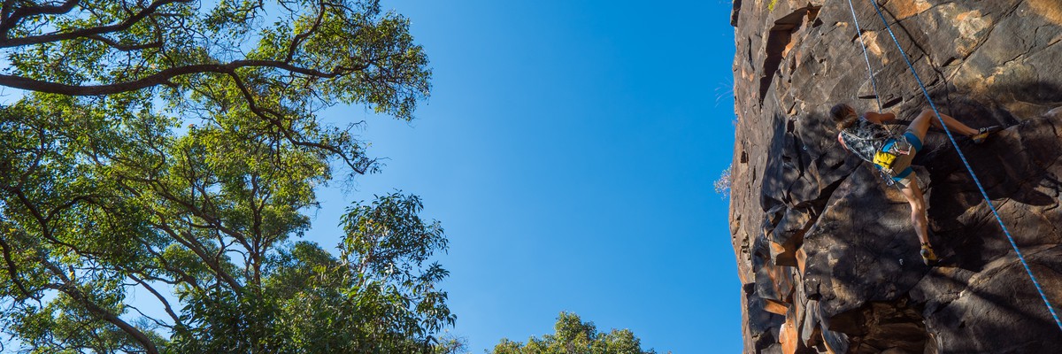
A few years ago, Churchman's Brook was one of the most popular climbing locations in the greater Perth region. On any weekend, many individual climbers and would-be climbers can be found there, all vying for a piece of the cliff. These days it is a lot quieter. The area is well developed in terms of established routes. These range from beginner to hardman climbs, with the majority around the grades 14 to 21.
Churchman's is located east of Armadale in bushland that overlooks the Roleystone Valley. Access is via a short walk from the end of Beeloo Close (dirt road), off Churchman Brook Road. The cliff is in two parts - to the west is a small beginners' slope, to the east is the main climbing area
The discovery of the Churchman's Brook cliffs in December 1975 by 'Mac' McArthur was a milestone for the sport of climbing in 'Western Australia'. Up until then, the only metro climbing areas were the quarries and several small cliffs in the Wungong Dam area. 'Mac' had known of the cliff for several years, but his furniture business had kept him from exploring it. When his busy schedule allowed, it only took half an hour of walking from Soldiers Road to locate the cliffs. Today's trails had not been formed at that time, and there was an abundance of vegetation at the base and top of the cliff. Mac was not the first visitor to the area, it is rumoured that local legend, bushranger Moondyne Joe, had a hideout in the cave near the descent gully
After the initial discovery, Mac led a group consisting of Mike Smith, David James and Richard Rathbone on the first CAWA look at the cliff. This group were responsible for most of the early routes. After a quick reconnoitre, all started up different routes in the centre of the cliff. These first climbs were slow affairs and saw several false starts because every handhold bigger than a thumbnail was covered in vegetation and dirt. Smith eventually led the first route, called 'The Sting' (14). The crux on this route was complicated by a hornets' nest which was not found until too late. Next to be stung was Dave James, while putting up the The Bite (16). 'The Fang' (16) by Mac followed
Climbs went up at regular intervals until the early 1980s, when CAWA went into a bit of a decline. During this period, a small but dedicated group including Ron Master, Warren Lees, Wayne Carroll, Mark Gommers and Mark Paramore, as well as some of the earlier climbers, continued to develop the cliff. Alex Oslow put up the classic Super Slab, a fine fingery 21 protected with the first bolt on the cliff. Paramore was responsible for the desperate Gates Of 'Mordor' (20R). Local climber Warren Lees freed the then hardest climb in WA, Up For Grabs (22) which is a brutal climb best attempted only after a long dry period
© (hotgemini)Approche
Follow your road map to the junction of Albany Hwy and South Western Hwy in Armadale. From here take the Albany Hwy for 200m east and then turn L on Carradine Rd. After 1km turn L on Canns Rd and after a further 3km turn L onto Churchman Brook Rd. Follow this for about 1km past a large paddock. Turn L into Beeloo Close, a dirt road with sign for Wungong Regional Park, Churchman's Bushland.After 500m park at a large cleared area before the gate (leave it clear). Leave nothing in the car, as break-ins have recently become common, in step with urban development in the area.
Track heads off to the right from carpark including many steps until reaching the east end of the crag. CAWA volunteers put in these steps and the ringbolts at the top of the crag. We hope that these actions will reduce erosion, increase your enjoyment, and encourage you to support CAWA.
Due to the large amount of small pebbles at the top, it is recommended that belayers wear a helmet here. Of course leaders are best served by wearing a helmet too - for example upside down falls onto this blocky cliff can be quite hazardous.
In summer, even early mornings can be very hot, but from mid-afternoon on the cliff is in the shade. Commercial abseiling is forbidden here.
Facing the cliff, the routes are described from L to right.
© (hotgemini)Planifiez votre voyage
Certains contenus ont été fournis sous licence de : © Australian Climbing Association Queensland (Creative Commons, Attribution, Share-Alike 2.5 AU)
Bonjour !
Ici pour la première fois ?
theCrag.com est un guide gratuit pour les sites d'escalade partout dans le monde, édité en collaboration par des grimpeurs passionnés, des bloqueurs et d'autres gens sympathiques.Vous pouvez enregistrer toutes vos ascensions, vous connecter et discuter avec d'autres grimpeurs et bien plus encore...» partez à la découverte, » en savoir plus or » posez-nous une question


Logements à proximité plus Cacher
Partager ceci
Photos Rechercher parmi toutes les photos
/cb/41/cb415b5ff4d2815cb447ab28ef72cd3927038c80)
★★ Red Giant 19 - 20240317_154727.jpg

Fang Wall - 20141012_121554-EFFECTS.jpg
/cf/e6/cfe61aee150675a0346bc93a51309816613d0aea)
★★ Slash and Burn 18 - E0841658-CFFC-40DD-AEB6-EFFED8344A9D.jpeg
/c3/25/c32551894195fc5f2419039137740bfbfaa0b6b2)
★★ Slash and Burn 18 - B36028BE-56BD-4DD1-98B3-2A906D853DA2.jpeg
Mar 25 Avr
Regardez ce qu'il se passe à Churchman's Brook.
Get a detailed insight with a timeline showing
- Ticks by climbers like you
- Discussions of the community
- Updates to the index by our users
- and many more things.
Login to see the timeline!