지도
계절특성
요약
몬조니암
섬장암
Topo and Article Greg Chapman, still handy 'best of' bouldering topo (kept naming and sector structure here)
설명
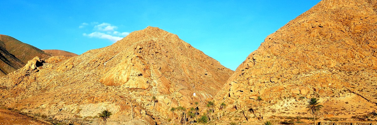
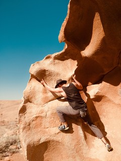
A former extensive climbing and bouldering area situated around the two prominent rocky peaks forming the Barranco de las Penitas. The rock here, a type of granite (monzonite) have large scooped features and arêtes that make the climbing in this area special and well worth a visit. There are over 70 sport routes and a wide variety of boulder problems ranging from lowball traverses to striking highballs throughout the grade range. There problems currently documented here are the most approachable, plenty of potential if you scramble up the hillsides.
Some of the best and more popular sport routes have new bolts but many are in need of re-equipping. With the closure of the crag 2022 some of the bolted lines have been removed.
Credits
The information has been gleaned by James and Dave Turnbull from Greg Chapman’s very good topo for the Ravine and Valley areas and local activist Josafat Espino Lopez who developed many of the problems. Check out Josafat’s Youtube channel for many of the problems. Thanks to paulatword who made the contact to the Turnbull brothers and aqcuired the permission to use their informations here on theCrag. Original PDF
접근 문제들
접근
- Main lower parking:
 (28.385807, -14.106054) Around 1km west of Pajara leave the FV-605 and follow FV-621 towards Ajuy. After just over 3km take a right (FV-627) and follow this for just over 1km to where the tarmac stops at a fork. Take the short steep RH fork and after 500m you will reach a large parking area in the dry river bed.
If you come from the north for a day trip and want to save the 20min more curvy driving to the main parking:
Upper parking tourist hike
(28.393595, -14.087960) Nice hike from Vega de Rio Palmas down the barrancoShortest way
(28.385914, -14.095198) Parking carefully, the local farmer wants to come through!
역사
Many of the problems developed by Josafat Espino Lopez.
태그들


화요일 25 4월
무슨일이 일으나고 있는지 Las Peñitas 알아보세요.
Get a detailed insight with a timeline showing
- Ticks by climbers like you
- Discussions of the community
- Updates to the index by our users
- and many more things.
Login to see the timeline!