
季节分布
准入问题 取自Glasshouse Mountains
Most 'Glasshouse Mountains' climbing is within the Glass House Mountains National Park. Please respect the environment and other people's enjoyment of it. Access to climbing here is a privilege, not a right.
The 2019 Ngungun track expansion & fortification work is now complete, and the mountain is once again fully open.
行为准则 取自Glasshouse Mountains
Modern climbers establishing new routes have taken great pains to ensure any new routes do not interfere with the historic routes established many decades ago.
Retro-bolting of existing routes is unacceptable!
New routes shall make use of traditional protection where available.
Hello!
First time here?
theCrag.com is a free guide for rock climbing areas all over the world, collaboratively edited by keen rock climbers, boulderers and other nice folks.You can log all your routes, connect and chat with other climbers and much more...» go exploring, » learn more or » ask us a question


Selected Guidebooks more 隐藏
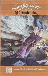
作者: Jimmy Blackhall & David Jefferson
日期: 2021
国际书号: 9377779499658
Hidden within the ordinary people of Queensland there exists a tight-knit community of scabby knuckles, grazed knees, massive forearms and iron-clad wills. This guidebooks seeks to shed light on this community and blocks of choice with all the information, skills and knowledge to open the door for you to explore all the bouldering that Queensland has to offer.
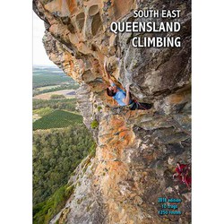
作者: Simon Carter
日期: 2018
国际书号: 9780958079068
A few years ago there was basically Frog Buttress and Coolum. Since then there has been more development than Barangaroo and South East Queensland should be on any climbers radar no matter what your style. Except ice climbing, definitely no ice climbing. But over 1250 routes with hard sport, multipitches and quality trad to make a great trip.
ⓘ
附近的住宿 more 隐藏
分享至
照片 浏览所有照片

Rick White在Gambier I 14 - Gambier 1968
/46/a4/46a40b5f9ae1c9565a689929a00a7394f1517ddf)
★★ East Beerwah 2 - 20141104_141424.jpg
Greg Sheard在Gambier II 14 - Gambier II
星期天 21 5月
查看North-east face的最新动态。
Get a detailed insight with a timeline showing
- Ticks by climbers like you
- Discussions of the community
- Updates to the index by our users
- and many more things.
Login to see the timeline!