季节分布
总结
This crag is still young in its development, and there's plenty of rock for new quality routes and boulder problems to be established.
描述
Initial development at Papineau Roadside was done by ice climbers who got a knack for bolting fun mixed-ice and drytooling lines. Many climbs have since been trundled, scrubbed and freed as rock routes. Papineau hosts a diversity of climbing styles, many of which are unique for the region. First ascensionists have put effort to clean things up, but still be mindful of potential hollow flakes and loose rock. The bottom of many climbs can be quite sandy, bring a brush!
准入问题
The crag is located on Crown Land. This area is active during hunting season in November - Be Seen, Be Heard!
前往
There are two areas for roadside parking both accommodating a couple vehicles. The south parking area located at the Scoop Loop trailhead about 20 meters north where the cliff meets the road ( 45°21'32.3"N 77°49'06.6"W). The grassy parking area located by the sparse pines 100 meters north of where the cliff meets the road (45° 21' 32.292" N 77° 49' 8.5375" W), and this parking provides better access to most of the crag. Parking on the side of the road is also permitted, and in the winter necessary.
Navigation around the crag is easiest using the ATV trail that runs parallel to the cliff, that is accessible either from the road (ATV entrance located between the two parking areas) or using the obvious path through the sparse pines if parked at the grassy parking. Climber’s trails have wood signs and pink trail markers. Once at the cliff, an unmarked cliffbase trail can be used moving between areas.
Scoop Loop - wooden signs depicting climbers at both entrances to the loop. South entrance is at the south parking, north entrance off of the ATV trail directly across the path from the grassy parking/ sparse pines. The Scoop area is reminiscent of “sport bouldering”, and where the routes lack height they compensate with how long their names are. Also located here is a phenomenal top access/descent gully.
Consolation Path - wooden signs with a figure 8 knot. Follow the ATV trail about 70 meters north from the north Scoop Loop entrance. Path takes you past the boulders and lands you at the bottom of where Consolation Prize ice route forms in the winter.
Wafer Path (requires trail work) - wooden sign with carabiner. Follow the ATV trail about 100 meters north of the Consolation Path (after a turn in trail and a bit uphill). Wafer Path takes you past boulders and lands you near Wafer Thin ice route.
你知道吗?
你知道吗?创建账户后,你可以记录、跟踪并分享你的攀登!数千计的攀登者已经在这么做了。
Selected Guidebooks more 隐藏
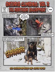
作者: Gus Alexandropoulos, Justin Dwyer
日期: 2016
国际书号: 9780995046610
A comprehensive guidebook to Southern Ontario’s famous climbing area, the Niagara Escarpment. This is the first complete guide to the region in almost 25 years. This volume covers the portion of the Escarpment north of Shelburne including the Beaver Valley area and the Bruce Peninsula. Includes an extensively researched history of climbing in the area, and detailed information on over 1000 rock-climbing routes.
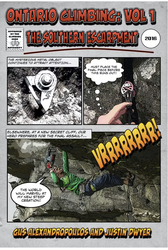
作者: Gus Alexandropoulos, Justin Dwyer
日期: 2016
国际书号: 9780995046603
A comprehensive guidebook to Southern Ontario’s famous climbing area, The Niagara Escarpment. This is the first complete guide to the region in almost 25 years. This volume covers areas close to Toronto, including the popular Milton crags. Includes extensively researched history of climbing in the area, and detailed information on over 1,000 rock climbing routes.
附近的住宿 more 隐藏
分享至
Get a detailed insight with a timeline showing
- Ticks by climbers like you
- Discussions of the community
- Updates to the index by our users
- and many more things.
Login to see the timeline!


