A Crag Guide gives an extensive view of all sub areas and climbs at a point in the index. It shows a snapshot of the index heirachy, up to 300 climbs (or areas) on a single web page. It shows selected comments climbers have made on a recently submitted ascent.
At a minor crag level this should be suitable for printing and taking with you on a climbing trip as an adjunct to your guidebook.
This guide was generated anonymously. Login to show your logged ascents against each route.
Warning
Rock climbing is extremely dangerous and can result in serious injury or death. Users acting on any information directly or indirectly available from this site do so at their own risk.
This guide is compiled from a community of users and is presented without verification that the information is accurate or complete and is subject to system errors. By using this guide you acknowledge that the material described in this document is extremely dangerous, and that the content may be misleading or wrong. In particular there may be misdescriptions of routes, incorrectly drawn topo lines, incorrect difficulty ratings or incorrect or missing protection ratings. This includes both errors from the content and system errors.
Nobody has checked this particlular guide so you cannot rely on it's accuracy like you would a store bought guide.
You should not depend on any information gleaned from this guide for your personal safety.
You must keep this warning with the guide. For more information refer to our:
Usage policy
Contributors
Thanks to the following people who have contributed to this crag guide:
Thomas Müller
Nicky
invalidmagic (josh)
Kai
Stefan
Marius Janosel
Barnabé
Julian
The size of a person's name reflects their Crag Karma, which is their level of contribution. You can help contribute to your local crag by adding descriptions, photos, topos and more.
Table of contents
- 1. Amazonenfels 34 in Cliff
- 2. Index by grade
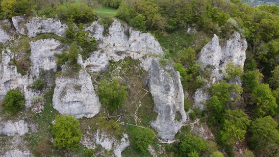
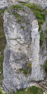
1. Amazonenfels
- Summary:
-
Lat / Long: 48.605770, 9.785140
准入问题
Climbing has not been permitted everywhere for several years. The Nature Conservation Act of Baden-Wuerttemberg includes the rocks among the so-called §24a biotopes. In principle, entering these biotopes is not permitted. In recent years, the nature conservation administration and the climbing associations have succeeded in defining the areas that can be climbed and the climbing bans for the entire Swabian Jura. Some rocks are now closed all year round, some climbing bans only apply seasonally during the breeding season of certain bird species (e.g. eagle owl or kestrel).
| Route | Grade | Style | Selected ascents | |||||
|---|---|---|---|---|---|---|---|---|
| 2 | Gailtalerin | 7 | ||||||
 |
||||||||
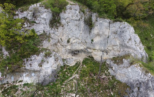
1.1. Nebenfels
- Summary:
-
Lat / Long: 48.605910, 9.785090
 |
||||||||
| Route | Grade | Style | Selected ascents | |||||
|---|---|---|---|---|---|---|---|---|
| 1 |
Direktes Späßchen
首攀: Matthies | 7- | ||||||
| 2 |
Kleines Späßchen
首攀: Matthies | 7- | ||||||
| 3 |
Testosaurus Rex
Start über Hallo Erde, dann links raus über 3 BH zum Umlenker. 首攀: H. Rapp & J. Rapp, 2020 | 9+ | 6 | |||||
| 4 |
Hallo Erde
首攀: Brandauer | 9 | ||||||
| 5 |
Z-Riss
首攀: Matthies | 7- | ||||||
| 6 |
Hägamark
首攀: Widmaier | 7- | ||||||
| 7 | Bauer Quergang | 7 | ||||||
| 8 |
Bohrsucht
首攀: Buchmann, 2011 | 8 | ||||||
| 9 |
Steiler Riss / Seibold Weg
首攀: Seibold | 6+ | ||||||
| 10 | Ramba Zamba Quergang | 7- | ||||||
1.2. West
- Summary:
-
Lat / Long: 48.605608, 9.785087
 |
||||||||
| Route | Grade | Style | Selected ascents | |||||
|---|---|---|---|---|---|---|---|---|
| 1 | Grewis | 6 | ||||||
| 2 | ★ Westwand | 6+ | 35m | |||||
| 3 | ★★★ Kongo | 7 | ||||||
| 4 | Via Elegante | 7+ | ||||||
| 5 | Orientalisches Dach | 8+ | ||||||
| 6 | Westwandüberhang | 8- | ||||||
| 7 |
Westwandmix
Einstieg über Via Elegante zur Brandauer-Westwand | 6+ | ||||||
| 8 | ★★★ Brandauer Westwand | 6+ | ||||||
| 9 | ★★ Entenklemmer | 7 | 35m | |||||
| 10 | ★★ Normalweg | 7 | 35m | |||||
| 11 | Normalweg Direktausstieg | 7+/8- | ||||||
| 12 | Entenklemmer - Normalweg - Kombination | 8- | ||||||
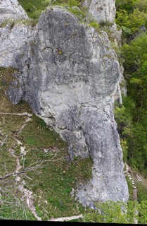
1.3. Süd
- Summary:
-
Lat / Long: 48.605558, 9.785131
 |
||||||||
| Route | Grade | Style | Selected ascents | |||||
|---|---|---|---|---|---|---|---|---|
| 1 | Luggaleskäs | 6+ | ||||||
| 2 | Normalweg | 6+ | ||||||
| 3 | ★★ Fichtelführe | 7 | 35m | |||||
| 4 | Fichtelführe a Und ab durch die Mitte | 8- | 35m | |||||
| 5 | ★ Junggesellenpfeiler | 7 | 35m | |||||
| 6 | ★★ Phentesilea | 8-/8 | ||||||
| 7 | Super Ambros | 6+ | ||||||
| 8 | Gailtalerin | 7+ | 35m | |||||
| 9 | ★ Adios Amigos | 6 | ||||||
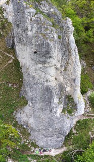
1.4. Ost
- Summary:
-
Lat / Long: 48.605565, 9.785209
| Route | Grade | Style | Selected ascents | |||||
|---|---|---|---|---|---|---|---|---|
| 1 | Cassinpfeiler Direkteinstieg | 5+ | ||||||
 |
||||||||
| Route | Grade | Style | Selected ascents | |||||
| 2 | ★★ Cassinpfeiler | 6- | 35m | |||||