Seasonality
Description
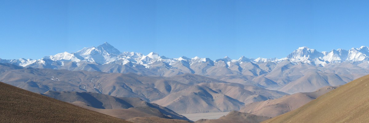
The Sagarmatha National Park (sagaramāthā rāṣṭriya nikuñja) is a protected area in the Himalayas of eastern Nepal that is dominated by Mount Everest. It encompasses an area of 443 square miles in the Solukhumbu District. In the north, it shares the international border with the Qomolangma National Nature Preserve of Tibet and extends to the Dudh Kosi river in the south. Adjacent to the east is the Makalu Barun National Park.
The park contains the upper catchment areas of the Dudh Kosi river, Bhotekoshi river basin and the Gokyo Lakes. It is largely composed of rugged terrain and gorges of the high Himalayas, including the world's highest peak Sagarmatha (Mt. Everest). Other peaks above 20,000 feet are Lhotse, Cho Oyu, Cholatse, Thamserku, Nuptse, Amadablam and Pumori.
Access issues
Trekking permit required to enter Sagamartha national park. As of 2018 a peak permit is required to climb above 5,800m - although only a set list of mountains can be legally climbed.
Approach
Typically a flight Fly from Kathmandu to Lukla (9,318 feet). Trek north to enter Sagarmatha National Park just past Monjo (9,317 feet). Continue on to Namche Bazaar (11,286 feet) as your starting point to the different areas within Sagarmatha National Park.
Or 4 day trek from Jiri.
Where to stay
Teahouses in the valley, then typically a tent for base camp and possibly high camps.
Plan your Trip
Hello!
First time here?
theCrag.com is a free guide for rock climbing areas all over the world, collaboratively edited by keen rock climbers, boulderers and other nice folks.You can log all your routes, connect and chat with other climbers and much more...» go exploring, » learn more or » ask us a question


Accommodations nearby more Hide
Share this
Photos Browse all photos

Sagarmatha Nationalpark - 182710_196918827004963_2056144_n.jpg

★★ Summit PD - PB038657.JPG

★★ Summit PD - HighCamp
Wed 26 Apr
Check out what is happening in Sagarmatha Nationalpark.
Get a detailed insight with a timeline showing
- Ticks by climbers like you
- Discussions of the community
- Updates to the index by our users
- and many more things.
Login to see the timeline!