A Crag Guide gives an extensive view of all sub areas and climbs at a point in the index. It shows a snapshot of the index heirachy, up to 300 climbs (or areas) on a single web page. It shows selected comments climbers have made on a recently submitted ascent.
At a minor crag level this should be suitable for printing and taking with you on a climbing trip as an adjunct to your guidebook.
This guide was generated anonymously. Login to show your logged ascents against each route.
Warning
Rock climbing is extremely dangerous and can result in serious injury or death. Users acting on any information directly or indirectly available from this site do so at their own risk.
This guide is compiled from a community of users and is presented without verification that the information is accurate or complete and is subject to system errors. By using this guide you acknowledge that the material described in this document is extremely dangerous, and that the content may be misleading or wrong. In particular there may be misdescriptions of routes, incorrectly drawn topo lines, incorrect difficulty ratings or incorrect or missing protection ratings. This includes both errors from the content and system errors.
Nobody has checked this particlular guide so you cannot rely on it's accuracy like you would a store bought guide.
You should not depend on any information gleaned from this guide for your personal safety.
You must keep this warning with the guide. For more information refer to our:
Usage policy
Contributors
Thanks to the following people who have contributed to this crag guide:
The size of a person's name reflects their Crag Karma, which is their level of contribution. You can help contribute to your local crag by adding descriptions, photos, topos and more.
Table of contents
- 1. Alantis 10 in Crag
- 2. Index by grade
1. Alantis 10 routes in Crag
- Summary:
-
All Sport climbing
Lat / Long: 60.457949, 4.926557
summary
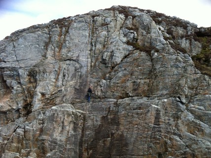
easy routes in a dramatic setting
approach
From Bergen drive to Turøy, about 35 mins. Park at large parking area on right just before last bridge to the island. walk back along the road for 100m where a marked path will bring you to the crag in 10 mins. when you get to the highest point on the path you will see a lighthouse to the north; you are close! go down and towards the sea, after scrambling a few meters down you are there.
history
developed in 2005.
 |
||||||||
| Route | Grade | Style | Selected ascents | |||||
|---|---|---|---|---|---|---|---|---|
| 1 |
★★ Fra inne til ute
steep route with big holds FA: Gisle Andersen & Gunnar Karlsen, 2005 | 4+ | 15m | |||||
| 2 |
★★★ Foxtrot
Shares the anchor with the route to the left. FA: Gisle Andersen & Gunnar Karlsen, 2005 | 6- | 15m | |||||
| 3 |
Vals
FA: Gisle Andersen & Gunnar Karlsen, 2005 | 5+ | 15m | |||||
| 4 |
Tango
FA: Gisle ANDERSEN & Gunnar Karlsen, 2005 | 5+ | 15m | |||||
| 5 |
Danseskolen
FA: Gisle Andersen & Gunnar Karlsen, 2005 | 5 | 13m | |||||
| 6 |
★ Vertikal dans
FA: Gisle Andersen & Gunnar Karlsen, 2005 | 5- | 18m | |||||
| 7 |
★ Ballett for nybegynnere
FA: Gisle Andersen & Gunnar Karlsen, 2005 | 5- | 18m | |||||
| 8 |
★★ Et sted må man starte
FA: Gisle Andersen & Gunnar Karlsen, 2005 | 4+ | 18m | |||||
| 9 |
Min første bolterute
FA: Gisle Andersen & Gunnar Karlsen, 2005 | 3+ | 12m | |||||
| 10 |
★★ Lær meg å lede
FA: Gisle Andersen & Gunnar Karlsen, 2005 | 3 | 12m | |||||
2. Index by grade
| Grade | Stars | Name | Style | Pop | |
|---|---|---|---|---|---|
| 3 | ★★ | Lær meg å lede | 12m | ||
| 3+ | Min første bolterute | 12m | |||
| 4+ | ★★ | Et sted må man starte | 18m | ||
| ★★ | Fra inne til ute | 15m | |||
| 5- | ★ | Ballett for nybegynnere | 18m | ||
| ★ | Vertikal dans | 18m | |||
| 5 | Danseskolen | 13m | |||
| 5+ | Tango | 15m | |||
| Vals | 15m | ||||
| 6- | ★★★ | Foxtrot | 15m |