Estacionalidad
Descripción
Sol por la tarde
oeste
This is the first section of cliff you meet when walking south from the Gap Creek Falls car park (or directly on your right as you come down the central gully).
It is characterised by the Joe's climb roof on the left and a smooth cracked wall on the right, with some of the best lines at the crag. The anchors of Profanity and Turquoisine can be accessed readily from above.
Be warned that it is a favourite haunt of abseilers.
Restricciones heredado de Monkey Face
Access to the crag is an easy 10min walk. The lower road, Bangalow Rd, has reopened in 2023 after several years of closure. However the climbers access track is closed after fires in late 2023. Therefore only access is from top again ( see paragraph below about access via Monkeyface Rd) . Park at Bangalow Campground/ day use area and walk up the hill, meeting the routes of So and Feeling the Pinch at Lower Crag. Go left from here to Turkey Walls, Big Banana Buttress and Smear Slabs. go right to access middle crag.
Alternatively the crag can be accessed from above via Monkeyface Rd. From the first top car park head south around large boulders before descending steeply to the top of Big Banana. Go climbers left to descend Central Gully. Rain in 2023 has dislodged several large blocks at the base of the gully and there may be a rickety wooden ladder. Fire has destroyed a lot of ground vegetation increasing rock fall and erosion risk, so be careful.
The walkway wooden retainers and steps have been burnt, although the track is still negotiable. Check the NPWS website for closures as contractors will be working in the area and it will be closed at times during 2024.
In case of emergency, reception is poor at the base of the cliff, but reliable on top of big banana buttress.
Acceso
5-10 min
Directly on your right as you come down the central gully or head left if coming from Bangalow campground.
Ética heredado de Monkey Face
Trad and mixed routes abound here with the occasional sport route. A number of routes are readily accessed to set up top ropes. As an older crag, the grades may feel quite stiff, so take this into account. The crag is within a national park, so no dogs, no smoking and use the toilets if you need to go.
Etiquetas
Planifica tu viaje
¡Hola!
¿Es tu primera visita al sitio?
theCrag.com es una guía gratis de zonas de escalada de todo el mundo, editada de manera colaborativa por escaladores, bloqueros y otros amables entusiastas.Puedes registrar todas tus vías, ponerte en contacto y charlar con otros escaladores y mucho más...» descubre más, » más información or » haz una pregunta


Selected Guidebooks more Ocultar
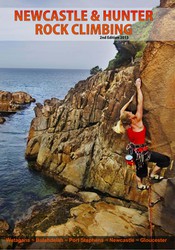
Autor(es): Tim Haasnoot
Fecha: 2013
número ISBN: 9780975129319
An area that has steep sport routes, trad cracks, deep-water-soling, sea cliff climbing and bouldering all within a short drive to some beautiful beaches and national parks is surely worth a look in. The Newcastle and Hunter Rock Climbing guide by Tim Haasnoot is feature packed and includes all the areas worth a day trip from Newcastle. This guide features over 950 routes, 170 boulder problems and 100 DWS with full topo maps and navigation info.
Alojamientos cercanos more Ocultar
Compartir contenido
Mié 10 Mayo
Echa un vistazo a lo que está ocurriendo en Turkey Walls.
Get a detailed insight with a timeline showing
- Ticks by climbers like you
- Discussions of the community
- Updates to the index by our users
- and many more things.
Login to see the timeline!