Use this Region Guide to easily find and compare Crags.
Table of contents
- 1.
Frankenjura / Franconian Jura / Frankenalb / Fränkische Alb
16221 in Region
-
1.1.
Frankenjura Nord / Nördliche Frankenalb 13966 routes in Area
- 1.1.1. Weißmain-Alb 1062 routes in Area
- 1.1.2. Fränkische Schweiz / "Fränkische" 8647 routes in Area
- 1.1.3. Hersbrucker Schweiz / Hersbrucker Alb 3731 routes in Area
- 1.1.4. Indoor / Kletter- und Boulderhallen 48 routes in Artificial
- 1.1.5. Amberger Gebiet / Oberpfälzer Alb 388 routes in Area
- 1.1.6. Neumarkter Gebiet 90 routes in Area
-
1.2.
Frankenjura Süd / Südliche Frankenalb 2254 routes in Crag
- 1.2.1. Klettersteinbruch Möhren 40 routes in Crag
- 1.2.2. Konstein 630 routes in Area
- 1.2.3. Altmühltal 688 routes in Crag
- 1.2.4. Labertal 339 routes in Crag
- 1.2.5. Donautal / Donaudurchbruch 127 routes in Crag
- 1.2.6. Naabtal 63 routes in Area
- 1.2.7. Kallmünzer Gebiet / Vilstal 222 routes in Area
- 1.2.8. Indoor / Kletter- und Boulderhallen 145 routes in Area
-
1.1.
Frankenjura Nord / Nördliche Frankenalb 13966 routes in Area
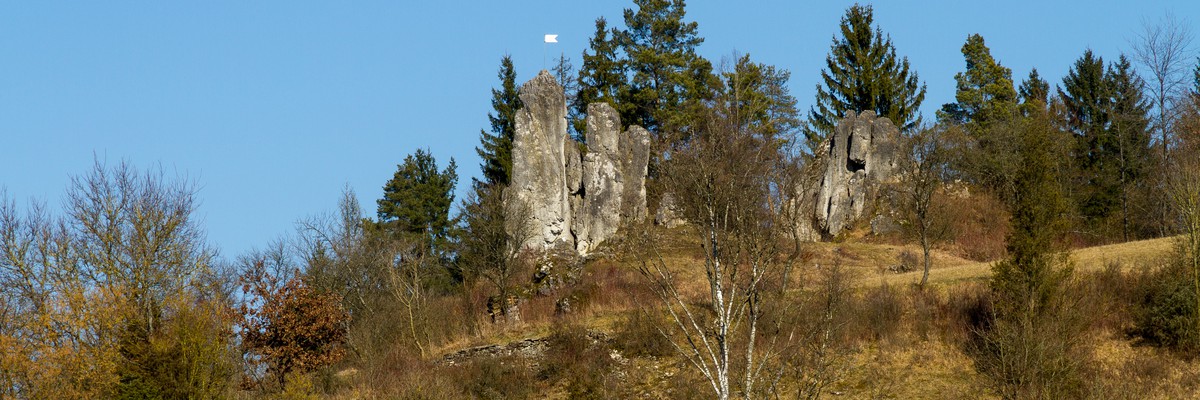
1. Frankenjura
- Summary:
-
Lat / Long: 49.247436, 11.408170
요약
Frankenjura is a world famous climbing destination hosting many classics that are listed in climbing history books. Its sheer size and variety of climbs offer a lifetime of climbing.
설명
Frankenjura is Germany's 2nd largest climbing area and a world-class sport climbing destination with a quite long history. In this large area in northern Bavaria, between the cities of Bamberg, Bayreuth and Nuremberg, there are approximately 1,000 different crags spread out in a pitoresque landscape of forested valleys and mediaval villages. Apart from climbing, don't forget to excessively test the excellent local beer and solid food.
The majority of the routes at Frankenjura are short powerful single pitch sport routes on excellent quality grey limestone. Most routes are either vertical or overhanging, finger pockets are very common. The best time to climb at Frankenjura is spring and autumn, but summer is also fine since many of the crags are hidden in the forest.
접근 문제들
Frankenjura has an established zone concept regulating whether a rock is allowed and if yes, how: https://ig-klettern.org/naturschutz/zonierungen/
For seasonal closures of crags, see: https://ig-klettern.org/naturschutz/aktuelle-sperrungen/
For bouldering, check first: https://ig-klettern.org/klettern/wissenswertes/boulderappell/. Especially, no publishing of boulders, and no bouldering after sunset.
접근
Coming from abroad it is probably best to fly into Munich and rent a car. As the crags are spread out over a fairly large area having a car is strongly recommended anyways.
Check the many crags for more detailed information on access.
For a detailed description on how to reach Frankenjura by fair means visit the Ecopoint Web-Site.
숙박 장소
Especially in the northern Frankenjura one can find plenty of rather cheap holiday appartments. Camping is another popular option. The legendary Oma Eichler campground in the Trubachtal is a meeting point for climbers since many years.
역사
A lot! Especially in the 80's, Frankenjura was the destination for hard-core climbing. You can find here the world’s first 8c ('Wallstreet') and 9a ('Action directe' 1991) and many more ultra classics. Frankenjura was also the birth-place of the redpoint concept, established by Kurt Albert † in the mid 70s.
1.1. Frankenjura Nord
- Summary:
-
Lat / Long: 49.590220, 11.481022
- Zone 1: NO climbing
- Zone 2: climbing on existing routes
- Zone 3: new routes possible
- R3 to Hersbruck, Neuhaus and Pegnitz
- R4 to Amberg via Hersbruck, Etzelwang
- S1 to Hartmannshof via Hersbruck
- R21 Gräfenberg
- R2/S1 to Bamberg voa Forchheim
- R22 from Forchheim to Ebermannstadt
- The limestone is soft – please clean your shoes from dirt in order to avoid polished handholds and steps.
- Don't toprope directly through bolts – use your own material.
- Clean chalk and tickmarks with a brush.
- Don't leave toilet paper.
- Pick up rubbish.
- No unnecessary noise.
- No camp fire and bivvy.
- Park considerately (tractor should be able to pass also at the weekend).
- Smoking in the forests is forbidden from March 1 until October 31 by law.
- No publishing of boulder blocks.
- 1905 the group "Rifflerbuben" climb the last tower ("Bolzenstein").
- 1960 Oskar Bühler invented the "Bühlerhaken" – father of glue-in bolts
- 1974 definition of "redpoint" by Kurt Albert † and friends
- 1991 "Action Directe" by Wolfgang Güllich † – first UIAA 11 route
요약
The biggest sport climbing area in Germany.
설명
Limestone – not very sharp. Good Variety and often with pockets.
Mostly single pitch sport climbing, but not always well-protected. Nuts and slings can be very useful.
접근 문제들
Seasonal closures for protected birds. See here: Closed crags
Additional information: IG Klettern closure list
Zoning concept
Please respect signs and zoning.
접근
The Frankenjura covers a big area; it depends where you want to climb and where you want to have your "base camp". The main city Nürnberg in the south west offers airport and railway connections to many crags. Public transport: VGN is your only option.
These are the important railway connections for this area:
Then you have to change to bus or bicycle. The valley of the Pegnitz, for example, can be reached by using the R3.
Some areas, however, are poorly connected with public transport (not much has happened since the middle ages). Most people have a car to travel around.
숙박 장소
Camping
The website of the Tourismuszentrale Fränkische Schweiz lists all camp grounds.
윤리문제
역사
1.1.1. Weißmain-Alb
- Summary:
-
1,062 routes in Area
Mostly 스포츠 클라이밍Lat / Long: 50.055844, 11.139386
설명
Ziegenfelder Alb und Staffelsteiner Alb
1.1.2. Fränkische Schweiz
- Summary:
-
Mostly 스포츠 클라이밍
8,647 routes in Area
Lat / Long: 49.828768, 11.309690
설명
1.1.3. Hersbrucker Schweiz
- Summary:
-
3,731 routes in Area
Mostly 스포츠 클라이밍Lat / Long: 49.589078, 11.565519
설명
1.1.4. Indoor
- Summary:
-
48 routes in Artificial
모두 스포츠 클라이밍Lat / Long: 49.686931, 11.274440
설명
Kletter- und Boulderhallen
1.1.5. Amberger Gebiet
- Summary:
-
388 routes in Area
Mostly 스포츠 클라이밍Lat / Long: 49.386993, 11.777700
윤리문제
see Mittlere Fränkische Alb / Oberpfälzer Alb / Mittlerer Frankenjura for info.
1.1.6. Neumarkter Gebiet
- Summary:
-
90 routes in Area
모두 스포츠 클라이밍Lat / Long: 49.288730, 11.533206
1.2. Frankenjura Süd
- Summary:
-
Lat / Long: 48.958760, 11.366309
1.2.1. Klettersteinbruch Möhren
- Summary:
-
Lat / Long: 48.927472, 10.874131
요약
Der Klettersteinbruch ist ein Gemeinschaftsprojekt der Stadt Treuchtlingen, dem Landkreis Weißenburg-Gunzenhausen und den drei DAV-Sektionen Gunzenhausen, Weißenburg und Treuchtlingen. Er liegt an der Staatsstraße 2217 von Möhren in Richtung Rehlingen (ca. 250m nach der Eisenbahnbrücke links)
Erschlossen sind mittlerweile über 40 Routen in Schwierigkeitsgraden von 4 bis 10.
Die Benutzung geschieht auf eigene Gefahr!
Fragen zur Nutzung des Klettersteinbruchs durch die Aktiven des DAV-Weißenburg können an den Spartenleiter Michael Meyer oder den Jugendleiter Manuel Preiß gestellt werden.
설명
1.2.2. Konstein
- Summary:
-
630 routes in Area
Mostly 스포츠 클라이밍Lat / Long: 48.857021, 11.095216
윤리문제
see Südliche Fränkische Alb / Südlicher Frankenjura for Info.
1.2.3. Altmühltal
- Summary:
-
688 routes in Crag
Mostly 스포츠 클라이밍Lat / Long: 48.950557, 11.773071
윤리문제
see Südliche Fränkische Alb / Südlicher Frankenjura for Info.
1.2.4. Labertal
- Summary:
-
339 routes in Crag
Mostly 스포츠 클라이밍Lat / Long: 49.066499, 11.873483
요약
Die verschiedenen Klettergebiete im Labertal befinden sich nur wenige Kilometer westlich von Regensburg.
설명
Aufgrund der Nähe zu Regensburg und der Popularität der Gebiete können diese speziell am Wochenende leicht überlaufen sein.
Some informations: https://www.alpenverein.de/chameleon/public/ec95d1b4-8ca1-130c-dca2-7d81b19ff7df/konzeption_jurataeler_30066.pdf
접근
Die Anfahrt zum Labertal erfolgt von Regensburg aus über die A3 bis zur Ausfahrt Nittendorf.
윤리문제
see Südliche Fränkische Alb / Südlicher Frankenjura for Info.
1.2.5. Donautal
- Summary:
-
Mostly 스포츠 클라이밍
127 routes in Crag
Lat / Long: 48.948159, 11.932512
윤리문제
see Südliche Fränkische Alb / Südlicher Frankenjura for Info.
1.2.6. Naabtal
- Summary:
-
63 routes in Area
Mostly 스포츠 클라이밍Lat / Long: 49.081000, 11.968862
요약
Das Klettergebiet Naabtal befindet sich nur wenige Kilometer nordwestlich von Regensburg.
접근
Die Anfahrt zum zum Naabtal erfolgt von Regensburg aus über die A3 bis zur Ausfahrt Nittendorf.
1.2.7. Kallmünzer Gebiet
- Summary:
-
222 routes in Area
Mostly 스포츠 클라이밍Lat / Long: 49.183059, 11.921498
1.2.8. Indoor
- Summary:
-
145 routes in Area
모두 스포츠 클라이밍Lat / Long: 49.032851, 12.129130