Use this Region Guide to easily find and compare Crags.
Table of contents
- 1.
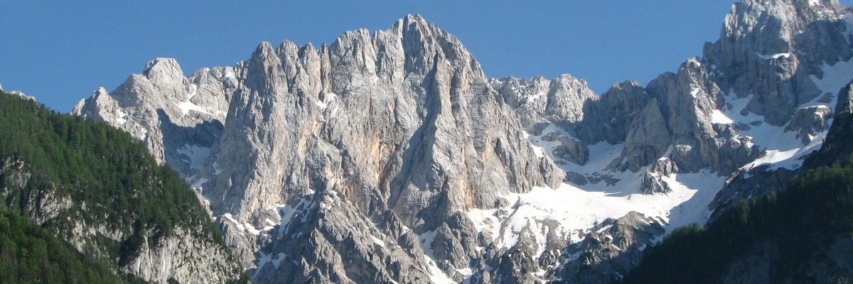
Julijske Alpe / Julische Alpen / Alpi Giulie
2255 in Region
-
1.1.
Ajdovscina 581 in Region
- 1.1.1. Vipava 296 in Crag
- 1.1.2. Podrta gora 19 in Crag
- 1.1.3. Vipavska Bela 133 in Crag
- 1.1.4. Vitovlje 49 in Field
- 1.1.5. Lijak 84 in Crag
-
1.2.
Skofja Loka 120 in Region
- 1.2.1. Prtovč 40 in Crag
- 1.2.2. Kamnitnik 40 in Crag
- 1.2.3. Matjazeve Kamre 16 in Crag
- 1.2.4. Pri Skalarju - Zminec 24 in Crag
- 1.3. Jesenice 0 in Region
-
1.4.
Lutne Skale 144 in Area
- 1.4.1. A 7 in Crag
- 1.4.2. B / I 3 in Crag
- 1.4.3. B / II 4 in Crag
- 1.4.4. B / III 3 in Crag
- 1.4.5. C / I 5 in Crag
- 1.4.6. C 9 in Crag
- 1.4.7. D 17 in Crag
- 1.4.8. E 5 in Crag
- 1.4.9. F 2 in Crag
- 1.4.10. G 11 in Crag
- 1.4.11. H 5 in Crag
- 1.4.12. I 19 in Crag
- 1.4.13. J 7 in Crag
- 1.4.14. J / I 7 in Crag
- 1.4.15. K 16 in Crag
- 1.4.16. L 4 in Crag
- 1.4.17. M 2 in Crag
- 1.4.18. O 12 in Crag
- 1.4.19. P 6 in Crag
-
1.5.
Tolmin 364 in Region
- 1.5.1. Pri Zvikarju 11 in Crag
- 1.5.2. Kal Koritnica 34 in Crag
- 1.5.3. Vršič 40 in Area
- 1.5.4. Nad Šitom Glava 17 in Crag
- 1.5.5. Mala Mojstrovka 11 in Area
- 1.5.6. Velika Mojstrovka 1 in Crag
- 1.5.7. Zadnjiški ozebnik, North Wall 4 in Area
- 1.5.8. Pri Pavru 23 in Crag
- 1.5.9. Pri Ciginju 45 in Crag
- 1.5.10. Pri Plajerju / Trenta 38 in Crag
- 1.5.11. Kobarid 104 in Area
- 1.5.12. Krn / Monte Nero 1 in Area
- 1.5.13. Kegl 33 in Crag
- 1.5.14. Mangart 2 in Area
- 1.5.15. Kanin 54 in Crag
- 1.6. Gore 38 in Crag
- 1.7. Retovje 26 in Crag
-
1.8.
Radvoljica 555 in Region
- 1.8.1. Bitnje 74 in Crag
- 1.8.2. Savica 1 in Area
- 1.8.3. Peč 42 in Crag
- 1.8.4. Bohinj 108 in Crag
- 1.8.5. Nomenj 34 in Crag
- 1.8.6. Kupljenk 33 in Crag
- 1.8.7. Bohinjska Bela 80 in Crag
- 1.8.8. Bodešče 67 in Area
- 1.8.9. Gorje / Gorje w 90 in Crag
- 1.8.10. Radovna 26 in Crag
- 1.9. Marof 44 in Area
- 1.10. Strug 82 in Crag
-
1.11.
Dolge Njive 81 in Crag
- 1.11.1. Zgoraj / Upper 24 in Sector
- 1.11.2. Spodaj / Lower 57 in Sector
-
1.12.
Senica 49 in Area
- 1.12.1. A - Steber 8 in Sector
- 1.12.2. B - Mala plošča 6 in Sector
- 1.12.3. C - Previs 9 in Sector
- 1.12.4. D - Velika plošča 26 in Sector
- 1.13. Triglav - North Wall 30 in Area
-
1.14.
Prisojnik / Prisank 4 in Crag
- 1.14.1. Ajdovska Deklica / Heathen Maiden 1 in Cliff
- 1.14.2. Južna stena / South 1 in Cliff
- 1.14.3. Hudičev steber 1 in Cliff
- 1.14.4. Waterfalls 1 in Crag
- 1.15. Drnulk 81 in Area
- 1.16. Široka peč 1 in Crag
- 1.17. Martuljek mountain 0 in Region
- 1.18. Špik 1 in Area
-
1.1.
Ajdovscina 581 in Region
1. Julijske Alpe 2,255 routes in Region
- Summary:
-
Mostly 스포츠 클라이밍
Lat / Long: 46.108565, 13.817438
설명
AVE 58
1.1. Ajdovscina 581 routes in Region
- Summary:
-
Mostly 스포츠 클라이밍
Lat / Long: 45.873305, 13.916795
1.1.1. Vipava 296 routes in Crag
- Summary:
-
모두 스포츠 클라이밍
Lat / Long: 45.833067, 13.975165
요약
A huge crag comprised of multiple cliffs in the Vipava valley. Great for spring and fall, hot in summer.
1.1.2. Podrta gora 19 routes in Crag
- Summary:
-
모두 볼더링
Lat / Long: 45.892067, 13.941864
접근
Parking spot GPS coordinates: N 45.8839 E 13.9386
1.1.3. Vipavska Bela 133 routes in Crag
- Summary:
-
모두 스포츠 클라이밍
Lat / Long: 45.871566, 13.972624
요약
A very popular crag in Slovenia with routes in all grades.
설명
접근
From Vipava drive in direction of Vrhpolje. Pass it, and stay right of the church. Drive uphil through some hairpin turns, pass a repair shop and park shortly after it along the road for sector Pr' Tekci. Continue along the road for the other sectors.
숙박 장소
Nice camping site: KAMP VRHPOLJE, Vrhpolje 42, 5271 Vipava
1.1.4. Vitovlje 49 routes in Field
- Summary:
-
모두 볼더링
Lat / Long: 45.942229, 13.771050
설명
One of Slovenia's major bouldering areas located in a forest.
접근
Near teh northern end of the village of Vitovlje, in direction of Trajnice.
1.1.5. Lijak 84 routes in Crag
- Summary:
-
모두 스포츠 클라이밍
Lat / Long: 45.962335, 13.719756
요약
A less frequented crag, great for colder days in a remote area with great views.
접근
Make your way to Loke and park near the church St. Magdalena.
1.2. Skofja Loka 120 routes in Region
- Summary:
-
모두 스포츠 클라이밍
Lat / Long: 46.154095, 14.154271
1.2.1. Prtovč 40 routes in Crag
- Summary:
-
Lat / Long: 46.219109, 14.122400
설명
A new crag located above Železniki, about halfway on mountain walkway between Jesenovec and village Prtovč.
접근
From village of Prtovč, follow marked footpath descending to Jesenovec until you can see the walls to the right off the path.
1.2.2. Kamnitnik 40 routes in Crag
- Summary:
-
Lat / Long: 46.169859, 14.311437
설명
Just a shot above centre of Škofja Loka is a nice 10m cliff of solid conglomerate rock. Below the cliff is nice flat area, some of it in shade throughout the day, making it a rather cozy experience for belayers. Climbers have to deal with polished holds and bouldery, pockety routes.
1.2.3. Matjazeve Kamre 16 routes in Crag
- Summary:
-
Lat / Long: 46.005557, 14.136433
1.2.4. Pri Skalarju - Zminec 24 routes in Crag
- Summary:
-
1.3. Jesenice 0 routes in Region
1.4. Lutne Skale 144 routes in Area
- Summary:
-
모두 스포츠 클라이밍
Lat / Long: 46.126268, 13.915105
접근
From the parking spot five minutes on the path across the field into the forest.
1.4.1. A 7 routes in Crag
- Summary:
-
1.4.2. B / I 3 routes in Crag
- Summary:
-
1.4.3. B / II 4 routes in Crag
- Summary:
-
1.4.4. B / III 3 routes in Crag
- Summary:
-
1.4.5. C / I 5 routes in Crag
- Summary:
-
1.4.6. C 9 routes in Crag
- Summary:
-
1.4.7. D 17 routes in Crag
- Summary:
-
1.4.8. E 5 routes in Crag
- Summary:
-
1.4.9. F 2 routes in Crag
- Summary:
-
1.4.10. G 11 routes in Crag
- Summary:
-
1.4.11. H 5 routes in Crag
- Summary:
-
1.4.12. I 19 routes in Crag
- Summary:
-
1.4.13. J 7 routes in Crag
- Summary:
-
1.4.14. J / I 7 routes in Crag
- Summary:
-
1.4.15. K 16 routes in Crag
- Summary:
-
1.4.16. L 4 routes in Crag
- Summary:
-
1.4.17. M 2 routes in Crag
- Summary:
-
1.4.18. O 12 routes in Crag
- Summary:
-
1.4.19. P 6 routes in Crag
- Summary:
-
1.5. Tolmin 364 routes in Region
- Summary:
-
Mostly 스포츠 클라이밍
Lat / Long: 46.253168, 13.689155
1.5.1. Pri Zvikarju 11 routes in Crag
- Summary:
-
모두 스포츠 클라이밍
Lat / Long: 46.320942, 13.485749
1.5.2. Kal Koritnica 34 routes in Crag
- Summary:
-
모두 스포츠 클라이밍
Lat / Long: 46.342119, 13.584245
요약
Quality rock with interesting features, sloping ledges and bulges to hold on to, very suitable for beginner climbers.
설명
접근
From the village Kal-Koritnica, follow markers towards 'Svinjak'. Shortly above the village (where the bunker-like structure, probably a basin, is), the path towards the crag will veer off to the left.
1.5.3. Vršič 40 routes in Area
- Summary:
-
모두 스포츠 클라이밍
Lat / Long: 46.430095, 13.740785
1.5.4. Nad Šitom Glava 17 routes in Crag
- Summary:
-
스포츠 클라이밍, 고전등반 그리고 빙벽등반
Lat / Long: 46.438253, 13.739845
1.5.5. Mala Mojstrovka 11 routes in Area
- Summary:
-
고전등반 그리고 알파인 등반
Lat / Long: 46.435711, 13.733352
1.5.6. Velika Mojstrovka 1 route in Crag
- Summary:
-
모두 고전등반
Lat / Long: 46.435096, 13.725221
1.5.7. Zadnjiški ozebnik, North Wall 4 routes in Area
- Summary:
-
모두 스포츠 클라이밍
Lat / Long: 46.378905, 13.764826
1.5.8. Pri Pavru 23 routes in Crag
- Summary:
-
모두 스포츠 클라이밍
Lat / Long: 46.394896, 13.742600
1.5.9. Pri Ciginju 45 routes in Crag
- Summary:
-
모두 스포츠 클라이밍
Lat / Long: 46.169554, 13.714287
1.5.10. Pri Plajerju 38 routes in Crag
- Summary:
-
모두 스포츠 클라이밍
Lat / Long: 46.363079, 13.716976
설명
Always cool Soča river and short, soft sheep-mown grass at the feet of boulders that rolled down the slopes of picturesque valley sometime in the past make for one of the most relaxing, cozy and beautiful climbing spots in Slovenia. The sport routes are short and on the easier side, however if you really want to strain yourself, there are plenty of boulder problems available. After you nail a hard one, pet the donkey to relax your forearms!
접근 문제들
This is private land. Absolutely no littering and try to keep the noise down, too. After crossing the bridge you'll pass by neighbour's house and through a gate - do not forget to close it.
접근
( , 46.362866904159816, 13.714469921073562) Park just after the tunnel on the right side of the road (going from Vršič pass towards Bovec). Cross the road and then the bridge, go left through the gate and find your way uphill.
숙박 장소
Camping and other lodging options are available 10 minute drive north towards Vršič pass.
1.5.11. Kobarid 104 routes in Area
- Summary:
-
모두 스포츠 클라이밍
Lat / Long: 46.252337, 13.550875
1.5.12. Krn 1 route in Area
- Summary:
-
모두 암벽등반
Lat / Long: 46.266662, 13.654288
요약
One via ferrata route to the summit
1.5.13. Kegl 33 routes in Crag
- Summary:
-
모두 스포츠 클라이밍
Lat / Long: 46.347286, 13.543880
접근
1.5.14. Mangart 2 routes in Area
- Summary:
-
스포츠 클라이밍 그리고 고전등반
Lat / Long: 46.436429, 13.650186
설명
1.5.15. Kanin 54 routes in Crag
- Summary:
-
모두 스포츠 클라이밍
Lat / Long: 46.357805, 13.476176
1.6. Gore 38 routes in Crag
- Summary:
-
모두 스포츠 클라이밍
Lat / Long: 46.008028, 14.051979
1.6.1. Left 7 routes in Sector
- Summary:
-
접근
Just after the parking spot towards the forest, watch for abandoned forest road leading left and down towards the sector.
1.6.2. Right 31 routes in Sector
- Summary:
-
접근
Sector is directly below the parking spot.
1.7. Retovje 26 routes in Crag
- Summary:
-
모두 스포츠 클라이밍
Lat / Long: 45.950788, 14.296366
요약
Compact overhanging wall in idyllic nature 15 minutes away from Ljubljana.
1.8. Radvoljica 555 routes in Region
- Summary:
-
Mostly 스포츠 클라이밍
Lat / Long: 46.331176, 13.999347
1.8.1. Bitnje 74 routes in Crag
- Summary:
-
모두 스포츠 클라이밍
Lat / Long: 46.285913, 13.964585
1.8.2. Savica 1 route in Area
- Summary:
-
모두 스포츠 클라이밍
Lat / Long: 46.273655, 13.914635
1.8.3. Peč 42 routes in Crag
- Summary:
-
모두 스포츠 클라이밍
Lat / Long: 46.277309, 13.895229
1.8.4. Bohinj 108 routes in Crag
- Summary:
-
Mostly 스포츠 클라이밍
Lat / Long: 46.283482, 13.858477
설명
Several crags located on the shore of Lake Bohinj. Perfect for a summer climb and swim.
접근
Continue past the famous Lake Bled to the quieter and more rugged Lake Bohinj.
1.8.5. Nomenj 34 routes in Crag
- Summary:
-
모두 스포츠 클라이밍
Lat / Long: 46.295705, 14.004490
1.8.6. Kupljenk 33 routes in Crag
- Summary:
-
모두 스포츠 클라이밍
Lat / Long: 46.337147, 14.076871
설명
Long pumpy routes on slighly overhanging plates. Base of the crag is in the shade of trees.
접근
Driving from Bled to Bohinj, turn left for village Kupljenk. Shortly after passing the first houses in a sharp left turn, turn right into a big gravel parking lot. From there, it's a 10 min walk through forest to the crag.
1.8.7. Bohinjska Bela 80 routes in Crag
- Summary:
-
모두 스포츠 클라이밍
Lat / Long: 46.343367, 14.054706
요약
The walls above Bohinjska Bela are with good rock and wide range of route difficulties, arguably one of the best climbing areas in Slovenia.
접근 문제들
Parking is allowed by the church (N46 20' 60", E14 4' 12") and by the store (N46 20' 58", E14 4' 1") in the village. Parking elsewhere is strictly forbidden. Do not leave trash behind you and stay as quiet as possible if climbing in Iglica, as there are houses next to the crag. Access via road to sector Bohinjska Bela is also by foot only.
1.8.8. Bodešče 67 routes in Area
- Summary:
-
모두 스포츠 클라이밍
Lat / Long: 46.343075, 14.141161
1.8.9. Gorje 90 routes in Crag
- Summary:
-
모두 스포츠 클라이밍
Lat / Long: 46.373130, 14.069897
접근
GPS coordinates: 46.3733939, 14.069983
윤리문제
The area is primary reserved for Caving rescue exercises and training for caving. If you see the exercise, you give way. They have priority in using the area.
Respect the locals!! You can engage with normal conversation and respect if they ask you about anything.
Take ALL the trash with you and not in the Bins around..(those are not necessarily trash bins. If you see any gear and material, do not take it or steal it. They are there for the caving exercises.
1.8.10. Radovna 26 routes in Crag
- Summary:
-
모두 스포츠 클라이밍
Lat / Long: 46.406853, 13.989644
요약
A summertime crag with long and attractive routs.Most of the routs are quite difficult and suitable for experienced climbers.The wall in sector A is overhangig, so it s posible to climb in light rain
설명
The wall is facing NE
접근 문제들
You can park at the hand- shaped monument in the valley Radovna. Cross the bridge, over the fance, flollow the stream. After the cart track levels up, heat right up a steep forest to get to the path leading to the crag.
접근
P: 46.411111, 13.995833
1.9. Marof 44 routes in Area
- Summary:
-
모두 스포츠 클라이밍
Lat / Long: 46.019124, 14.034223
1.9.1. A 23 routes in Sector
- Summary:
-
1.9.2. B 21 routes in Sector
- Summary:
-
1.10. Strug 82 routes in Crag
- Summary:
-
모두 스포츠 클라이밍
Lat / Long: 45.970489, 14.009815
1.10.1. A 62 routes in Sector
- Summary:
-
1.10.2. B 7 routes in Sector
- Summary:
-
1.10.3. C 13 routes in Sector
- Summary:
-
1.10.4. D - Zob 0 routes in Crag
1.10.5. E 0 routes in Crag
1.10.6. F - Velika stena 0 routes in Crag
1.11. Dolge Njive 81 routes in Crag
- Summary:
-
모두 스포츠 클라이밍
Lat / Long: 46.023142, 13.609035
요약
Dolge Njive offers very different climbing styles on the upper and lower sectors. The lower ones are rather short and bouldery while the upper ones are more technical and longer.
접근
Follow the Soča river to Solkan. Just before the restaurant Dermota you will find 2 parking spots, the first one for the upper, the second one for the lower sectors.
1.11.1. Zgoraj 24 routes in Sector
- Summary:
-
Lat / Long: 46.020106, 13.611825
접근
Follow the road until you see trails going into the woods, follow the trails taht are marked by cairns to the cliff.
1.11.2. Spodaj 57 routes in Sector
- Summary:
-
Lat / Long: 46.025843, 13.606587
접근
Cross the road from the parking and find trails that lead you the cliff.
1.12. Senica 49 routes in Area
- Summary:
-
모두 스포츠 클라이밍
Lat / Long: 46.161109, 13.775823
1.12.1. A - Steber 8 routes in Sector
- Summary:
-
1.12.2. B - Mala plošča 6 routes in Sector
- Summary:
-
1.12.3. C - Previs 9 routes in Sector
- Summary:
-
1.12.4. D - Velika plošča 26 routes in Sector
- Summary:
-
1.13. Triglav - North Wall 30 routes in Area
- Summary:
-
모두 고전등반
Lat / Long: 46.384787, 13.834237
설명
1.14. Prisojnik 4 routes in Crag
- Summary:
-
고전등반, 스포츠 클라이밍 그리고 빙벽등반
Lat / Long: 46.426507, 13.767272
요약
Prisojnik is a mountain of the Julian Alps. Its summit is 2547m ASL. It is located above the Vršič Pass, from where most climbs of the mountain start.
설명
1.14.1. Ajdovska Deklica 1 route in Cliff
- Summary:
-
모두 고전등반
Lat / Long: 46.428167, 13.758746
설명
The face that resembles a human face.
1.14.2. Južna stena 1 route in Cliff
- Summary:
-
모두 스포츠 클라이밍
Lat / Long: 46.422638, 13.764299
1.14.3. Hudičev steber 1 route in Cliff
- Summary:
-
모두 고전등반
Lat / Long: 46.429615, 13.767968
1.14.4. Waterfalls 1 route in Crag
- Summary:
-
모두 빙벽등반
Lat / Long: 46.434867, 13.765967
1.15. Drnulk 81 routes in Area
- Summary:
-
모두 스포츠 클라이밍
Lat / Long: 46.064551, 13.812105
접근
Follow the road and the path into the forest.
1.15.1. A 7 routes in Sector
- Summary:
-
Lat / Long: 46.064774, 13.811376
1.15.2. B 11 routes in Sector
- Summary:
-
Lat / Long: 46.064970, 13.811502
1.15.3. C 26 routes in Sector
- Summary:
-
Lat / Long: 46.064801, 13.811891
1.15.4. D 18 routes in Sector
- Summary:
-
Lat / Long: 46.064625, 13.812446
1.15.5. E 7 routes in Sector
- Summary:
-
Lat / Long: 46.064532, 13.811603
1.15.6. F 12 routes in Sector
- Summary:
-
Lat / Long: 46.064191, 13.812394
1.16. Široka peč 1 route in Crag
- Summary:
-
모두 고전등반
Lat / Long: 46.443852, 13.841889
설명
Luka Lindic:
"The north face of Široka peč its a famous face in Slovenia but beyond the Slovenian border practically no one knows it. It’s known mostly for its really loose rock, and consequently all the routes are a serious alpine outing. I believe there is no single bolt on the wall and most of the routes are the work of the Slovenian climber who placed Slovenian alpinism on a "world map” in the 70s and 80s - Silvo Karo."
1.17. Martuljek mountain 0 routes in Region
1.18. Špik 1 route in Area
- Summary:
-
모두 고전등반
Lat / Long: 46.449926, 13.816133