A Crag Guide gives an extensive view of all sub areas and climbs at a point in the index. It shows a snapshot of the index heirachy, up to 300 climbs (or areas) on a single web page. It shows selected comments climbers have made on a recently submitted ascent.
At a minor crag level this should be suitable for printing and taking with you on a climbing trip as an adjunct to your guidebook.
This guide was generated anonymously. Login to show your logged ascents against each route.
Warning
Rock climbing is extremely dangerous and can result in serious injury or death. Users acting on any information directly or indirectly available from this site do so at their own risk.
This guide is compiled from a community of users and is presented without verification that the information is accurate or complete and is subject to system errors. By using this guide you acknowledge that the material described in this document is extremely dangerous, and that the content may be misleading or wrong. In particular there may be misdescriptions of routes, incorrectly drawn topo lines, incorrect difficulty ratings or incorrect or missing protection ratings. This includes both errors from the content and system errors.
Nobody has checked this particlular guide so you cannot rely on it's accuracy like you would a store bought guide.
You should not depend on any information gleaned from this guide for your personal safety.
You must keep this warning with the guide. For more information refer to our:
Usage policy
Contributors
Thanks to the following people who have contributed to this crag guide:
Fredrik Eckardt
Southbeach
Nils Winell
Anders Grahn
Keoni "Come on Obe" Onsaga
The size of a person's name reflects their Crag Karma, which is their level of contribution. You can help contribute to your local crag by adding descriptions, photos, topos and more.
Table of contents
- 1.
Brakmaren
17 in Crag
- 1.1. Roadside 17 in Sector
- 1.2. By the water 0 in Sector
- 2. Index by grade
1. Brakmaren 17 routes in Crag
- Summary:
-
모두 스포츠 클라이밍
Lat / Long: 59.204683, 18.318301
요약
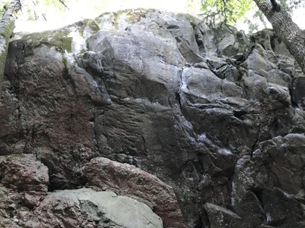
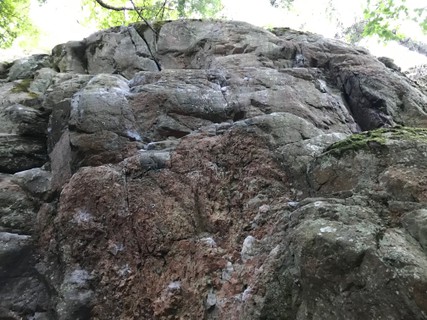
Small, steep crag.
접근 문제들
Please used designated parking areas. Check Sweden climbing association access database: https://access.klatterforbundet.se/
접근
1.1. Roadside 17 routes in Sector
- Summary:
-
Lat / Long: 59.203922, 18.319167
| Route | Grade | Style | Selected ascents | |||||
|---|---|---|---|---|---|---|---|---|
| 1 | Mer eller mindre | FR:7a | ||||||
| 2 | Bakom trädet | FR:7b+ | ||||||
| 3 | 500 | FR:7c | ||||||
 |
||||||||
| Route | Grade | Style | Selected ascents | |||||
| 4 | ★★ 499 | FR:7b+ | ||||||
| 5 | ★★ Knep och knåp | FR:7b | ||||||
| 6 | Knep och knåp direkt | FR:7b+ | ||||||
| 7 | ★ Knep och knåp (to second anchor) | FR:7c | ||||||
| 8 | Upp och ner | FR:8a | ||||||
| 9 | ★★★ Fly | FR:7c | ||||||
   |
||||||||
| Route | Grade | Style | Selected ascents | |||||
| 10 | ★★ Linjär succe | FR:7a | ||||||
| 11 | Linjär succé delux | FR:7b | ||||||
| 12 |
Varm up route
Link. | FR:6c | ||||||
| 13 | ★★ Berits kiosk | FR:7c+ | ||||||
| 14 |
Rimliga ramar
Steep and hard start leads to significant easier finish. | FR:7b | ||||||
| 15 | No name | FR:7c+ | ||||||
| 16 | ★ Ägget är löst | FR:7a | ||||||
| 17 |
Chutima
Finish in the single "anchor bolt" over the edge, that you can not see from below. (Possible to use the anchor of 'ägget är löst' to clean. | FR:6c | ||||||
1.2. By the water 0 routes in Sector
2. Index by grade
| Grade | Stars | Name | Style | Pop | Area | |
|---|---|---|---|---|---|---|
| 6c | Chutima | 1.1. Roadside | ||||
| Varm up route | 1.1. Roadside | |||||
| 7a | ★★ | Linjär succe | 1.1. Roadside | |||
| Mer eller mindre | 1.1. Roadside | |||||
| ★ | Ägget är löst | 1.1. Roadside | ||||
| 7b | ★★ | Knep och knåp | 1.1. Roadside | |||
| Linjär succé delux | 1.1. Roadside | |||||
| Rimliga ramar | 1.1. Roadside | |||||
| 7b+ | ★★ | 499 | 1.1. Roadside | |||
| Bakom trädet | 1.1. Roadside | |||||
| Knep och knåp direkt | 1.1. Roadside | |||||
| 7c | 500 | 1.1. Roadside | ||||
| ★★★ | Fly | 1.1. Roadside | ||||
| ★ | Knep och knåp (to second anchor) | 1.1. Roadside | ||||
| 7c+ | ★★ | Berits kiosk | 1.1. Roadside | |||
| No name | 1.1. Roadside | |||||
| 8a | Upp och ner | 1.1. Roadside |