Use this Region Guide to easily find and compare Crags.
Table of contents
- 1.
Brandenburg
676 in Region
- 1.1. Rothsteiner Felsen 46 in Crag
- 1.2. Bucksche Schweiz 5 in Field
-
1.3.
Markgrafensteine 32 in Field
- 1.3.1. Großer Markgrafenstein / Der "Halbe" 17 in Boulder
- 1.3.2. Kleiner Markgrafenstein / Der "Ganze" 15 in Boulder
- 1.4. Owis Stein / Großer Stein 15 in Boulder
- 1.5. Kobbelner Stein 10 in Boulder
- 1.6. Der Große Stein Oderberg-Neuendorf / Findling Oderberg-Neuendorf 2 in Boulder
- 1.7. Findling Brück 3 in Boulder
- 1.8. Riesenstein Ringewalde 11 in Boulder
- 1.9. Haselberger Haselnuss 4 in Boulder
- 1.10. Findling Jänschwalde 1 in Boulder
-
1.11.
Bunker "Koralle" / Bunker Lobetal / Lankebunker / Bunker Lanke 62 in Crag
- 1.11.1. Östliche Tunnelwand 21 in Sector
- 1.11.2. Pik Lobetal 12 in Sector
- 1.11.3. Mount Lanke 7 in Sector
- 1.11.4. Bunkerspitze 10 in Sector
- 1.11.5. Westliche Tunnelwand 8 in Sector
- 1.11.6. Boulderquergang 0 in Field
- 1.11.7. Lager "Koralle" 4 in Field
-
1.12.
Ludwigsfelde / Quackenwald 109 in Field
- 1.12.1. Plattenstein 48 in Field
- 1.12.2. Affenhorn 29 in Field
- 1.12.3. Abendtor 32 in Field
-
1.13.
Brücke Rudower Fließ 24 in Field
- 1.13.1. Vorderseite 12 in Feature
- 1.13.2. Rückseite 12 in Feature
- 1.14. Autobahnbrücke Ruhland 11 in Cliff
- 1.15. Adlerbrücke Neuseddin 7 in Crag
- 1.16. Brücke Dreilinden 14 in Cliff
- 1.17. Stadtmauer Müncheberg 3 in Cliff
-
1.18.
Kahleberg 41 in Crag
- 1.18.1. Boulderschwein 1 in Boulder
- 1.19. Braschelstein 50 in Artificial
- 1.20. Landmarke Sedlitzer Turm 25 in Artificial
- 1.21. Reichenbacher Zinne Guben / Gubener Ayers Rock 29 in Artificial
- 1.22. Teichlandgiraffe Cottbus / Erlebnispark Teichland 34 in Artificial
- 1.23. Kletterwand Rideplatz Rathenow 3 in Field
- 1.24. Kletterfelsen Großräschen 15 in Cliff
- 1.25. Klettergarten Schwedt 0 in Artificial
- 1.26. DAV-Kletterhalle Frankfurt (Oder). 0 in Gym
- 1.27. Kletteranlage Altes Heizwerk 0 in Gym
- 1.28. Kletterturm Beeskow 5 in Gym
-
1.29.
Kletterzentrum Neuruppin 104 in Gym
- 1.29.1. Routen am Außenturm / Outdoor 16 in Sector
- 1.29.2. Boulderbereich 24 in Sector
- 1.29.3. 15m Wand rechter Teil 12 in Sector
- 1.29.4. 15m Wand linker Teil 10 in Sector
- 1.29.5. 15m Wand Dach (ganz links) 8 in Sector
- 1.29.6. 5m Wand 8 in Sector
- 1.29.7. 8m Wand Überhang 7 in Sector
- 1.29.8. 8m Wand Stirnseite 7 in Sector
- 1.29.9. 8m Wand rechter Teil 10 in Sector
- 1.29.10. Moonboard 1 in Sector
- 1.29.11. Klettersteig Indoor 1 in Sector
- 1.29.12. Kinderwände 0 in Sector
- 1.30. Satori Fitness Club Babelsberg 0 in Gym
- 1.31. Vital Gesundheitsclub Senftenberg 10 in Gym
- 1.32. 7aplus 0 in Gym
- 1.33. bloc.48 Boulderhalle Eberswalde 0 in Gym
- 1.34. Blockzone 0 in Gym
- 1.35. Die Gämse Boulderhalle Wildau 0 in Gym
- 1.36. Klunker Cottbus 1 in Gym
- 1.37. FamilyRocks 0 in Gym
- 1.38. Boulder Werft 0 in Gym
1. Brandenburg 676 routes in Region
- Summary:
-
运动攀岩, Bouldering 和 其它类型
Lat / Long: 52.465259, 13.416782
总结


 "Dickes B – Kletter- und Boulderführer Berlin - Brandenburg", 3. Auflage 2023, Gerald Krug, Geoquest Verlag Halle, ISBN 9783948622084
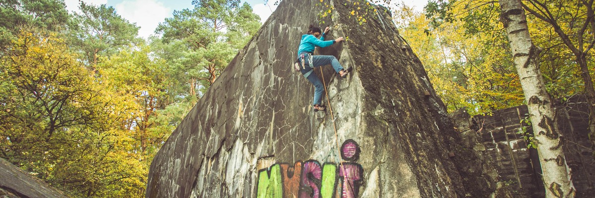
1.1. Rothsteiner Felsen 46 routes in Crag
- Summary:
-
运动攀岩, 传统攀登 和 Bouldering
Lat / Long: 51.556960, 13.407137
总结
Only natural climbable cliff in the federal state of Brandenburg.
描述
"Dickes B - Kletterführer Berlin-Brandenburg", 2. Auflage 2013, Gerald Krug, Geoquest Verlag Halle, ISBN 978-3-00-016977-9
"Sportkletter- & Boulderführer Ostsachsen", Bergverlag Jürgen Schmeißer, 2014, ISBN 3-933787-62-9
前往
Parking spots next to the street, then follow the sign "Felsenbühne".
1.2. Bucksche Schweiz 5 routes in Field
- Summary:
-
所有 Bouldering
Lat / Long: 51.434592, 13.983005
描述
Sehr weicher Sandstein, vergleichbar mit den "weichesten" Gebieten der Sächsischen und Böhmischen Schweiz. Verlässliche Griffe sind daher nur die Risse und größeren Strukturen. Und Teile der zahlreichen Touristen-Ritzungen...
前往
Vom Parkplatz westwärts betonierten Waldweg zum 25m hohen Aussichtsturm folgen. Die Felsen befinden sich nordwestlich darunter.
1.3. Markgrafensteine 32 routes in Field
- Summary:
-
所有 Bouldering
Lat / Long: 52.319453, 14.035406
总结
"Dickes B - Kletterführer Berlin-Brandenburg", 2. Auflage 2013, Gerald Krug, Geoquest Verlag Halle, ISBN 978-3-00-016977-9
描述
There are 2 stones with multiple bouldering problems on them. The area is situated inside a forest. Near this area, we can also access a lookout (Aussichtsturm Rauener Berge) by walk (fee: 1 Eur per person - you need to have the change)
前往
You can park at "Parkplatz Rauener Berge": ( 52.32579097, 14.02336583069). The parking is free. From there it's a 10 minutes walk to access the rocks (
 52.32579097, 14.02336583069). The path is well maintained, and there are signs at crosses.
1.3.1. Großer Markgrafenstein 17 routes in Boulder
- Summary:
-
Lat / Long: 52.319592, 14.035301
1.3.2. Kleiner Markgrafenstein 15 routes in Boulder
- Summary:
-
Lat / Long: 52.319342, 14.035518
1.4. Owis Stein 15 routes in Boulder
- Summary:
-
所有 Bouldering
Lat / Long: 53.226539, 13.421434
- From Mahlendorf, 30 min, 2.4 km
- From Küstrinchen, 45 min, 3.7 km
描述
A 2.80 meter tall granite stone. With 3.70 meter length and width. Together a scope of 9.70 meter.
前往
Park at the junction Mahlendorf (53.227409, 13.454993). Ignore the signpost, where some joker turned the sign to Küstrinchen wrongly south. Instead follow the road west through the buildings for 2 km and turn right on a path to the rock (53.226582, 13.421503).
历史
This stone has been a present from Adolf-Heinrich Graf von Arnim-Boitzenburg to his mother "Owi" Luise Gräfin von Arnim-Boitzenburg.
1.5. Kobbelner Stein 10 routes in Boulder
- Summary:
-
所有 Bouldering
Lat / Long: 52.098932, 14.558611
描述
Large (2nd largest in Brandenburg) dug out boulder in a nice public area maintained by a local club. Perimeter of 25m and height of 4,50m. Quite smooth granite.
"Dickes B - Kletterführer Berlin-Brandenburg", 2. Auflage 2013, Gerald Krug, Geoquest Verlag Halle, ISBN 978-3-00-016977-9
前往
历史
1.6. Der Große Stein Oderberg-Neuendorf 2 routes in Boulder
- Summary:
-
所有 Bouldering
Lat / Long: 52.893639, 14.044964
描述
One leftover half of a glacial erratic, 6 x 4 m and 3,50 m height. Climbing on the burst side on boreholes and saw spur.
The rock is protected as 'Naturdenkmal', so use no or only few chalk and brush afterwards. More boulders possible, although a wirebush and removing stinging nettles would be beneficial also for the rocks value as 'Naturdenkmal'.
07/2021 after a few days raining unbearable mosquito hell. Bring repellent and long clothes or wait for drier or colder conditions...
前往
(52.893741, 14.046728), follow the cobblestone road for 150 m and then turn left to the rock (52.893742, 14.044862)
历史
1.7. Findling Brück 3 routes in Boulder
- Summary:
-
所有 Bouldering
Lat / Long: 52.176730, 12.757507
描述
"Dickes B - Kletterführer Berlin-Brandenburg", 2. Auflage 2013, Gerald Krug, Geoquest Verlag Halle, ISBN 978-3-00-016977-9
http://www.klettern-in-berlin.de/klettern.php?nr=251&aktion=showone
1.8. Riesenstein Ringewalde 11 routes in Boulder
- Summary:
-
所有 Bouldering
Lat / Long: 53.060905, 13.721936
描述
Im Gutspark ruht auf einer kleinen Anhöhe unter alten Bäumen ein über zwei Meter hoher und 66 Tonnen schwerer Findling aus Granit. Der Sage nach wurde dieser "Riesenstein" vom Teufel dorthin geschleudert, um den Bau eines Klosters zu verhindern.
1.9. Haselberger Haselnuss 4 routes in Boulder
- Summary:
-
所有 Bouldering
Lat / Long: 52.709981, 14.017143
描述
Minor boulder on a silent forest edge with good rough rock. Could be upvalued by digging.
前往
历史
Listed on 27crags with a picture from geo-archiv.de with no more info.
1.10. Findling Jänschwalde 1 route in Boulder
- Summary:
-
所有 Bouldering
Lat / Long: 51.789808, 14.481355
描述
http://www.geo-archiv.de/objekt/findling_an_der_verwaltung_tagb.jaenschwaldeund_cottbus_nord%2C_vattenfall_europe_mining_ag%2C_lausitz%2C_brandenburg%2C_%28d%29/25895.html
1.11. Bunker "Koralle" 62 routes in Crag
- Summary:
-
运动攀岩, Bouldering 和 其它类型
Lat / Long: 52.739244, 13.574970
- loose concrete parts, on the ground and the walls
- metal rods sticking out of the concrete
- old, poorly placed or non-conforming bolts
- some route may require extra gear Back up you pro, don't get hurt. If you do, don't blame anyone.
- Approach by foot or bike; or leave your car as indicated below. Driving through the forest can be heavily fined!
- Don't leave any rubbish and take out those of other.
- Be nice to other visitors and bunker enthusiasts.
- If any, bury your feces at sufficient distance.
- No fire, no loud music
- No bolting and chipping without prior inquiry
总结
Demolished bunker remains in the middle of the woods with "quasi-natural" and chipped routes.
描述
"Dickes B - Kletterführer Berlin-Brandenburg", 2. Auflage 2013, Gerald Krug, Geoquest Verlag Halle, ISBN 978-3-00-016977-9
The demolition of the bunker created a turmoil of impressive toppled concrete pieces, partially with "quasi-natural" breaking faces, cracks, roofs and slabs.
Warning!
This is not a sport gym! There are imminent dangers from:
Keep low-profile!
The owner has expressly said climbing is not permitted despite no signage to the effect at the location. He has asked the DAV to take responsibility but they have not done so yet.
If you do decide to risk it follow these precautions:
前往
Best approached by bike (10 km from Bernau station) or bus stop Försterei Woltersdorf (1.5 km).
With a car, park at the pullouts next to the road between Ladeburg and Lanke (:parking52.741450, 13.568500). These have been recently upgraded with guardrails making it much more difficult to park. From this parking spot just go to the east to the bunker (52.739643, 13.575633). Don't drive to the bunker!
历史
The bunker "Koralle" served as naval headquarters in WW-II. It stood more than 10 m above ground. After the victory, the Red Army blew up the bunker. The area remained restricted for several decades and was used a a military training range. When access became possible in the 1990ies, development of bouldering and climbing routes was driven mainly by Berlin climbers.
1.11.1. Östliche Tunnelwand 21 routes in Sector
- Summary:
-
运动攀岩, Bouldering 和 其它类型
Lat / Long: 52.739611, 13.575777
描述
Easternmost wall
下撤信息
Rappel off or downclimb Kiefernsteig
1.11.2. Pik Lobetal 12 routes in Sector
- Summary:
-
运动攀岩 和 传统攀登
Lat / Long: 52.739593, 13.575640
描述
Southern block with overhanging south face and "quasi-natural" north face, consisting of toppled former bunker ceiling .
1.11.3. Mount Lanke 7 routes in Sector
- Summary:
-
总体而言 运动攀岩
Lat / Long: 52.739689, 13.575733
描述
Central northern summit. The blank west face is covered with a thick layer of concrete that should be treated with great caution. Bolting may be unsafe there.
1.11.4. Bunkerspitze 10 routes in Sector
- Summary:
-
所有 运动攀岩
Lat / Long: 52.739688, 13.575590
描述
Central structure with sunny slabs on its Eastern flanks
1.11.5. Westliche Tunnelwand 8 routes in Sector
- Summary:
-
总体而言 运动攀岩
Lat / Long: 52.739702, 13.575471
描述
Western Wall
1.11.6. Boulderquergang 0 routes in Field
描述
Keine genaue Beschreibung der Boulder vorhanden.
1.11.7. Lager "Koralle" 4 routes in Field
- Summary:
-
所有 Bouldering
Lat / Long: 52.738896, 13.574347
1.12. Ludwigsfelde 109 routes in Field
- Summary:
-
所有 Bouldering
Lat / Long: 52.311932, 13.261459
总结
Das Bouldergebiet besteht aus zahlreichen Betonblöcken, die zu Beginn der 2000er als Bouldergebiet erschlossen wurden.
描述
"Dickes B - Kletterführer Berlin-Brandenburg", 2. Auflage 2013, Gerald Krug, Geoquest Verlag Halle, ISBN 978-3-00-016977-9
Blöcke aus Vorkriegsbeton mit Stahlbewehrung, teils Kacheln, teils Ziegel. Probleme sind überwiegend kurz und meist unterhalb von 2,5m Höhe. Viele Sitzstartprobleme an Kanten und kleinen Leisten. Reibungsprobleme und einzelne Risse sind ebenfalls vertreten. Die Größte Auswahl an Boulderproblemen besteht im 5. und 6. Grad FB. Richtig Spaß macht es meist ab dem 2., 3. Besuch, wenn man das Gros der Blöcke bereits kennt. Der Beton ist überwiegend sehr rauh und beansprucht Haut und Schuhe.
准入问题
Sehr genaue Betrachtung des Fallgeländes und gegebenenfalls der Zuverlässigkeit der Griffe Tritte notwendig. Beton ist sehr porös und ggf. brüchig. Abgesägte Stahlbewehrungen sollten als mögliche Verletzungsquelle berücksichtigt werden. Die Zustiegswege möglichst nicht verlassen, wegen möglicher Blindgänger und Sprengmittelrückstände. Astschere und Drahtbürste kann notwendig werden, bei länger nicht gekletterten Problemen. Das Bouldern ist nicht offiziell genehmigt.
前往
Trampelpfade führen vom schwarzen Radweg im Wäldchen an der Straße der Jugend ins Bouldergebiet. Die einzelnen Sektoren sind durch gut zu antizipierende Wege miteinander verbunden. Im Sommer/Herbst sind diese teils sehr zugewachsen. Keine eigenen Wege suchen! Fußläufig vom Bahnhof Birkengrund und vom Parkplatz am Krankenhaus in wenigen Minuten erreichbar.
行为准则
Wenig Aufmerksamkeit erwecken, da man sich in einer Grauzone bewegt. Kein Geäst entfernen, außer das Klettern unmittelbar behindernder Jungpflanzen. Keinen Müll da lassen, evtl. etwas vom aufgefundenen Müll wieder mitnehmen.
历史
An der Stelle des heutigen Bouldergebietes stand ein Prüfstandsgebäude für Daimler Flugmotoren, welches teil von Europas größtem Flugmotorenwerk in den 1930er/40er Jahren war. Die nicht demontierten Überreste wurden nach dem Krieg gesprengt. Dies führte zur jetzigen Form der Blöcke. Im Zuge der Erschließung als Bouldergebiet wurden einige Zustiegswege angelegt. Eine finale Sprengmittelberäumung fand nicht statt.
1.12.1. Plattenstein 48 routes in Field
- Summary:
-
Lat / Long: 52.312134, 13.261606
前往
5
1.12.2. Affenhorn 29 routes in Field
- Summary:
-
Lat / Long: 52.311841, 13.261422
前往
5
1.12.3. Abendtor 32 routes in Field
- Summary:
-
Lat / Long: 52.311576, 13.261165
前往
5
1.13. Brücke Rudower Fließ 24 routes in Field
- Summary:
-
所有 Bouldering
Lat / Long: 52.399131, 13.472895
1.13.1. Vorderseite 12 routes in Feature
- Summary:
-
Lat / Long: 52.399141, 13.472877
1.13.2. Rückseite 12 routes in Feature
- Summary:
-
Lat / Long: 52.399124, 13.472904
1.14. Autobahnbrücke Ruhland 11 routes in Cliff
- Summary:
-
总体而言 Bouldering
Lat / Long: 51.445106, 13.837929
描述
Porphyr train bridge close to the highway.
"Dickes B - Kletterführer Berlin-Brandenburg", 2. Auflage 2013, Gerald Krug, Geoquest Verlag Halle, ISBN 978-3-00-016977-9
前往
From Ortrander Straße in Ruhland (51.455140, 13.852247) drive west over a bridge over the highway. Then turn left (southwest) on an unpaved road along the highway for 1km until you reach the train bridge (51.445089, 13.837967).
1.15. Adlerbrücke Neuseddin 7 routes in Crag
- Summary:
-
Top roping, Bouldering 和 运动攀岩
Lat / Long: 52.279878, 12.962678
总结
1.16. Brücke Dreilinden 14 routes in Cliff
- Summary:
-
Top roping, Bouldering 和 运动攀岩
Lat / Long: 52.399685, 13.181537
描述
"Dickes B - Kletterführer Berlin-Brandenburg", 2. Auflage 2013, Gerald Krug, Geoquest Verlag Halle, ISBN 978-3-00-016977-9
http://www.klettern-in-berlin.de/klettern.php?nr=47&aktion=showone
1.17. Stadtmauer Müncheberg 3 routes in Cliff
- Summary:
-
所有 Bouldering
Lat / Long: 52.502239, 14.138532
描述
1.18. Kahleberg 41 routes in Crag
- Summary:
-
总体而言 运动攀岩
Lat / Long: 52.364148, 13.085071
- "Natural features" as rock tunnels (Sanduhren: SU) may not be used for placing gear.
- Please use your own gear (2 biners or quickdraws) at the top for extended toproping to protect the installed anchors.
- Public, but ask if you wanna use it commercially. Groups of the DAV have priority to a reasonable extent.
- May not be used in the dark, under icy conditions or if there´s a thunderstorm.
- Climbing the Tower: Basic belaying and age 14+ or with an adult
- Boulder: age 10+
- 3m up you need a rope.
- Use all bolts.
- Don´t make changes to the surface.
- Due to various bad experience, dogs are not allowed anymore.
总结
Situated in Potsdam, it offers various climbing techniques and feels very natural, because no artificial holds have been installed. The location at the edge of the forest gives a great experience.
描述
"Dickes B - Kletterführer Berlin-Brandenburg", 2. Auflage 2013, Gerald Krug, Geoquest Verlag Halle, ISBN 978-3-00-016977-9
Please report damages to kletterturm@dav-potsdam.de
Its homepage is http://www.r-sandmann.de/training/eidechse1710-klettern/kletteranlagen/kahleberg/ and you can find it on facebook: https://www.facebook.com/Kahleberg
Top view, route descriptions and information courtesy of the Kahleberg´s supervisor Robby Sandmann: http://www.r-sandmann.de
Zum Kahleberg (Sportplatz), Potsdam http://www.dav-potsdam.de
400 m²
Zum Kahleberg (Sportplatz), Potsdam
Tel: Robby Sandmann
准入问题
Please note some of the rules (shorted):
前往
Out of Heinrich-Mann-Allee into "Zum Kahleberg". Follow it up to the forest, turn left and follow until you pass the public sporting ground that is adjacent to the tower. A bit east is a great playing ground with a giant swing. No real public parking in the vicinity, so it´s best to come by bike or tram (91 and 93 go regularly - station: Zum Kahleberg). Right before the sporting ground 10-12 cars can usually park.
行为准则
As a tribute to the Elbsandsteingebirge, the Saxon rating system is applied. The route descriptions are also loosely based on those of real routes. The names have a historical background of persons and companies involved in the construction.
历史
Built in 2007 as a monolith of reinforced concrete covered with shotcrete, some say it is the best one in eastern germany.
1.18.1. Boulderschwein 1 route in Boulder
- Summary:
-
所有 Bouldering
Lat / Long: 52.364152, 13.085027
描述
Small block for warming up and the kids. Create your own problems ad lib.
前往
In the shadows of the main tower.
1.19. Braschelstein 50 routes in Artificial
- Summary:
-
总体而言 运动攀岩
Lat / Long: 51.738364, 14.254512
描述
Der erste Kletterturm dieser Art aus Betonabrissmaterial von DDR-Plattenbauten (1996). Betreuung durch den Alpenverein Cottbus / Quackensturm e. V. Benutzerordnung.
"Dickes B - Kletterführer Berlin-Brandenburg", 2. Auflage 2013, Gerald Krug, Geoquest Verlag Halle, ISBN 978-3-00-016977-9
前往
(51.737485, 14.254712) Nur auf der Gewerbeparkstraße parken, nicht auf den Betriebsparkplätzen! Der Zugang ist rechts vom Betriebsgebäude der Firma Vestas (51.737745, 14.254760) durch ein offenes Gattertor zum sichtbaren Kletterturm hinter dem Betriebsgebäude.
1.20. Landmarke Sedlitzer Turm 25 routes in Artificial
- Summary:
-
总体而言 运动攀岩
Lat / Long: 51.548074, 14.051071
总结
Künstlicher Kletterfelsen aus Spritzbeton im Lausitzer Seenland, dem Elbsandstein nachempfunden. Neben dem Hauptfels stehen 3 Boulderfelsen auf dem Sportplatzgelände vom OT Sedlitz / Senftenberg.
描述
Freistehend, 13 Meter hoch, naturnahe Griffe, sportklettermäßige Absicherung mit Umlenkketten, aber auch Ausstieg auf den Gipfel, Gipfelbuch, sächsischen Abseilring. 3 Boulderfelsen (3m hoch) stehen neben dem Hauptfels. Routennummern angeschrieben und Topo, Nutzerordnung etc. hängt vor Ort aus.
"Dickes B - Kletter- und Boulderführer Berlin-Brandenburg", 3. Auflage 2023, Gerald Krug, Geoquest Verlag Halle, ISBN 978-3-948622-08-4
前往
ÖPNV: vom Bahnhof Sedlitz in 10-15 Minuten zu Fuß zum Sportplatz. Mit dem Auto von der B169 zum Sportplatz, parken auf dem vorderen Teil des Sportplatzes. KEINESFALLS BIS ZUM FELSEN VORFAHREN! Eingebunden in das Seenland-Radwegenetz.
历史
Nach ersten Plänen der Sedlitzer Bergfreunde für einen künstlichen Felsen in den 80iger Jahren wurde 2020 erste Ideen zur Umsetzung des alten Vorhabens zum Bau eines künstlichen Felsens im Lausitzer Seenland begonnen in die Tat umzusetzen. Eine AG wurde gebildet, der Standort auf dem Sportplatz in Sedlitz gefunden und der lange Weg durch Behörden und Finanzierung begonnen. Im März 2023 konnte der erste Spatenstich erfolgen und am 24. August 2023 wurde der erste Teil der Kletteranlage mit der 13 Meter hohen Schulter sowie 3 Boulderfelsen zur Nutzung freigegeben. 2024 soll neben der Schulter noch ein 18 Meter hoher Turm in die Höhe wachsen.
1.21. Reichenbacher Zinne Guben 29 routes in Artificial
- Summary:
-
总体而言 运动攀岩
Lat / Long: 51.956445, 14.681413
总结
Öffentlich zugänglicher Kletterturm im Gubener "Park am Kletterfelsen".
Public accessible climbing tower in a park.
描述
Die ursprünglich angeschraubten Griffe sind nur noch zum Teil vorhanden. Es werden daher nur die ursprünglichen Angaben der Schwierigkeiten ohne Griffe übernommen, klettert die Routen mit Rest-Griffen und gebt die Schwierigkeit hier an!
"Dickes B - Kletterführer Berlin-Brandenburg", 2. Auflage 2013, Gerald Krug, Geoquest Verlag Halle, ISBN 978-3-00-016977-9
前往
历史
Einweihung 2004.
1.22. Teichlandgiraffe Cottbus 34 routes in Artificial
- Summary:
-
总体而言 运动攀岩
Lat / Long: 51.815507, 14.435945
总结
Öffentlich zugänglicher Kletterturm im Erlebnispark Teichland. Zutritt frei, Bezahlen mit Chips für die Attraktionen, aber für selbst klettern?
描述
"Dickes B - Kletterführer Berlin-Brandenburg", 2. Auflage 2013, Gerald Krug, Geoquest Verlag Halle, ISBN 978-3-00-016977-9
前往
1.23. Kletterwand Rideplatz Rathenow 3 routes in Field
- Summary:
-
所有 Bouldering
Lat / Long: 52.601864, 12.340446
总结
1.24. Kletterfelsen Großräschen 15 routes in Cliff
- Summary:
-
Top roping 和 Bouldering
Lat / Long: 51.594710, 14.005958
描述
"Dickes B - Kletterführer Berlin-Brandenburg", 2. Auflage 2013, Gerald Krug, Geoquest Verlag Halle, ISBN 978-3-00-016977-9
前往
1.25. Klettergarten Schwedt 0 routes in Artificial
1.26. DAV-Kletterhalle Frankfurt (Oder). 0 routes in Gym
1.27. Kletteranlage Altes Heizwerk 0 routes in Gym
1.28. Kletterturm Beeskow 5 routes in Gym
- Summary:
-
所有 运动攀岩
Lat / Long: 52.172775, 14.250589
总结
1.29. Kletterzentrum Neuruppin 104 routes in Gym
- Summary:
-
运动攀岩, Bouldering 和 攀岩
Lat / Long: 52.924770, 12.799620
描述
1.29.1. Routen am Außenturm 16 routes in Sector
- Summary:
-
总体而言 运动攀岩
Lat / Long: 52.924073, 12.796133
描述
der erste Umlenker befindet sich links neben der Eingangstür in 18m Höhe. Weitere Umlenker sind dann im Uhrzeigersinn beschrieben
1.29.2. Boulderbereich 24 routes in Sector
- Summary:
-
所有 Bouldering
描述
auf der 1. Ebene im Turm rund 30m² Boulderbereich
1.29.3. 15m Wand rechter Teil 12 routes in Sector
- Summary:
-
所有 运动攀岩
1.29.4. 15m Wand linker Teil 10 routes in Sector
- Summary:
-
所有 运动攀岩
1.29.5. 15m Wand Dach (ganz links) 8 routes in Sector
- Summary:
-
所有 运动攀岩
1.29.6. 5m Wand 8 routes in Sector
- Summary:
-
所有 运动攀岩
1.29.7. 8m Wand Überhang 7 routes in Sector
- Summary:
-
所有 运动攀岩
1.29.8. 8m Wand Stirnseite 7 routes in Sector
- Summary:
-
所有 运动攀岩
1.29.9. 8m Wand rechter Teil 10 routes in Sector
- Summary:
-
所有 运动攀岩
1.29.10. Moonboard 1 route in Sector
- Summary:
-
所有 运动攀岩
1.29.11. Klettersteig Indoor 1 route in Sector
- Summary:
-
所有 攀岩
1.29.12. Kinderwände 0 routes in Sector
描述
Wände zum Einklettern bzw. für unsere Kleinsten
1.30. Satori Fitness Club Babelsberg 0 routes in Gym
描述
200 m²
Rudolf-Breitscheid-Straße 12, Potsdam
Tel: 0331 / 719400
1.31. Vital Gesundheitsclub Senftenberg 10 routes in Gym
- Summary:
-
所有 运动攀岩
Lat / Long: 51.520156, 14.001381
描述
Überwiegend senkrechte Kletterwand, auch 2 überhängende Segmente. Kursangebote vom DAV Sedlitz.
120m², 8m.
Rudolf-Breitscheid-Straße 2A, 01968 Senftenberg.
1.32. 7aplus 0 routes in Gym
总结
Boulderhalle
描述
前往
Bushaltestelle Am Findling/ Willi-Frohweinplatz (5 min Fusweg), S Bahnhof Babelsberg (14 min Fußweg), S Bahnhof Griebnitzsee, Potsdam Medienstadt
1.33. bloc.48 Boulderhalle Eberswalde 0 routes in Gym
总结
Bouldergym
描述
http://www.bloc48.de/ Coppistr. 3 (Halle 48/Ost-Seite) ROFIN-Gewerbepark 16227 Eberswalde
1.34. Blockzone 0 routes in Gym
描述
Zum Kahleberg 28, Potsdam Tel: 0331/70417800 http://www.blockzone.de
前往
See 'Kahleberg'. The Blockzone is run by the bouldering group of the DAV Potsdam.
1.35. Die Gämse Boulderhalle Wildau 0 routes in Gym
1.36. Klunker Cottbus 1 route in Gym
- Summary:
-
所有 Bouldering
Lat / Long: 51.751609, 14.340164
总结
1.37. FamilyRocks 0 routes in Gym
- Bushaltestelle Oranienburg, Adolf-Mertens-Str. (3 min Fussweg)
- S Bahnhof Oranienburg (21 min Fussweg)