Use this Region Guide to easily find and compare Crags.
Table of contents
- 1.
Erzgebirgsvorland / Mittelsachsen
1112 in Region
-
1.1.
Rochlitzer Berg / Rochlitz 128 in Crag
- 1.1.1. Seidelbruch 74 in Cliff
- 1.1.2. Gleisbergbruch 51 in Cliff
- 1.1.3. Haberkornsche Brüche / Hinkelstein 3 in Sector
-
1.2.
Muldetal bei Rochsburg / Tal der Zwickauer Mulde 153 in Crag
- 1.2.1. Muldewand 46 in Crag
- 1.2.2. Amtmannsfelsen 5 in Cliff
- 1.2.3. Gelobte Wand 17 in Cliff
- 1.2.4. Gelobtes Land 67 in Field
- 1.2.5. Rose 3 in Cliff
- 1.2.6. Oberer Block 8 in Cliff
- 1.2.7. Brauselochwächter 1 in Cliff
- 1.2.8. Hauboldszahn 6 in Cliff
-
1.3.
Chemnitztal 527 in Field
- 1.3.1. Bärenhöhle 114 in Sector
- 1.3.2. Chemiefabrik 28 in Crag
- 1.3.3. Felsenstraße 57 in Sector
- 1.3.4. Maaskantje 41 in Sector
- 1.3.5. Magischer Wald 51 in Sector
- 1.3.6. Schweizerthal 119 in Crag
- 1.3.7. Turnvater Jahn 117 in Sector
-
1.4.
Kriebethaler Wände 83 in Crag
- 1.4.1. Hauptwand 52 in Cliff
- 1.4.2. Rechte Wand 31 in Cliff
-
1.5.
Gebiet von Mittweida 159 in Crag
- 1.5.1. Malerfelsen 27 in Crag
- 1.5.2. Wilde Wand bei Ringethal 20 in Crag
- 1.5.3. Felsen bei Kokisch 49 in Crag
- 1.5.4. Eichberg 20 in Crag
- 1.5.5. Roter Bruch 43 in Crag
- 1.5.6. Blöcke Spielplatz Turnerstraße 0 in Field
-
1.6.
Unteres Zschopautal 36 in Crag
- 1.6.1. Zschopauwand / Sachsenburg 36 in Cliff
- 1.7. Kletterbogen Töpelwinkel / Overhill-Kletterbogen 11 in Cliff
- 1.8. Schießstände Döbeln 15 in Field
- 1.9. Boulderlounge 0 in Gym
- 1.10. Kletterzentrum Chemnitz 0 in Gym
-
1.1.
Rochlitzer Berg / Rochlitz 128 in Crag
1. Erzgebirgsvorland 1,112 routes in Region
- Summary:
-
Bouldering, 运动攀岩 和 传统攀登
Lat / Long: 50.986051, 12.901229
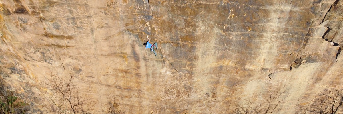
1.1. Rochlitzer Berg 128 routes in Crag
- Summary:
-
总体而言 运动攀岩
Lat / Long: 51.026634, 12.771105
总结
Former red porphyry quarries. The Seidelbruch is family and beginner friendly sport crag on mostly chipped holds. The Gleisbergbruch requires scramble / rap in for hard natural lines.
描述
Information of the Saxonian Climbing Club SBB


 "Kletterführer Mittelsachsen", Lutz Zybell und Gerald Krug, Geoquest-Verlag, 2021, ISBN 978-3-948622-00-8
"Der Sächsische Vulkan", Tom Ehrig und Gerald Krug, Geoquest Verlag, 2019, ISBN 978-3-9819515-3-0
前往
( 51.024584, 12.767253) Follow the road east then northeast until 50m after the tower a path leads left to the crag (
 51.026778, 12.772247).
住宿
Rochlitz
行为准则
Chalk is tolerated, but should be used sparingly and and brushed afterwards.
Most routes are bolted sport and require only quickdraws. However, some trad gear is advisable when visiting the Gleisbergbruch.
Chipping holds is forbidden under local ethics, the artificial routes in the Seidelbruch are an outstanding exception.
No camping and fires! New routes only after approval.
历史
Vielseitige Geschichte: Im Gleisbergbruch entstanden in den 1990er Jahren die großen Risslinien sowie einige wenige künstliche Touren. Die erschließung des Seidelbruchs als familienfreundlicher Klettergarten begann in Zusammenarbeit der Stadt Rochlitz, dem SBB, dem Verpächter und freiwilligen ab ca 2016. Seit dem herrsch Hochbetrieb!
1.1.1. Seidelbruch 74 routes in Cliff
- Summary:
-
总体而言 运动攀岩
Lat / Long: 51.026967, 12.772098
描述
Easy-access family friendly sector.
Entering the active quarrying back (north) part of the Seidelbruch is forbidden!
1.1.2. Gleisbergbruch 51 routes in Cliff
- Summary:
-
总体而言 运动攀岩
Lat / Long: 51.027825, 12.771699
描述
Deep old quarry behind the Seidelbruch.
前往
Enter from Seidelbruch or walk around from the back, depending on the sector. Most routes require rapping in or a scramble.
下撤信息
several descent routes and rappel anchors, see sector descriptions
历史
The numbers on the "Zahlenwand" indicate 200 years of active quarrying.
1.1.3. Haberkornsche Brüche 3 routes in Sector
- Summary:
-
传统攀登 和 运动攀岩
Lat / Long: 51.025844, 12.770190
描述
Historic climbing site. Closed nature protection area, all bolts are removed.
1.2. Muldetal bei Rochsburg 153 routes in Crag
- Summary:
-
Bouldering, 传统攀登 和 运动攀岩
Lat / Long: 50.926954, 12.728865
1.2.1. Muldewand 46 routes in Crag
- Summary:
-
传统攀登 和 运动攀岩
Lat / Long: 50.940433, 12.753821
总结
South facing granulite walls, bottom in shade,routes ranging from good beginner slabs to hard sport routes. Mostly good, but sometimes a bit smooth or vegetated or loose. Bring a helmet!
描述
"Kletterführer Mittelsachsen", Lutz Zybell und Gerald Krug, Geoquest-Verlag, 2021, ISBN 978-3-948622-00-8
准入问题
In the past there were closures due to nesting birds, respect signages.
前往
(50.945887, 12.760745) God south over the pedestrian bridge and the Zwickauer Mulde river and follow the hiking path for 15min (800m) until you see the cliffs to the left (50.940369, 12.753901).
历史
Kurt Sachse 1935 Plattenwand
1.2.2. Amtmannsfelsen 5 routes in Cliff
- Summary:
-
传统攀登 和 运动攀岩
Lat / Long: 50.950412, 12.771148
1.2.3. Gelobte Wand 17 routes in Cliff
- Summary:
-
所有 运动攀岩
Lat / Long: 50.950943, 12.766991
描述
New hard climbing granulite cliff. Helmet rcommended!
Legal status not clarified yet. Don't enter the factory area to the north!
"Kletterführer Mittelsachsen", Lutz Zybell und Gerald Krug, Geoquest-Verlag, 2021, ISBN 978-3-948622-00-8
前往
(50.950286, 12.763004) Follow the meadow border norteast, thean head east in the wood to the crag (50.950957, 12.767017).
1.2.4. Gelobtes Land 67 routes in Field
- Summary:
-
所有 Bouldering
Lat / Long: 50.950611, 12.770384
总结
Area under development since 2016
Check www.erzbloc.de for current infos and closures
准入问题
Please behave considerately when driving through the residential area!
前往
(50.953358, 12.767742) be sure that you are on the correct side of the river ")
Follow the train tracks from the Parking until the old bridge. The sector is located on your left.
1.2.5. Rose 3 routes in Cliff
- Summary:
-
所有 传统攀登
Lat / Long: 50.950618, 12.770164
1.2.6. Oberer Block 8 routes in Cliff
- Summary:
-
总体而言 传统攀登
Lat / Long: 50.950720, 12.770164
1.2.7. Brauselochwächter 1 route in Cliff
- Summary:
-
所有 传统攀登
Lat / Long: 50.938925, 12.773034
1.2.8. Hauboldszahn 6 routes in Cliff
- Summary:
-
所有 传统攀登
Lat / Long: 50.903501, 12.680562
描述
Kleines Gipfelchen nördlich vom Hauboldstein. Gegenüber liegt das Hauboldsmassiv. Gestein sind niedrigmethmorphe Gneise der Wolkenburger Gruppe.
前往
Vom Hauboldstein Pfad einige 10er Meter in nördlicher Richtung und dann steilen Erdhang absteigen oder von Wolkenburg der stillgelegten Bahnstrecke folgen und von dort steil hinauf.
下撤信息
Abklettern oder vom Bäumchen abseilen.
历史
Erstbesteigung nicht bekannt. Auf dem Gipfel alter Nagel.
1.3. Chemnitztal 527 routes in Field
- Summary:
-
总体而言 Bouldering
Lat / Long: 50.943681, 12.830567
总结
Gneiss Bouldering
描述
Detailed information (in German): http://www.erzbloc.de
Watch out for current closures! check website 
The wiki counts the sector "Gelobtes Land" as part of the Chemnitztal, despite it not actually being located there.
准入问题
Watch out for current closures! check http://www.erzbloc.de!
No FAs! Exemptions must be cleared with local authories.
1.3.1. Bärenhöhle 114 routes in Sector
- Summary:
-
所有 Bouldering
Lat / Long: 50.932490, 12.850818
描述
Except for Seaside, all blocs are located in a nature reserve. See erzbloc.de for more details.
1.3.2. Chemiefabrik 28 routes in Crag
- Summary:
-
所有 Bouldering
Lat / Long: 50.941972, 12.830614
准入问题
Please do not use the truck parking of Zschimmer&Schwarz(!).
Instead, head further down the road towards Mohsdorf and park on the right side of the road.
1.3.3. Felsenstraße 57 routes in Sector
- Summary:
-
所有 Bouldering
Lat / Long: 50.953848, 12.811825
1.3.4. Maaskantje 41 routes in Sector
- Summary:
-
所有 Bouldering
Lat / Long: 50.951835, 12.808140
1.3.5. Magischer Wald 51 routes in Sector
- Summary:
-
所有 Bouldering
Lat / Long: 50.941770, 12.825921
1.3.6. Schweizerthal 119 routes in Crag
- Summary:
-
总体而言 Bouldering
Lat / Long: 50.935514, 12.846073
准入问题
Tolerated, but access is hanging by a thread as the owner is not a fan...
Be extra quiet, take all trash you find, etc, to ensure this beautiful spot stays open.
1.3.7. Turnvater Jahn 117 routes in Sector
- Summary:
-
所有 Bouldering
Lat / Long: 50.951606, 12.810068
1.4. Kriebethaler Wände 83 routes in Crag
- Summary:
-
总体而言 运动攀岩
Lat / Long: 51.043971, 13.020063
描述
Sonnige Granulit-Wand mit bis zu 33m langen Routen. Zustieg nicht Kleinkinder-geeignet.
Sunny solid granulite cliffs with route lengths up to 33m. The area is strewn with boulders and in the immediate vicinity of the water. Therefore, not suitable for unsupervised children.
"Kletterführer Mittelsachsen", Lutz Zybell und Gerald Krug, Geoquest-Verlag, 2021, ISBN 978-3-948622-00-8
"Glück auf! - Kletterführer Erzgebirge", Geoquest Verlag , 2016, ISBN 978-3-00-052908-5
"Rotgelbes Felsenland - Klettern in Mitteldeutschland", Geoquest Verlag, 2014, ISBN 978-3-00-023134-6
准入问题
Climbing is banned in the sectors "Großer Turm" and "Schluchtwand" from 15.01. to 30.06. to protect nesting eagle owls.
前往
(51.0439343, 13.0186347) or (51.044635, 13.018593) or
(51.045335, 13.018024) Park near the bridge and approach through the forest. Use the steel ladder and the via ferrata to get to the rocks (51.044086, 13.019427).
Follow trail from the parking north of the bridge 50m east into the woods. Then 5m down an iron ladder (look for the metal handhold on the left) and cross a 30m via ferrata above the Zschopau river to the crag.
 Might not be suitable for everyone, esp. small children or the infirm.
1.4.1. Hauptwand 52 routes in Cliff
- Summary:
-
所有 运动攀岩
Lat / Long: 51.044124, 13.019645
1.4.2. Rechte Wand 31 routes in Cliff
- Summary:
-
总体而言 运动攀岩
Lat / Long: 51.043648, 13.020661
1.5. Gebiet von Mittweida 159 routes in Crag
- Summary:
-
运动攀岩, 传统攀登 和 Bouldering
Lat / Long: 50.992293, 12.997031
总结
Quarries and cliffs around the city of Mittweida.
"Kletterführer Mittelsachsen", Lutz Zybell und Gerald Krug, Geoquest-Verlag, 2021, ISBN 978-3-948622-00-8
1.5.1. Malerfelsen 27 routes in Crag
- Summary:
-
传统攀登 和 运动攀岩
Lat / Long: 51.001188, 12.980176
总结
2 granulite cliffs with short but nice trad and sport routes
描述
"Kletterführer Mittelsachsen", Lutz Zybell und Gerald Krug, Geoquest-Verlag, 2021, ISBN 978-3-948622-00-8
前往
(51.005393, 12.982122) Follow the path south for 300m to the rocks (51.000943, 12.980405).
1.5.2. Wilde Wand bei Ringethal 20 routes in Crag
- Summary:
-
总体而言 运动攀岩
Lat / Long: 51.003897, 13.006772
总结
new granulite sport crag
描述
"Kletterführer Mittelsachsen", Lutz Zybell und Gerald Krug, Geoquest-Verlag, 2021, ISBN 978-3-948622-00-8
准入问题
The first rocks at the parking are protected bird area, no climbing there!
前往
(51.004364, 13.004417) Walk 150m east to the crag (51.003792, 13.006820).
1.5.3. Felsen bei Kokisch 49 routes in Crag
- Summary:
-
运动攀岩 和 传统攀登
Lat / Long: 50.999334, 13.005034
总结
Good new sport climbing crags. "Koksche Wand" is an old quarry with also harder routes. The Katzfelsen are wonderful sunny rocks directly at the Zschopau river.
描述
"Kletterführer Mittelsachsen", Lutz Zybell und Gerald Krug, Geoquest-Verlag, 2021, ISBN 978-3-948622-00-8
准入问题
Do not disturb the residents!
前往
Coming from the east (direction Dresden) it is shorter to park at the east riverside (50.996465, 13.006776) and walk over the pedestrian bridge. Coming from the west park in Kokisch (50.995431, 13.006729). Then follow the hiking path 250m northwest to "Koksche Wand" (50.997462, 13.003871). To "Katzfelsen" (,50.998540, 13.004806)follow the path 150m further down to the river. To "Vergessene Wand" (51.001607, 13.007638) go left upstairs and follow the hiking path above the river to the rock.
1.5.4. Eichberg 20 routes in Crag
- Summary:
-
运动攀岩, 传统攀登 和 Bouldering
Lat / Long: 50.990551, 13.013114
1.5.5. Roter Bruch 43 routes in Crag
- Summary:
-
所有 运动攀岩
Lat / Long: 50.981165, 13.001446
总结
High former quarry with long routes up to 40m. DANGER of rockfall, wear helmets!
描述
"Kletterführer Mittelsachsen", Lutz Zybell und Gerald Krug, Geoquest-Verlag, 2021, ISBN 978-3-948622-00-8
前往
(50.981029, 13.000516) Park at the side of the road and walk into the quarry.
行为准则
sportclimbing, chalk allowed, no trad gear necessary
1.5.6. Blöcke Spielplatz Turnerstraße 0 routes in Field
描述
Zwei 3m hohe Boulderblöcke mit Struktur (ohne geschraubte Griffe).
1.6. Unteres Zschopautal 36 routes in Crag
- Summary:
-
总体而言 运动攀岩
Lat / Long: 50.931685, 13.031342
前往
Am Anfang des Buttermilchbergs. Parken am Straßenrand. 20m Zugang zum Felsen
1.6.1. Zschopauwand 36 routes in Cliff
- Summary:
-
总体而言 运动攀岩
Lat / Long: 50.930035, 13.035759
描述
Jährliche Sperrung aus Artenschutzgründen vom 15.02.-15.04. Momentan sind, aufgrund des Felssturzes, links von Frühjahrsputz alle Einstiege (Nr.1-10) gesperrt.
"Kletterführer Mittelsachsen", Lutz Zybell und Gerald Krug, Geoquest-Verlag, 2021, ISBN 978-3-948622-00-8
前往
Walk 50m east to the wall.
1.7. Kletterbogen Töpelwinkel 11 routes in Cliff
- Summary:
-
所有 运动攀岩
Lat / Long: 51.120960, 13.020711
描述
artificial climbing crag, 10m height. Prior registration necessary.
前往
1.8. Schießstände Döbeln 15 routes in Field
- Summary:
-
所有 Bouldering
Lat / Long: 51.128743, 13.109662
总结
outdoor boulder crag
描述
"Kletterführer Mittelsachsen", Lutz Zybell und Gerald Krug, Geoquest-Verlag, 2021, ISBN 978-3-948622-00-8
前往
Unsere Wand befindet sich in einen Park von Döbeln, den Klosterwiesen. Parkmöglichkeiten findet ihr am Ende der Heinrich-Heine Straße. P1 ca 200 Meter bis zur Wand. Die 2te und wesentlich größere Parkfläche findet ihr beim Kino. Das ist der Steigerhausplatz dort hinter der Polizei parken. P2 ca 400 meter bis zu unserer Anlage. (Quelle)
or: (51.123606, 13.109068) Follow the Freiberger Mulde river 550m until the end of the park and you see right the walls.