A Crag Guide gives an extensive view of all sub areas and climbs at a point in the index. It shows a snapshot of the index heirachy, up to 300 climbs (or areas) on a single web page. It shows selected comments climbers have made on a recently submitted ascent.
At a minor crag level this should be suitable for printing and taking with you on a climbing trip as an adjunct to your guidebook.
This guide was generated anonymously. Login to show your logged ascents against each route.
Warning
Rock climbing is extremely dangerous and can result in serious injury or death. Users acting on any information directly or indirectly available from this site do so at their own risk.
This guide is compiled from a community of users and is presented without verification that the information is accurate or complete and is subject to system errors. By using this guide you acknowledge that the material described in this document is extremely dangerous, and that the content may be misleading or wrong. In particular there may be misdescriptions of routes, incorrectly drawn topo lines, incorrect difficulty ratings or incorrect or missing protection ratings. This includes both errors from the content and system errors.
Nobody has checked this particlular guide so you cannot rely on it's accuracy like you would a store bought guide.
You should not depend on any information gleaned from this guide for your personal safety.
You must keep this warning with the guide. For more information refer to our:
Usage policy
Contributors
Thanks to the following people who have contributed to this crag guide:
Thomas Müller
Nicky
Tim
Marko Di Marko
Kai
Markus Jansen
Marius Janosel
Barnabé
The size of a person's name reflects their Crag Karma, which is their level of contribution. You can help contribute to your local crag by adding descriptions, photos, topos and more.
Table of contents
- 1. Kleine Hausener 22 in Cliff
- 2. Index by grade
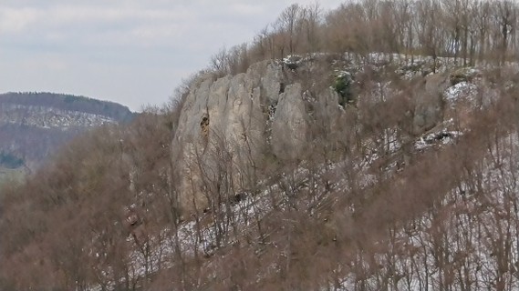
1. Kleine Hausener
- Summary:
-
Lat / Long: 48.614710, 9.769230
접근 문제들
Climbing has not been permitted everywhere for several years. The Nature Conservation Act of Baden-Wuerttemberg includes the rocks among the so-called §24a biotopes. In principle, entering these biotopes is not permitted. In recent years, the nature conservation administration and the climbing associations have succeeded in defining the areas that can be climbed and the climbing bans for the entire Swabian Jura. Some rocks are now closed all year round, some climbing bans only apply seasonally during the breeding season of certain bird species (e.g. eagle owl or kestrel).
접근
Parken am südöstlichen Ortsausgang von Oberböhringen. Dem rechten, erst noch asphaltierten Landwirtschaftweg bis zum Trauf folgen. an diesem in westlicher Richtung, unter den Stromleitungen durch und wenn rechts des Weges Bäume anfangen links den Weg steil Bergab (über angelehnte Leiter) zu den Einstiegen.
| Route | Grade | Style | Selected ascents | |||||
|---|---|---|---|---|---|---|---|---|
| 1 | Westwand | 7+ | ||||||
| 2 | ★ Westriss | 7- | ||||||
| 3 | ★ Direkter Westgrat | 6+ | 25m | |||||
| 4 |
Westgrat
Am linken Rand dem leicht speckigen Riss leicht rechtshaltend folgen. Nach dem ersten Steilstück auf dem linken Grad noch bis zum Umlenker | 6- | 25m | |||||
| 5 |
★★ Müsliweg
Einstieg über Schlinge und dann leicht rechts hoch über Bohrhaken | 6 | 25m | |||||
| 6 |
★★ Bagno
Einstiegsvariante links vom Müsliweg über einen Bohrhaken (rechts davon die Platte hoch) und dann über Müsliweg voll aussteigen. | 7- | 25m | |||||
| 7 | ★★ Linke Schurr Führe / Linker Schurrweg | 6 | 25m | |||||
| 8 | ★★ Glühwürmchen | 7+ | ||||||
| 9 | ★★ Schurr Führe / Schurrweg | 7 | ||||||
| 10 |
?Projekt?
etwas reingequetscht zwischen "Schurrweg" und "Mitte", recht langer runout im Mittelteil | 7 | ||||||
| 11 | Mitte | 6+ | ||||||
| 12 |
Originaler Kaminausstieg
Start wie Mitte und Oben dann durch den großen Kamin aussteigen | 6- | ||||||
| 13 |
★★ Chicco
Vom ersten zum dritten Haken schwer, danach deutlich leichter. Oben knapp rechts vom großen Kamin. | 7+ | 25m, 8 | |||||
| 14 |
★★ Bienenwand
Start mit Plättchen, dann links davon gerade hoch über geschlagene Haken bis zum großen Bühler, an diesem in großer Linksschleife zum mittleren Umlenker | 6+ | 25m, 8 | |||||
| 15 |
Bierbrauerweg
zwischen Bienenwand und Ameisenweg | 6+ | ||||||
| 16 | ★★ Ameisenweg | 7 | 25m, 13 | |||||
| 17 |
Originalweg
Variante Ameisenweg Unten von rechts Oben nach rechts | 5+ | ||||||
| 18 |
★★★ Grewisführe
Einstieg über zwei Bohrhaken rechts vom Riss, dann eine große Linksschleife den Haken folgend bis zum Umlenker | 7 | ||||||
| 19 |
Güntnerführe
Einstieg über zwei Bohrhaken rechts vom Riss, dann rechthaltend hoch | 7- | 6 | |||||
| 20 | Rissle | 4 | ||||||
| 21 | ★ Bässlerführe | 5- | 20m, 5 | |||||
| 22 | Karle Absturz Weg | 6- | ||||||
 /47/61/4761d1c3219fad1673f4d3cca8648cdc038d78cb) /3f/ce/3fce54690292f7e08814e301e5af803cebb154ef) |
||||||||
2. Index by grade
| Grade | Stars | Name | Style | Pop | |
|---|---|---|---|---|---|
| 4 | Rissle | ||||
| 5- | ★ | Bässlerführe | 20m, 5 | ||
| 5+ | Originalweg | ||||
| 6- | Karle Absturz Weg | ||||
| Originaler Kaminausstieg | |||||
| Westgrat | 25m | ||||
| 6 | ★★ | Linke Schurr Führe | 25m | ||
| ★★ | Müsliweg | 25m | |||
| 6+ | ★★ | Bienenwand | 25m, 8 | ||
| Bierbrauerweg | |||||
| ★ | Direkter Westgrat | 25m | |||
| Mitte | |||||
| 7- | ★★ | Bagno | 25m | ||
| Güntnerführe | 6 | ||||
| ★ | Westriss | ||||
| 7 | ?Projekt? | ||||
| ★★ | Ameisenweg | 25m, 13 | |||
| ★★★ | Grewisführe | ||||
| ★★ | Schurr Führe | ||||
| 7+ | ★★ | Chicco | 25m, 8 | ||
| ★★ | Glühwürmchen | ||||
| Westwand |