Seasonality
Summary
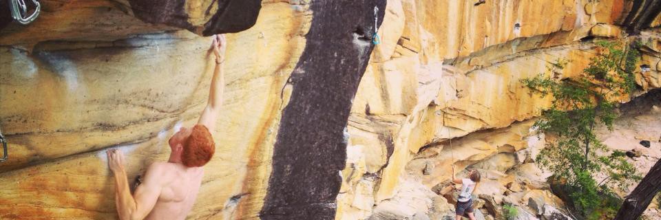
Sandstone
The Largest concentration of routes and great rock in the Coffs Area
Description
Morning sun
Wet in rain
East
Great crag with most routes in the 21-27 range. Majority of routes are on fixed hangers or ring bolts but a few need bolt plates and pieces of gear. Some climbs stay dry in the rain.
Access issues inherited from New South Wales and ACT
If you have benefited from climbing infrastructure in NSW, please consider making a donation towards maintenance costs. The Sydney Rockclimbing Club Rebolting Fund finances the replacement of old bolts on existing climbs and the maintenance of other hardware such as fixed ropes and anchors. The SRC purchases hardware, such as bolts and glue, and distributes them to volunteer rebolters across the state of New South Wales. For more information, including donation details, visit https://sydneyrockies.org.au/rebolting/
Approach
Gentle
5-10 min
Fort Knox can no longer be accessed 'from the bottom' with a 2WD and must be approached 'from the top' with a 4WD.
- Bottom Access
- Please note access is NOT POSSIBLE FROM THE BOTTOM ANY LONGER
Access from the top
Access to the top of the crag provides an easier walk but a 4WD is needed.
Top Access from Coffs Harbour:
Take the Pacific Highway North. At Moonee take the Moonee Beach/Nana Glen exit and then left at the roundabout onto Solitary Island Way. After about 1.8 km turn west onto Bucca road.
Set your odometer to zero here and use the following mileages:
- 4.6km
- turn right onto Sherwood Forest Road
- 12.1km
- stay left at the junction with Marys Waterhole road.
- 15.1km
- stay left at the junction with Plum Pudding Road.
- 21km
- go straight ahead/right at the junction with Waihoo Rd.
- 25.8km
- turn right onto Conglomerate Trail (unmarked).
- 28.3km
- turn right onto Get Lost Trail. (Not signposted).
- 29.1km
- park at the end of the road.
From end of road there is a walking track heading down the hill. Walk about 200m down the hill, cross a creek and continue another 50m until a vague track veers right. Drop a little downhill but stay above a series of drop offs below as the track then traverses left around to the Strong Room.
Access is also available via Nana Glen however Waihoo road is often in a poor state so it is best to use the access outlined above.
Top access from Nana Glen.
At Nana Glen turn east onto Bucca Rd. After 1.5km turn left onto Morrows Rd and set your odomenter to zero:
- 0.0km
- - Follow Morrows Rd for a few kilometers where it forks.
- 5.0km
- - Take the right fork across the railway line. The road now becomes Waihou Rd. Keep going up zig zags until you reach Sherwood Forest Rd
- 12.3km
- - Turn a sharp left onto Sherwood Forest Road.
- 17.2km
- - Turn right into Conglomerate Trail (unmarked - 4 Wheel drive only) and travel for approx. 1.5 km to the junction of Get Lost Trail and Brush Trail.
- 19.7km
- - Veer right down Get Lost Trail and continue on.
- 20.5km
- - Park at end of road.
From end of road there is a walking track heading down the hill. Cross a creek and continue another 50m until a vague tack veers right which will take you to the strong room. A fairly well worn trail continues along the top of the cliffs and can be used to access pooh wall.
Ethic
New route potential
Fort Knox is a sport Crag. There are a few trad lines or mixed routes and theses are marked as such but in general you can have a great day with a handful of quickdraws and a rope.
History
Fort knox was discovered by Ben Christian and Jeff Gracie on their way to a winter climbing break from Armidale to visit Wonderland crag. After quickly realising the crags potential they met up with he rest of the Armidale crew and moved camp from Wonderlands to the infamous ‘Camp Butthole’ (where the top car park now is but camping is now banned). The first route to be completed was Gordon Lows 'Missing Monkeys' and by the end of the week another 20 routes had been completed. Most of the early development occurred in 1996 and 1997 which was still early days for sport climbing in Australia so some of the anchors are a little experimental! A number of routes on Pooh wall were added in 2001 which pretty much ended the development of new routes at Knox until late 2009 when the Waglands moved into the Area. Nick and Dave bolted a number of hard projects ('Overshadowed' 26 being the pick of the completed ones) and with the aid of others put up a number of routes around the Motherlode' area. In 2011 Steve Hawkshaw showed up with a new drill and gave the main crag a second wind. In a spurt of new route activity Steve and his cronies unearthed a number of hidden gems which have provided a lot more in the 16-20 grade range, many of which had been overlooked amongst the harder lines. In 2012, Allan Ezzy finally sent an abandoned project to establish the hardest line at the cliff 'Monkey See, Monkey Do (28)' and Steve re-discovered the Twilight Wall which had somehow been mostly overlooked even though it is about 50m from the parking lot!
Tags
Plan your Trip
Hello!
First time here?
theCrag.com is a free guide for rock climbing areas all over the world, collaboratively edited by keen rock climbers, boulderers and other nice folks.You can log all your routes, connect and chat with other climbers and much more...» go exploring, » learn more or » ask us a question


Accommodations nearby more Hide
Share this
Nearby Icons
| 17 | ★★ Winnie The Pooh Goes Honey Hunting | ||
| 21 | ★★ Magic Dick Sixteen | ||
| 23 | ★★ Sex And Drugs On The Rock And Roll | ||
| 25 | ★★ White Man's Voodoo | ||
| 26 | ★★★ Overshadowed |
Photos Browse all photos

Strong Room - VideoCapture_20230205-214940.jpg

David Jefferson on ★★ White Man's Voodoo 25 - White Man's Voodoo.jpg

Alan Ezzy at Fort Knox - Alan and Amy at Knox.jpg
Wed 26 Apr
Check out what is happening in Fort Knox.
Get a detailed insight with a timeline showing
- Ticks by climbers like you
- Discussions of the community
- Updates to the index by our users
- and many more things.
Login to see the timeline!