Seasonality
Summary
Granite
Route 66 ") ! Erste vollständige Fototopo einer ganzen Felsgruppe im Steinwald (Stand 08/2015)! Denke, das ist auch eine gute, eindeutige Grundlage für jedes event. noch gezeichnete Topo
! Erste vollständige Fototopo einer ganzen Felsgruppe im Steinwald (Stand 08/2015)! Denke, das ist auch eine gute, eindeutige Grundlage für jedes event. noch gezeichnete Topo ")
Description
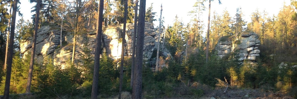
'Ratfelsen' (Hauptmassiv und Nebenmassiv), Waldkopf und 'Y-Riss-Felsen' '
Access issues inherited from Steinwald
überwiegend Zone 2
Approach

2018 wurden vom DAV in Absprache mit dem Forst 6 neue Parkplätze hinter dem Waldrand, vor den Forst-Sperrschildern, geschaffen. Nicht mehr auf der Wiese parken! (da ohnehin "Privat"-Schilder)
History
Fototopos: V1.0: 08/2015 (Zeichnungen in gepuzzelten Fotos), V2.0: 02/2016 (Nutzung des Thecrag-Topo-Features)
Tags
Plan your Trip
Did you know?
Did you know that you can create an account to record, track and share your climbing ascents? Thousands of climbers are already doing this.


Accommodations nearby more Hide
Share this
Photos Browse all photos

★ (Jonas 30) 6- - sse-wand.JPG

★ Gewitterweg 3 - image.jpg
/b2/eb/b2eb810ec9ba4ece4d40cffe40bffade299c996c)
Sylvesterweg 4 - image.jpg
/d9/02/d9023cf0295920507af7b496d37a5c02b25e5210)
Süd-Zentral - image.jpg
Sun 30 Apr
Check out what is happening in Ratfelsen-Gruppe.
Get a detailed insight with a timeline showing
- Ticks by climbers like you
- Discussions of the community
- Updates to the index by our users
- and many more things.
Login to see the timeline!