A Crag Guide gives an extensive view of all sub areas and climbs at a point in the index. It shows a snapshot of the index heirachy, up to 300 climbs (or areas) on a single web page. It shows selected comments climbers have made on a recently submitted ascent.
At a minor crag level this should be suitable for printing and taking with you on a climbing trip as an adjunct to your guidebook.
This guide was generated anonymously. Login to show your logged ascents against each route.
Warning
Rock climbing is extremely dangerous and can result in serious injury or death. Users acting on any information directly or indirectly available from this site do so at their own risk.
This guide is compiled from a community of users and is presented without verification that the information is accurate or complete and is subject to system errors. By using this guide you acknowledge that the material described in this document is extremely dangerous, and that the content may be misleading or wrong. In particular there may be misdescriptions of routes, incorrectly drawn topo lines, incorrect difficulty ratings or incorrect or missing protection ratings. This includes both errors from the content and system errors.
Nobody has checked this particlular guide so you cannot rely on it's accuracy like you would a store bought guide.
You should not depend on any information gleaned from this guide for your personal safety.
You must keep this warning with the guide. For more information refer to our:
Usage policy
Contributors
Thanks to the following people who have contributed to this crag guide:
The size of a person's name reflects their Crag Karma, which is their level of contribution. You can help contribute to your local crag by adding descriptions, photos, topos and more.
Table of contents
- 1.
Mt Assiniboine Provincial Park
2 in Area
- 1.1. Mt Assiniboine 2 in Area
- 2. Index by grade
1. Mt Assiniboine Provincial Park 2 routes in Area
- Summary:
-
모두 고전등반
1.1. Mt Assiniboine 2 routes in Area
- Summary:
-
요약
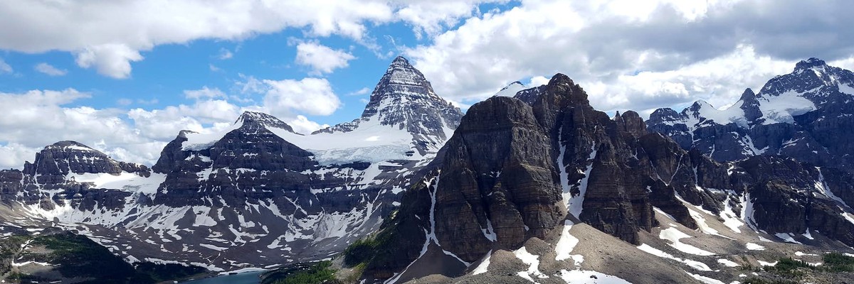
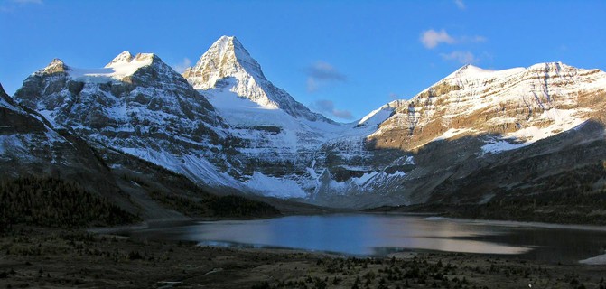
Mount Assiniboine is a serious and often difficult mountain frequently underestimated. There is substantial exposure and rockfall hazard. In dry conditions, it is technically straightforward. More likely though, it will be snowed or iced up and the climbing will be very challenging. This is not a peak for beginner mountaineers or alpine climbers.
The most popular route on the 11,867ft. (3618m) the mountain is the North Ridge. This 3,000ft. ridge is steep and exposed without being too technically difficult. Initially, you will move up a series of gullies and climb a rock band before reaching the ridge crest which is followed to the ‘Red Band’. Once there you will be climbing fifth class rock for several hundred feet to the corniced summit. The view from the summit is truly incredible.
역사
“In 1901, Edward Whymper brought Swiss guides to Canada. Three serious attempts on Assiniboine had already been repulsed. All the higher peaks in the Canadian Rockies were still unclimbed too. The arrival of the alpine superstars created a stir in the competitive world of Canadian peak bagging. No worries! Mr Whymper was reluctant to leave the good life of the Lake Louise/CPR climbing scene (Chris Jones, Climbing in North America, 1971).
The Swiss guides and James Outram couldn't let such opportunities slip by. Whilst Whymper stayed in Lake Louise, Mr Outram politely "borrowed" Mr Whymper's frustrated guides and the enthusiastic team SENT! First, they made it up Assiniboine by traversing to the backside and discovering an easier route (SW Face, 4th class). Then they made sure to tick the route everyone else had been trying, the North Ridge (5.5x, onsight downclimb, 1903)”.
  |
||||||||
| Route | Grade | Style | Selected ascents | |||||
|---|---|---|---|---|---|---|---|---|
| 1 |
★★★ North Face
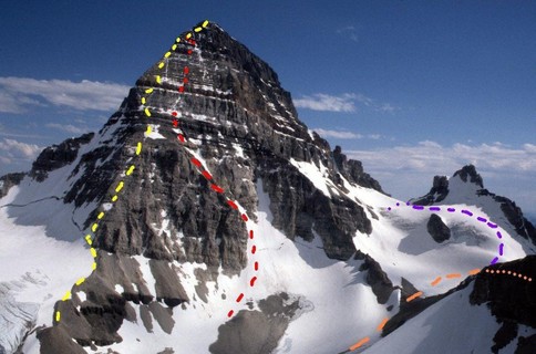
Mt Assiniboine is one of Canada’s most famous mountains, often nicknamed and compared to as the “Matterhorn” of the Rockies. The north face route is not much different to the popular North Ridge route (5.5). With lots of rock fall and extreme exposure, this a serious big mountain venture, so cold temperatures and early starts are a must. Normally done as a 3 day outing, parties with high fitness do it as a 48 hour slog. At 3,618 m (11,870 ft), it is the highest peak in the Southern Continental Ranges of the Canadian Rockies. Mount Assiniboine rises 2086m in prominence- making it unbelievably sheer. FFA: Chris Jones, Yvon Chouinard & Joe Faint, 1967 | AI2 - 3 | 700m, 14 | |||||
| 2 |
★★★ North Ridge
The standard route on Assiniboine was climbed by William Douglas and a strong team of guides. Christian Hasler had already descended the route two years before. Hasler was one of Whymper's guides from the Matterhorn, thirty-eight years earlier. (Chris Jones, Climbing in North America, 1976)(Randy Morse, The Mountains of Canada, 1978) Gmoser's Highway ("mosers") is the start of serious terrain. I once watched some gnarly East Face candidates rappel the scary snow gully to climbers left, after using Gmoser's on the way up. They had huge packs. I don't recommend the gully. Instead, lower your big pack down the upper headwall, 30' of steep jugs (5.0) with a landing that might save you. The crux of the lower traverse is the less difficult, but more exposed. A roped fall could be very dangerous. Have the rack ready, even though a fixed pin may be found at the low end belay. 30km’s into and the route out is 32.5 kilometers and involves 2420 of vertical gained and 5500 feet of descending on the day. FFA: Christian Hasler & James Outram, 1901 | 5.5 | 700m | |||||
2. Index by grade
| Grade | Stars | Name | Style | Pop | Area | |
|---|---|---|---|---|---|---|
| 5.5 | ★★★ | North Ridge | 700m | 1.1. Mt Assiniboine | ||
| AI2 - 3 | ★★★ | North Face | 700m, 14 | 1.1. Mt Assiniboine |