계절특성
요약
Sandstone conglomerate cliff at the south end of Extension Ridge. Named after the Extension Prospect coal mine (operated from 1940-1947), the entrance to which lies just 100 meters south of the crag.
설명
The rock here is highly featured in sections and nearly blank in others. Generally intermediate to advanced climbing. The rock quality is fairly solid by Nanaimo Sandstone Formation standards, with micro-pebble style conglomerate, similar to Sunny Side. Some sections of the ridge are comprised of poorly consolidated conglomerate - these have been left undeveloped. The crag base is situated very close to a popular, well established mountain bike trail so please avoid leaving gear on, or belaying from, the trail itself.
접근 문제들
As with the majority of the south Nanaimo area, this property is private and is owned by TimberWest/Mosaic. Several user groups recreate here - hikers, mountain bikers, professional dog walkers, dirt bikers - and have done so for many years without issue. Like other Mosaic properties that are used extensively by the public, continued access depends on responsible behaviour. Do not litter, leave graffiti, make campfires or cut down trees. Coexist peacefully with other user groups - we are all trespassing and no single group’s activity is any more or less righteous than the others.
접근
If coming from Nanaimo, take Extension Road turnoff from the old island highway in Chase River and head south. Turn right onto Extension Road. Then turn right again onto Virostko Road. Stay on Virostko for about 500 meters, drive through a small neighbourhood (please drive slowly - lots of kids, dogs and farm animals) until the road turns to gravel. Drive past the natural gas pipeline easement, then park in the obvious pullout on the left (see map in photo section). Walk up to the parallel logging road above where you parked. Turn right and walk on this for 50 meters to an obvious grassy pullout. Find the steep trail up a black slag pile, follow this for 100 meters until it intersects the mountain bike trail "Creeper". Turn left and walk along Creeper for 100 meters and the first climbs will be immediately on your right.
윤리문제
Climbers share this area with mountain bikers. Please be respectful and do not leave gear on or belay from a mountain bike trail. They were here first, and have been very accommodating by re routing one of their trails to make room for our belay area.
This is a newly developed crag and there are still several closed/red tagged projects. Please stay off these routes until they are completed. There are also a couple open projects - have a go!
역사
The Extension Prospect coal mine was established near the end of the coal mining era in Nanaimo. It only operated for a short time (1940-1947), and many remnants of mining equipment can be found in the forest near the crag. The access trail to the crag passes one of the mine entrances, but it is considered dangerous to enter abandoned coal mines due to the potential for toxic gas accumulation. The trail that passes under the crag base is a well known black diamond mountain bike trail called Creeper. This 3 km long trail was established in 2020 and is still being expanded to the north, and will ultimately span the full 5 km length of Extension Ridge.
Plan your Trip
안녕하세요!
첫 방문이세요?
theCrag.com은 골수 암벽등반가들과 볼더러들 그리고 좋은 사람들이 협동하여 편집한 전 세계의 암벽등반지를 위한 무료 안내 사이트입니다. 귀하는 모든 루트들을 일지로 기록할 수 있고 다른 등반가들과 연결하여 대화도 나눌 수 있으며 더 많은 것들을 할 수 있습니다. » 탐색하세요, » 더 많이 알기 or » 저희들에게 질문 하십시오.

Selected Guidebooks more Hide
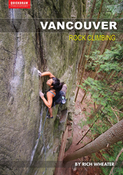
Author(s): Rich Wheater
일자: 2015
ISBN: 978-0-9877796-5-6
With 300 routes, 600 boulder problems and a handful of fine alpine objectives, Vancouver Rock Climbing provides comprehensive coverage of the diverse climbing scene around Vancouver, Canada.
- Provides detailed coverage of Howe Sound, Caulfeild Sea Cliffs, Cypress Falls Park, Cypress Mountain, Grouse Mountain, Lynn Valley and Deep Cove
- Includes full-color images and maps, descriptions of conditions and approach notes for each climbing area
- Each climb description tells you what gear to use, how many bolts there are, a difficulty rating, the pitch length and where to start and end
ⓘ
Accommodations nearby more Hide
Share this
부근의 상징들
| 5.10a | ★★★ Sunflower |
사진들 모든 사진들 훑어보기

Prospect Crag - 32ADFA3E-0916-47A1-8FA1-10C0E9A76FED.jpeg

★★★ Sunflower 5.10a - 32341C33-AE12-4AAC-8D85-1E80CBAFFB91.jpeg

★ Chocolate Sprinkles 5.8 - ED5BF0C5-7F94-4069-8751-2D09F19D7BC2.jpeg

{루트}의 등반가 - Clan of the Cave Bear.JPG
월요일 15 5월
무슨일이 일으나고 있는지 Prospect Crag 알아보세요.
Get a detailed insight with a timeline showing
- Ticks by climbers like you
- Discussions of the community
- Updates to the index by our users
- and many more things.
Login to see the timeline!