Despite the fact that theCrag holds over 170,000 climbing areas you might encounter the need to add new or missing areas, restructure an existing one or at least complement existing area information at one point in time.
Adding and editing areas is very easy and mostly self-explanatory. This article describes the details and provides guidance on structuring climbing areas.
The climbing community and the team of theCrag count on you to contribute whenever you can and to complement missing and correct wrong information for the sake of everyone. Thank you!
Permissions내용으로 돌아가기
This article assumes that you have sufficient permissions to perform the described tasks, please refer to the 사용자 허가들 article if you lack them.
Area Types내용으로 돌아가기
In order to structure regions, climbing areas and crags theCrag allows you to select from different, hierarchically organized area types.
While theCrag typically already provides structure on country and region level you might structure a climbing area in multiple ways. How you do that is vastly dependent on the climbing area itself, the way it is geographically structured, how it is approached and how developed it is. That being said, how a climbing area is organized on theCrag might change over time. Same as climbing areas change and develop over time.
The following table provides a list of available area types on theCrag and provides a short description of their intended use.
| 형태 | 설명 |
|---|---|
| 지역 | This covers all areas from the world down to the level above crags (top level crag or TLC). This includes country pages, states and political or geographic sub-areas. All areas below the top level crag should not be assigned as a region. Generally these pages are controlled by site administration with very restrictive user permissions. |
| 지역 | Area might be used as a collection of crags or cliffs, either hierarchically above or below a crag. It can be used as a grouping element for large crags like in the example of Frankenjura Nord. |
| 암장 | A Crag is a climbing and/or bouldering area. A Crag could be a major crag or a minor one. A crag can have more crags as sub areas. Typically major crags feature in guidebook titles, and minor crags in guidebook chapter headings. Assign Crag area types for all climbing or mixed (climbing and bouldering) nodes from a region down to a cliff, boulder field or boulder. When in doubt, if you make it a Crag you won’t go too far wrong. |
| 절벽 | The Cliff area type should be used for an area that has either routes or sectors as children. As the name says, it is typically also defined by the actual physical cliff. |
| 부문 | Sector areas are typically sub areas under the cliff level. |
| 분야 | The Boulder Field area type is for areas that have multiple boulders as sub areas. |
| 볼더 | The Boulder area type is used to specify a single boulder. |
| 특징 | The Feature area type can be a feature of a cliff or boulder. Generally it is used as a sub-type for bouldering purposes or in a gym. |
| 실내암장 | A climbing gym or wall. This area type allows for different management of routes. See also theCrag에 의한 실내암장 문제해결. |
| 인공암장 지역 | An artificial climbing area that is not a gym. For example a bridge with artificial holds like the Perolles Brücke. This area type allows for different management of routes. |
Adding Areas내용으로 돌아가기
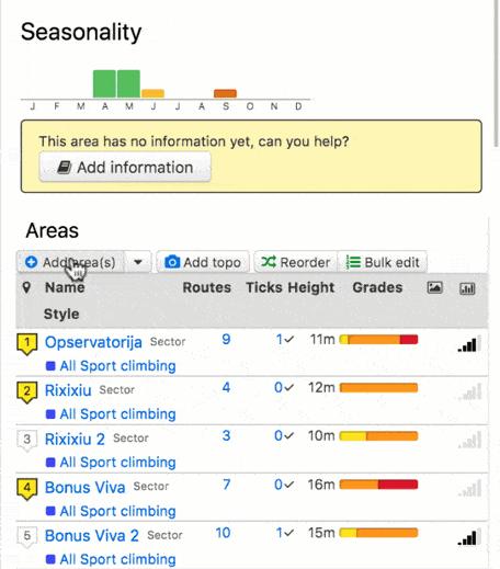
Adding one or multiple areas is as simple as clicking the 'Add Area(s)' button located just above the list of existing areas. Click on the button to add one area or on the arrow next to it to add multiple ones.
Adding area(s)
Select the area type of choice and fill in as much information as you have. Refer to the table below for detailed information on each data field. Fields marked with a '*' are mandatory. Be aware that not all fields are available for all area types (see Inheriting for details).
Once you are done just hit Save and verify the information you entered.
| Field | 설명 |
|---|---|
| 성함 * | This is the principal name of the 지역. Record it as written and known in the climbing area. If you want to add alternative names ('aka') or names in different languages, please refer to the field 'AKA'. Names (incl. AKA’s) have to be unique within the same level of hierarchy. |
| 다르게 알려진 바로는 (다르게 알려진 바로는) | This field allows for one or multiple alternative names of the 지역. On every edit an additional AKA name might be added. The options are:
|
| 이전 삽입 | Here you choose where you want to insert the 지역 if you add additional 지역들. Leave empty if it is a new 지역 or you want to reorder the 지역들 later. |
| 요약 | A 200 character description of the crag. Typically a short summary of specifics of the respective crag. |
| 설명 |
The general description of the area. Put here everything that is specific to this level of hierarchy and not covered by a different, more structured field. DO NOT copy descriptions from guide books! See Formatting Text for information about the formatting of text. |
| 접근 문제들 | Fill in this field if there are any known issues when accessing this area. This might be information on land ownership (eg. private or public land, national park, state park), seasonal closures or other issues affecting access. |
| 접근 |
Describe here how to reach the respective area. This might be an extensive description on crag level incl. GPS positions of parking, public transport and hike in or just a one liner for a sector of a cliff. See Formatting Text for information about the inclusion of GPS positions and the formatting of text. Add walk time and other walk in parameters as structured tag. Please refer to 태그 조직하기 for details. |
| 하강시 주의점 | Special instructions describing how to get off one or more routes in the area. |
| 숙박 장소 | Camping and other accommodation options nearby. |
| 윤리문제 | Any relevant information regarding the local climbing ethic (eg. attitudes towards bolting, retro-bolting, use of chalk, chipping holds, etc). |
| 역사 | Information about the development of climbing in the area. |
| 구성된 태그들 |
Please add specific structured tags for an area here. This makes searching and filtering of data easier. Please refer to 태그 조직하기 for details. |
theCrag uses the concept of the TLC for some of its system features. It is defined as the first area in a hierarchy that is not of area type 'region'. For example, if you look at Kalymnos, its hierarchy is: World > Europe > Greece > Aegean Islands (all regions) followed by Kalymnos (area type crag) which makes Kalymnos the TLC. The TLC, amongst other things, affects the following system functions:
- Your notable ascents on your profile are grouped by TLC
- Edit and ascent activities in the activity stream are aggregated by TLC
- You can not create a PDF 암장가이드 for areas above a TLC
- Route results from 검색하기 show the TLC
- Various other advanced searches and filters will show TLC or group by TLC (depending on the ‘sort by’ field) - ascents in Greece for example.
Adding areas to a list of routes내용으로 돌아가기
While not a preference, in some rare cases it might be desirable to add areas to a list of routes. In order to do so click on the 3 dots next to Edit Area (top right) and select the menu item 'Add a sub area'. An example is El Arcotete which is the main crag but has a small cliff with slightly different approach nearby.
Adding Annotations내용으로 돌아가기
On top of the different area types, theCrag allows you to use annotations to provide additional structure to a list of routes or areas.
Annotations are great to use to create separations between routes on the same cliff or sector (e.g. left of the crack, right of the crack) or to distinguish between boulders in a small boulder area where you do not want to create individual boulders.
You may add an annotation to a list of routes or areas by simply clicking on the 3 dots next to the 'Edit Area' button and selecting 'Add an annotation'. Annotations may either be added with or without title. If you enter a title, the annotation is automatically added to the clickable table of contents above the route list for easier navigation. Without title it is only a textual separation in the list of routes.
Use the reorder function if you want to move the annotation up or down in the list.

Adding annotation
Structuring Areas내용으로 돌아가기
Probably the best approach in structuring a climbing area is by splitting it up geographically and by approach. A great example of structuring a climbing area is the area of Viñales on Cuba.
The region of Viñales is comprised of just a few crags and cliffs. Some cliffs such as Mogote Palmarito just hold a handful of routes while others such as Mogote del Valle are made up of multiple cliffs and sectors with hundreds of routes. One of the cliffs is Guajiro Ecológico which as such is structured into several sub-sectors using annotations.
There would be, of course, many other ways to structure this area but the following generic example of two cliffs on a single mountain might help you in structuring a climbing area, small or big:
- Is there common geography? E.g. are 2 cliffs on the same mountain? Then, most likely they belong to the same crag or at least the same area. Refer to the geo-location if in doubt.
- Do the 2 cliffs have the same parking but different hike ins? Then, they are most likely part of the same crag but are different cliffs (or crags) on theCrag. This allows you to record the same approach info for the main crag and individual hike in information for the cliffs, including separate info for cliff orientation etc.
- Are the 2 cliffs in the same crag next to each other, just separated by e.g. a gully? Now it is up to you, they might be just 2 different sectors of the same cliff, still allowing you to record independent information for them or you record them as one cliff and separate the routes by using a simple annotation.
As you can see, there is no right or wrong, just multiple options to do the same. Even if you decide for one option today, you can switch to a different one later, theCrag gives you this flexibility and thus allows to reflect the changes and developments at a crag as they occur.
Sorting Areas내용으로 돌아가기
Same as for structuring areas, ordering areas can be done in multiple ways. While parent regions and areas are often sorted alphabetically (e.g. countries, states), climbing areas are typically sorted by geography. Meaning they are sorted as you approach them on your hike or from left to right along a valley, etc. A nice example is the Miller Fork Recreational Preserve in the Red River Gorge where all cliffs along the small valleys are sorted left to right as you would hike along them if you were to visit all of them.
Inheriting내용으로 돌아가기
As mentioned above, not all area types provide all data fields for entry. Also, some of the data fields (and structured tags) are inherited from higher levels to make them visible at the levels below unless more specific information is entered at a lower level.
For example, Access Issues entered at crag level also appear on cliff and / or sector level or text entered in the field Ethic for an area is showing at all levels below.
The following table gives an overview about the data fields available per area type and their behaviour. 'Yes' stands for available, '물려받다' for inherited from a higher level.
| 지역 | 지역 | 암장 | 절벽 | 부문 | 분야 | 볼더 | 특징 | |
|---|---|---|---|---|---|---|---|---|
| 접근 문제들 | 물려받다 | 물려받다 | 물려받다 | 물려받다 | 물려받다 | 물려받다 | 물려받다 | 물려받다 |
| 접근 | Yes | Yes | Yes | Yes | Yes | Yes | Yes | Yes |
| 하강시 주의점 | . | . | . | Yes | Yes | . | . | . |
| 설명 | Yes | Yes | Yes | Yes | Yes | Yes | Yes | Yes |
| 윤리문제 | 물려받다 | 물려받다 | 물려받다 | 물려받다 | 물려받다 | 물려받다 | 물려받다 | 물려받다 |
| 요약 | Yes | Yes | Yes | . | . | . | . | . |
| 숙박 장소 | Yes | Yes | Yes | . | . | . | . | . |
| 역사 | Yes | Yes | Yes | Yes | Yes | Yes | Yes | Yes |
Editing Areas내용으로 돌아가기
There are two ways for editing existing or adding missing information for areas. Provided you have the correct permissions, you may change and add all the information described in the chapters above.
Simply click on the 'Edit area' button on the top right to edit the area you are currently in (incl. its sub-areas or routes) or click the 'Bulk Edit' button just above a list of areas to do the same.
Editing and Removing Annotations내용으로 돌아가기
To edit an annotation simply click on 'Edit Item' next to the annotation of choice. In order to remove an annotation completely, edit the annotation and delete the title, description and potential alternative names (AKA’s) and click save.