Use this Region Guide to easily find and compare Crags.
Table of contents
- 1.
Cape Winelands
1775 in Region
- 1.1. Bain's Kloof 2 in Crag
- 1.2. Castle Rocks 6 in Area
-
1.3.
De Doorns 21 in Crag
- 1.3.1. Lost Fingers Crag 9 in Crag
- 1.3.2. The Prow Crag 0 in Crag
- 1.3.3. Krymptonite Boulders 7 in Field
- 1.3.4. Rooi Nagmerrie 5 in Crag
-
1.4.
Du Toit's Kloof 330 in Region
- 1.4.1. The Waterfront 5 in Crag
- 1.4.2. Du Toit's Peak 8 in Crag
- 1.4.3. Hellfire 217 in Crag
- 1.4.4. Witteberg 5 in Crag
- 1.4.5. Yellowwood 78 in Crag
- 1.4.6. Righteous Condemnation 1 in Cliff
- 1.4.7. Weighbridge 1 in Field
- 1.4.8. Slanghoek Amphitheatre 10 in Area
-
1.5.
Gecko Rock 29 in Crag
- 1.5.1. Tsunami Wall 16 in Sector
- 1.5.2. Gecko Wall 6 in Sector
- 1.5.3. Arch Enemies 7 in Sector
-
1.6.
Houdenbek 126 in Crag
- 1.6.1. Houdenbek Crag / Sport 39 in Sector
- 1.6.2. Houdenbek Block / Sport 4 in Sector
- 1.6.3. The Arch Crags 51 in Crag
- 1.6.4. The Mecca Crags 6 in Crag
- 1.6.5. Valley of Kings 7 in Area
- 1.6.6. The Incredible Health Area 13 in Area
- 1.6.7. South Side 5 in Area
- 1.6.8. Campsite 1 in Area
-
1.7.
Karbonaaitjies Kraal 52 in Crag
- 1.7.1. East Spur 29 in Area
- 1.7.2. Gaper Kloof Prow 5 in Area
- 1.7.3. Main Amphitheatre 9 in Cliff
- 1.7.4. The Junction 7 in Cliff
- 1.7.5. West Spur 1 in Area
- 1.7.6. The Road 1 in Area
- 1.8. Milner Amphitheatre 24 in Crag
-
1.9.
Montagu 719 in Crag
- 1.9.1. Legoland Area 50 in Area
- 1.9.2. Bosch Kloof 64 in Crag
- 1.9.3. Kalkoennes 13 in Area
- 1.9.4. The Fort 12 in Crag
- 1.9.5. Keur Kloof 89 in Crag
- 1.9.6. Cogman's Area 18 in Area
- 1.9.7. Riverside Crags 81 in Area
- 1.9.8. Bad Kloof / Badskloof 199 in Area
- 1.9.9. Donker Kloof 31 in Crag
- 1.9.10. The Farm 41 in Area
- 1.9.11. Oorlogs Kloof 55 in Crag
- 1.9.12. The Sanctuary 7 in Area
- 1.9.13. Lost World 0 in Crag
- 1.9.14. Guano Caves 59 in Area
-
1.10.
Paarl Rock 312 in Crag
- 1.10.1. Paarl Rock Boulder Field 143 in Field
- 1.10.2. Cannon Fodder Wall 17 in Sector
- 1.10.3. Euro Wall 7 in Sector
- 1.10.4. Weasel Wall 10 in Sector
- 1.10.5. Little Dutch Boy Wall Left 6 in Sector
- 1.10.6. Little Dutch Boy Wall Right 7 in Sector
- 1.10.7. Wonderland Wall 3 in Sector
- 1.10.8. Cobalt Blue Wall 11 in Sector
- 1.10.9. Parklife Wall 8 in Sector
- 1.10.10. Arbor Cave 2 in Sector
- 1.10.11. Hidden By Day Wall 9 in Sector
- 1.10.12. Top Parking 3 in Area
- 1.10.13. Belly Button Slab 15 in Sector
- 1.10.14. Granite Graffiti Wall 4 in Sector
- 1.10.15. Sands of Time Wall Left 6 in Sector
- 1.10.16. Sands of Time Wall Right 17 in Sector
- 1.10.17. Casualties of War Wall 5 in Sector
- 1.10.18. Wastelands Wall 7 in Sector
- 1.10.19. North Wall 3 in Sector
- 1.10.20. Blue Diamonds Sector 6 in Sector
- 1.10.21. Splinter Area 10 in Sector
- 1.10.22. Hidden Gem Boulders / Crank Prank 6 in Field
- 1.10.23. Nante's Boulder 1 in Boulder
- 1.10.24. Two Cents Slab 5 in Sector
- 1.10.25. Gladde Rock 1 in Sector
-
1.11.
Stellenbosch 45 in Area
- 1.11.1. Botmanskop 13 in Area
- 1.11.2. Campus Crag 10 in Crag
- 1.11.3. Duiwel's Kloof 10 in Crag
- 1.11.4. Jonkershoek 1 in Area
- 1.11.5. Winelands Crag 11 in Crag
- 1.12. Superior Kloof 4 in Area
- 1.13. Tunnel Vision 4 in Crag
- 1.14. Waaihoek/Zeeba's berg 1 in Crag
-
1.15.
Wydekloof/ Turret Peak 84 in Area
- 1.15.1. The Turret 16 in Sector
- 1.15.2. The Spires 10 in Sector
- 1.15.3. The Zoo 8 in Sector
- 1.15.4. Stormtrooper Spire 4 in Sector
- 1.15.5. Hanging Block 5 in Sector
- 1.15.6. Hanging Pinnacles 8 in Sector
- 1.15.7. The Puzzle Prow 1 in Sector
- 1.15.8. The Chopping Block 18 in Sector
- 1.15.9. The Chambers (Front) 14 in Sector
- 1.15.10. The Chambers (Back) 0 in Sector
- 1.15.11. The Outlook 0 in Sector
- 1.15.12. Stove Legs 0 in Sector
- 1.15.13. The Other Legs 0 in Sector
- 1.15.14. The Fins 0 in Sector
- 1.15.15. The Football Field 0 in Sector
- 1.15.16. The BOW (Big Orange Wall) 0 in Sector
- 1.15.17. THEE Gulley 0 in Sector
- 1.15.18. The Gates 0 in Sector
- 1.15.19. The Outer Rim 0 in Sector
- 1.15.20. The Tsotsi Area / South Area of Summit 0 in Sector
- 1.15.21. The Bread Sector 0 in Sector
- 1.15.22. Austrian Wall (aka The Wings Wall) 0 in Sector
- 1.15.23. The Parrot 0 in Sector
- 1.15.24. Slither Sector 0 in Sector
- 1.15.25. The Perchling 0 in Sector
- 1.15.26. The Lookout 0 in Sector
- 1.15.27. The Sausage Factory 0 in Sector
- 1.15.28. The Little Box of Terror 0 in Sector
- 1.15.29. The Butchery 0 in Sector
- 1.15.30. The Terrarium 0 in Sector
- 1.15.31. Six Shooter of the South 0 in Sector
- 1.15.32. The Pirate 0 in Sector
- 1.15.33. The Abattoir 0 in Sector
- 1.15.34. Warren Sector 0 in Sector
-
1.16.
Witzenberg 15 in Area
- 1.16.1. Titan Uranus 3 in Boulder
- 1.16.2. Searching for Sugarman 1 in Boulder
- 1.16.3. Take Back Tomorrow 1 in Boulder
- 1.16.4. Get Busy Living 1 in Boulder
- 1.16.5. Goldfish 1 in Boulder
- 1.16.6. The Atheist 1 in Boulder
- 1.16.7. Coke 1 in Boulder
- 1.16.8. Last Chance Salon 1 in Boulder
- 1.16.9. Ginger Ninja 1 in Boulder
- 1.16.10. Spartacus 1 in Boulder
- 1.16.11. Midnight Monkey 2 in Boulder
- 1.16.12. General Awesomeness 1 in Boulder
- 1.17. Haelhoek Sneeukop Massif 1 in Area
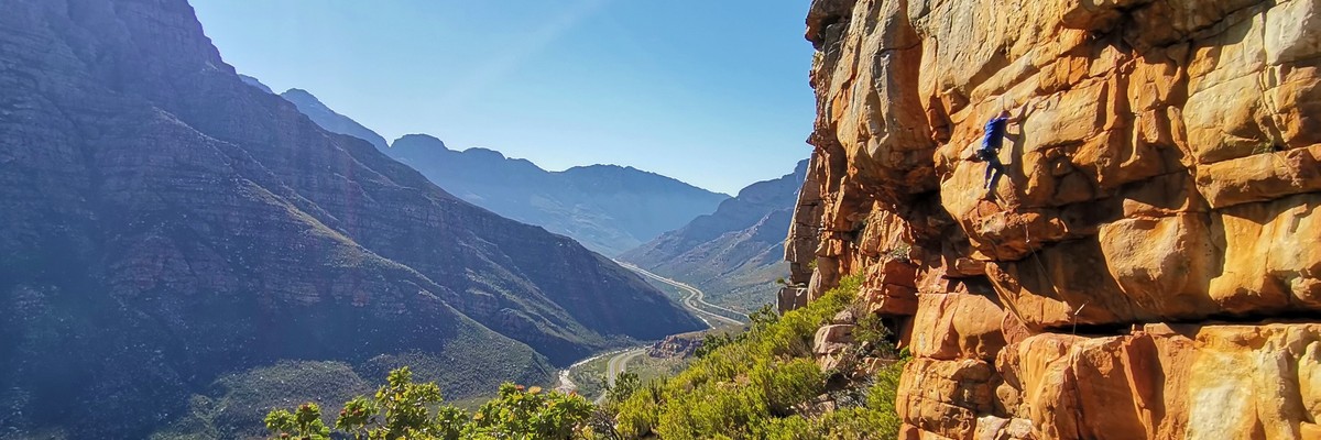
1. Cape Winelands 1,775 routes in Region
- Summary:
-
Sport climbing, Trad climbing and other styles
Lat / Long: -33.341187, 19.716372
summary
Home to some of the best routes in Africa.
description
Home to some of the best routes in Africa.
1.1. Bain's Kloof 2 routes in Crag
- Summary:
-
All Trad climbing
Lat / Long: -33.605619, 19.122137
approach
From Wellington one has to drive over the pass and some way down the other side towards Wolseley. The best routes are on the imposing crag that is on the south side of the valley. Park at the appropriate siding on the pass and descend to the river. A long walk up to the base of the crag leads one into a nice cave.
1.2. Castle Rocks 6 routes in Area
- Summary:
-
All Trad climbing
Lat / Long: -33.406631, 19.305766
approach
Drive over Bain's Kloof Pass and head for Ceres. Continue past the turn-off for Wolsely/Tulbagh to the start of Mitchell's Pass. Turn right at a gate leading down into a picnic site (Dwars River). Half a kilometre up the Witels, cross and walk straight up the slope towards the three Castle turrets above. Trend slightly leftwards into a gully running down between the main and right-hand turrets, to a point where a traverse line leads left across to the base of the rock
ethic
No bolting.
1.3. De Doorns 21 routes in Crag
- Summary:
-
Mostly Sport climbing
Lat / Long: -33.465453, 19.662757
1.3.1. Lost Fingers Crag 9 routes in Crag
- Summary:
-
Mostly Sport climbing
Lat / Long: -33.479300, 19.671137
summary
1.3.2. The Prow Crag 0 routes in Crag
1.3.3. Krymptonite Boulders 7 routes in Field
- Summary:
-
All Sport climbing
Lat / Long: -33.440830, 19.645964
1.3.4. Rooi Nagmerrie 5 routes in Crag
- Summary:
-
All Sport climbing
Lat / Long: -33.438738, 19.646538
1.4. Du Toit's Kloof 330 routes in Region
- Summary:
-
Trad climbing, Sport climbing and other styles
Lat / Long: -33.716183, 19.182778
1.4.1. The Waterfront 5 routes in Crag
- Summary:
-
All Sport climbing
Lat / Long: -33.734741, 19.114742
description
Permits available from Cape Nature.
Take the N1 out of town, and through the Huguenot Tunnel. Exiting the tunnel, continue towards Du Toits Lodge trout farm. Here, cross over to the other side of the N1 and head back towards Cape Town.
At the truck weigh bridge, there is a turn off to a parking area on the right hand side of the road. Park here. On foot, follow the trail making its way towards the Huguenot tunnel, passing under the N1 at the tunnel entrance (cross the river here). Now following the river on the right hand bank, you will see the crag just a bit further upstream. If you come to a concrete weir, you have gone too far.
access issues
Permits available from Cape Nature 021 483 0190
approach
About 10 to 15 minutes on foot from the parking area.
1.4.2. Du Toit's Peak 8 routes in Crag
- Summary:
-
All Trad climbing
Lat / Long: -33.750643, 19.188453
summary
Du Toits Peak is situated in Du Toits Kloof. It is a prominent peak, standing at 1995m above sea-level.
description
The North-West aspect of Du Toits Peak offers a 400m+ wall that has several country climbs established on it. A big day out, adventure climbing at its best.
approach
3-4hr hike in.
ethic
Trad climbing venue. No bolting allowed.
1.4.3. Hellfire 217 routes in Crag
- Summary:
-
Trad climbing, Sport climbing and other styles
Lat / Long: -33.731140, 19.173917
description
There are about 160 trad routes and 45 sport routes at Hellfire. Most trad routes are one or two pitches and 40-50m in height, although there are also some four-pitch test pieces. Sport routes vary in height from 15-45m. The rock is generally excellent quality hard sandstone. Some trad routes have the odd loose block so be aware of what you are pulling on and wear a helmet. All grades are present from short grade 8 beginner climbs to a grade 30+ open sport projects of 40m in length. Although any grade of climber will be happy climbing here the real meat of the crag is in the intermediate grades 18-23.
The crag is in the sun for most of the day and can get very hot. Winter is the best time to climb here.
When driving from Cape Town on the N1, pass through the Huguenot Tunnel (toll is about R50) or drive over the old Du Toits Kloof Pass. After the tunnel, pass the turn-off to Du Kloof Lodge on your left. The crag should be visible on your right. Continue past the crag keep an eye out for the Klip Rivier sign (pass over a small bridge). Shortly after the bridge keep in the right-hand lane and make a u-turn on the right (-33.722227, 19.182227). Drive back towards the tunnel. After three sections of wall on your left, there is a big road sign followed by a grassy area on the side of the road to park (-33.723839, 19.173719). Walk about 100 meters back and keep an eye out for a cairn at the start of the trail. The trail goes up towards the pylon, follow the cairns.
There is a comprehensive guidebook available from climbing stores in Cape Town or direct from the publisher. To order direct from the publisher e-mail ross@highadventure.co.za The price is R185 excluding postage.
access issues
The climbing is situated in the Limietberg reserve which is managed by Cape Nature. You MUST obtain a permit to climb at this area. Book permits by contacting their office in Rondebosch Cape Town and asking for a permit for the 'Hellfire trail' in the Limietberg reserve.
Cape Nature: www.capenature.co.za
Tel: 021 659 3500.
Permits can also be obtained at the Du Kloof resort (hotel) from the curio shop, useful if you decide to go on the spur of the moment and have not pre-booked permits.
approach
( -33.723879, 19.173503)
1 - 1 ½ hour drive from the Cape Town. 40min walk up to crags.
-33.723879, 19.173503)
1 - 1 ½ hour drive from the Cape Town. 40min walk up to crags.
where to stay
The Du Kloof Resort offers a range of accommodation options.
ethic
Alien Plants: Hakea Removal: Thin saplings can be easily pulled out by hand. Teen plants up to finger diameter can also be removed by pulling with more effort. Larger than this can be cut. Cut as close to the ground so that the plant does not regrow. A pull saw works well for this. Tip- Remove stones around the base before cutting so as not to dull your blade. Stack all the removed plants in a pile and weight it down with rocks. This helps the winged seeds to not spread. *Note: Gloves will save your hands.
history
Developed by Ross Suter, Malcolm Gowans and Greg Hart in the '90s
1.4.4. Witteberg 5 routes in Crag
- Summary:
-
All Trad climbing
Lat / Long: -33.714148, 19.137274
1.4.5. Yellowwood 78 routes in Crag
- Summary:
-
Mostly Trad climbing
Lat / Long: -33.726022, 19.206887
description
All informations are taken from the wiki with the authorization of the main author and crag developer, Charles Edelstein. Special thanks to him since he shared this while publishing a guidebook:
Yellowwood and Chess Pieces – A Climber’s Guide
152 pages – full colour - 148mm x 210mm – A5
AUTHOR(S) Charles Edelstein and Tony Lourens
ISBN 978-1-990927-83-6
For more information on routes, access, and permits please see the following websites:
Mountain Club of South Africa: www.mcsa.org.za - Look at “Who we are” for the different sections of the MCSA ClimbZA Wiki: http://www.climbing.co.za/wiki/Yellowwood_Amphitheatre Welcome to the largest & most comprehensive online database of Southern African climbing information. ClimbZA Forum: https//www.climbing.co.za/forum/ A south-african climbing forum where you can find climbing partners or more about different climbing areas and climbs.
access issues
The Ravine, Amphitheatre and most of the climbable rock is on the farm Gevonden 733 and is privately owned by the Dave Richter family trust. There is tacit permission to climb at Yellowwood by the beneficiaries of the trust provided we do not engage in any eco-unfriendly practises.
approach
Yellowwood Amphitheatre is in Du Toits Kloof on the Worcester side of the Huguenot Tunnel, approximately an hour's drive from Cape Town. The amphitheatre is on the south side of the N1, so the right hand side coming from Cape Town.
From Cape Town, drive along the N1, through the tunnel and into Du Toit’s Kloof, and continue past the Du Toit’s Kloof Resort/Hotel on the left. There are two spots you can park. About 3 or 4 km from the resort, you can squeeze a car behind the barrier on a long left bend, just before Yellowwood Ravine. Alternatively, about 1km on you can park at the first break in the barrier just below Yellowwood Ravine – this is a farm access road, so don’t park in front of the gate.
A path winds up the right-hand side of Yellowwood Ravine to reach the foot of the Amphitheatre. The path leaves the N1 several hundred metres down from the large pylon on the right hand side of the gully. The path passes beneath this pylon and is marked by cairns the whole way. The walk-in is steep, involves an 840m elevation hike starting at 360m above sea level to the base of the main amphitheatre that is at 1,200m, and takes about two hours.

Yellowwood - walk in.jpg
where to stay
There is no facilities, and only limited bivvy spots on site. There is a water drip near the base of Yellowwood that is unreliable and seasonal - June to December.
ethic
The prevailing ethic for Yellowwood is tread lightly.
"Tread lightly" means no bolting of belay stances unless all possible alternatives have been completely exhausted. No placing of bolts for running belays that are not absolutely essential. No use of pitons, unless necessary. No use of power drills is accepted!
Climbers are asked to respect the prevailing ethic which is intended to preserve the aesthetic appeal of Yellowwood as a world-class Trad climbing destination.
It is essential for first time visitors to do an ascent of one of the existing classic trad routes to appreciate the committing and adventurous nature of the climbing at Yellowwood. Older routes such as Armageddon Time (and the direct), Blood is Sweeter than Honey and Time Warp are all test pieces for their grade. And newer routes such as Prime Time (and the direct) and Fantastic Time as well as "routes in progress" of which there at least 3, are no less demanding at the grade. Most, if not all the trad routes on the main wall have at least one "R" (run-out) pitch but none are "X" rated. There is minimal fixed gear and very few fixed stance
A new route on Yellowwood, Fighting The Dark Side Of Gravity, has had all its bolts removed, except for two that are essential for the leader on Pitch 3. Two non-essential pitons have also been removed.
There has been much debate about Yellowwood and the most active Yellowwood climbers have talked extensively so as to settle the ethos of this high-value cliff.
In a recent meeting Adam Roff, Jeremy Samson and Hilton Davies distilled the following:
Yellowwood is a very special Trad climbing venue and there have been some mis-steps in route development at the crag. Newborn was bolted many years ago before locals had given much thought to bolting and ethics. It is a legacy that shall remain, but should not be seen as guidance for route development at Yellowwood. More recently four new routes have been established by visitors who have made extensive use of non-essential bolting. Whilst route development is encouraged, non-essential bolting is not; and these new routes are getting their non-essential bolts removed. They will remain as good adventurous routes.
2014: There have been no less than 10 new multi-pitch trad routes established at Yellowwood in the first 5 months of this year. Together they constitute no less than 60 pitches or, combined, more than 1500m of climbing. All the routes have been free-climbed with the vast majority of the pitches of being moderate grade and only 2 pitches of grade 22 and one of grade 24. The routes are all well protected and no fixed gear was necessary.
1.4.6. Righteous Condemnation 1 route in Cliff
- Summary:
-
All Trad climbing
Lat / Long: -33.686029, 19.232286
1.4.7. Weighbridge 1 route in Field
- Summary:
-
All Bouldering
Lat / Long: -33.706053, 19.229581
1.4.8. Slanghoek Amphitheatre 10 routes in Area
- Summary:
-
All Trad climbing
Lat / Long: -33.671617, 19.176212
description
Slanghoek Amphitheatre is on the north side of the Slanghoek Massif, a little distance east of the Goudini Spa. It is a huge amphitheatre, approximately 500m high. The first route being, A Private Universe.
approach
From Cape Town travel on the N1 through Du Toits Kloof and take the righthand turn-off for Rawsonville. After some distance turn left to Goudini continuing with a bridge over the N1 and proceed past the Goudini Spa. After a few kilometres turn left onto the farm marked Breeland (Lee & Jones). Proceed down the twin tracks for 100 metres then take a right towards wine cellars. At the cellars take a small road down to the left that leads for about 5 kilometres across vineyards to the home of owners Mortimer and Louise Lee (tel 023 344 3127). Proceed on a track past the farmhouse for 50 metres with a normal car, else 2 kilometres with a high clearance vehicle. Walk to the head of the valley. The huge red wall will come into view high on the left. Head up the gorge for 2 to 3 hours, including the ascent of a 20m waterfall, to reach the wall.
history
The first route being, A Private Universe.
1.5. Gecko Rock 29 routes in Crag
- Summary:
-
All Sport climbing
Lat / Long: -33.526704, 20.129995
summary
Technical climbing across easy to moderate grades in a unique, beautiful setting.
description
The Gecko Rock crags are situated in the Gecko Rock Nature Reserve.
access issues
The Gecko Rock Nature Reserve is a private nature reserve. An accommodation booking or day pass (purchased at reception) is required to climb.
approach
Three to three and a half hours from Cape Town, with the final +-30Km on dirt roads.
where to stay
The Gecko Rock Nature Reserve has a multitude of different accommodation options.
1.5.1. Tsunami Wall 16 routes in Sector
- Summary:
-
Lat / Long: -33.525604, 20.121924
description
A relatively short wall, but the climbs are interesting. A good crag for beginners.
approach
5 min walk with a slight elevation gain. Park at the water pump station on the road between Gecko Rock reception and De Wet's Rus campsite. The trail head is directly across the road from the water tanks, and is marked with a sign. At the first and only fork in the path, keep left. The trail takes you straight to the crag.
1.5.2. Gecko Wall 6 routes in Sector
- Summary:
-
Lat / Long: -33.522865, 20.137503
approach
Park at the Echo Valley campsite (the access road is on the limit of the ground clearance for a standard vehicle). Walk towards the campsite bathrooms and pass the windmill to find the start of the trail which leads into the valley. Approximately 5 mins along this trail a sign marks where you turn right to head up the ridge line, following a vague path, guided by fairly regular cairns. Towards the top of the ridge, the path moves left over the rock bands and onto a fairly steep slope. Continue following the path, and when you crest the top of the slope, the crag is visible to your right.
1.5.3. Arch Enemies 7 routes in Sector
- Summary:
-
Lat / Long: -33.518900, 20.140263
1.6. Houdenbek 126 routes in Crag
- Summary:
-
Trad climbing, Sport climbing and Bouldering
Lat / Long: -32.951769, 19.421738
1.6.1. Houdenbek Crag 39 routes in Sector
- Summary:
-
Mostly Sport climbing
Lat / Long: -32.955391, 19.429648
description
Good sport moderate sport climbing. Good campsite with awesome toilet and swimming.
1.6.2. Houdenbek Block 4 routes in Sector
- Summary:
-
All Sport climbing
Lat / Long: -32.956304, 19.430876
description
Block to the right
approach
5' walk
1.6.3. The Arch Crags 51 routes in Crag
- Summary:
-
All Trad climbing
Lat / Long: -32.951741, 19.417298
1.6.4. The Mecca Crags 6 routes in Crag
- Summary:
-
All Trad climbing
Lat / Long: -32.951666, 19.429587
1.6.5. Valley of Kings 7 routes in Area
- Summary:
-
All Bouldering
Lat / Long: -32.956216, 19.417382
1.6.6. The Incredible Health Area 13 routes in Area
- Summary:
-
All Bouldering
Lat / Long: -32.953679, 19.431365
1.6.7. South Side 5 routes in Area
- Summary:
-
All Bouldering
1.6.8. Campsite 1 route in Area
- Summary:
-
All Bouldering
Lat / Long: -32.954039, 19.425615
1.7. Karbonaaitjies Kraal 52 routes in Crag
- Summary:
-
Mostly Trad climbing
Lat / Long: -33.379814, 19.827954
summary
Very nice multi-pitch tradding in a big amphitheatre with a large amount of potential for new routes.
description
The climbing is on good sandstone, although it can be loose in certain places (bottom left hand corner in particular (take your brain bucket along for amphitheatre routes). There are only 2 sport routes (a short 24 and a 26) and more than 50 trad routes of good quality and the scenery around you is quite tranquil.
access issues
The climbing is located on Karoo 1's property. Recently access has been re-negotiated with the Karoo 1 hotel. To climb one has to stay at the Karoo 1 hotel although further negotiations are in process.
approach
From Cape Town, get onto the N1 towards Paarl, go over the Du Toits Kloof pass or through the tunnel. Stay on the N1 past Worcester, past De Doorns, up the Hex river pass and when you see a right hand turn to Montagu, you turn left into the Karoo1 Hotel and Village. Stop off at reception and declare your arrival!
where to stay
On site, upmarket accomodation and restaurant.
ethic
Avoid bolting.
1.7.1. East Spur 29 routes in Area
- Summary:
-
Mostly Trad climbing
Lat / Long: -33.379457, 19.829961
summary
The river right side of the crag. This part of the crag contains the only bolted routes in the whole kloof.
1.7.2. Gaper Kloof Prow 5 routes in Area
- Summary:
-
All Trad climbing
description
There is a sling rap point on the west side of the prominent prow above Puppy Dog, besides an unoccupied stick nest. Also easy to walk off.
1.7.3. Main Amphitheatre 9 routes in Cliff
- Summary:
-
All Trad climbing
Lat / Long: -33.380930, 19.829457
description
This 100m high cliff boasts some brilliant (and scary) climbing. The walls are overhanging and get more and more blocky as one climbs higher.
1.7.4. The Junction 7 routes in Cliff
- Summary:
-
All Trad climbing
Lat / Long: -33.380898, 19.828779
description
The Junction holds the easiest and some of the best multi-pitch routes in Karbonaatjieskraal.
approach
Hike across the top of the main amphitheatre to the west ridge. About 30m down the west ridge there is a rap point that will take you to the bottom of the junction wall. This rap is exactly 60M so don't attempt with shorter ropes.
You can also approach by following the cairns down the west ridge. (quicker than rappeling)
1.7.5. West Spur 1 route in Area
- Summary:
-
All Trad climbing
Lat / Long: -33.380585, 19.828102
1.7.6. The Road 1 route in Area
- Summary:
-
All Trad climbing
Lat / Long: -33.379895, 19.826136
summary
Opposite the Princess Di wall a bit further down to the right is a buttress with 2 corner systems
1.8. Milner Amphitheatre 24 routes in Crag
- Summary:
-
Mostly Rock climbing
Lat / Long: -33.462872, 19.506082
1.9. Montagu 719 routes in Crag
- Summary:
-
Mostly Sport climbing
Lat / Long: -33.776406, 20.079195
summary
Montagu is recognised as one of the most outstanding climbing destinations in South Africa due to the quality and number of climbing routes available. Montagu’s rock walls offer a wide variety of climbing opportunities at every level from beginner to expert.
description
The charming town of Montagu is situated in the Klein Karoo (semi desert region) on the east side of the Langeberg mountain range 2 hours / 200km drive east of Cape Town. Montagu is well known for it’s hot mineral springs as well as climbing and mountain biking.
approach
rom Cape Town, get onto the N1 towards Paarl. You have the choice of taking the tunnel (toll is R26.00) or driving over the pass which is very scenic and recommendable in good weather. Once on the other side of the mountain (you’re now in Du Toits Kloof) keep on the N1 until you pass the Shell Ultra City. Turn right and follow the signs to Robertson and then through Ashton and then onto Montagu. Be aware of speed traps in the towns (60km zones) and sometimes in the kloof before Montagu
where to stay
There is accommodation in Montagu to suite any budget and style. There are two campsites in Montagu as well as many child & pet friendly self-catering holiday rentals, bed & breakfasts and hotels.
ethic
To avoid any further Altercations with land owners and incorrect equipment being used, the Montagu Mountain Committee (who are responsible for the Montagu Reserve) have asked for applications to be submitted before a new route is bolted.
Applications here: http://www.climbing.co.za/bolting-information/bolting-new-routes-montagu/
history
Once a sleepy little Karoo town where not much happened, the town has since transformed into a vibrant energetic holiday destination. Montagu’s hot springs were first documented in the late 1700′s. The hot spring water comes out at 43° C from a fissure estimated to be 3km deep and is unaffected by drought. In 1877, Thomas Bain built the Cogmans Kloof pass and the tunnel that trade began to develop the area. Between 1902 and 1985 the Brink Brother’s enterprises were of major significance to the town. Their activities included general dealers, bottling works, canning factory, dried fruit production and a department store. In 1936 Montagu was declared a health resort. This resulted in an influx of wealthy people purchasing holiday houses.
1.9.1. Legoland Area 50 routes in Area
- Summary:
-
All Sport climbing
Lat / Long: -33.814112, 20.090925
access issues
No permit required
1.9.2. Bosch Kloof 64 routes in Crag
- Summary:
-
All Sport climbing
Lat / Long: -33.813292, 20.099313
access issues
A permit is required. Permits available at: https://montaguclimbing.com/boschkloof/product/day-permit/
1.9.3. Kalkoennes 13 routes in Area
- Summary:
-
All Sport climbing
Lat / Long: -33.802868, 20.090987
access issues
Access sensitive. Permission required! Kalkoennes is privately owned by the Basson family, and although the Bassons are climber friendly and have allowed the crags to be developed, the venue does have accommodation that is hired out to the public for recreational purposes. While the accommodation is inhabited, no one else is allowed access to the property. So basically climbing is only permitted if there is no one occupying the house, or if you and your group hire it, then you will have exclusive use of the whole area. For more information, permission for day visits to climb at Kalkoennes, and/or to hire the accommodation, contact Peter Basson on 082 331 4135
Do not in any way attempt to access the cliff from the adjacent farm as the farmer does not want any climbers on his land and we would like to keep a good relationship with landowners, even those who do not want climbers accessing cliffs through their land.
1.9.4. The Fort 12 routes in Crag
- Summary:
-
All Sport climbing
Lat / Long: -33.802675, 20.095019
description
Near the tunnel
access issues
No access issues
1.9.5. Keur Kloof 89 routes in Crag
- Summary:
-
Mostly Sport climbing
Lat / Long: -33.812403, 20.112001
summary
A fairly wild kloof that doesn't get the traffic it deserves, probably due to the hike ins required to get to the crags (compared to say Bad Kloof).
description
Great variety of crags catering to all sorts of styles with a few multipitch (double pitch) climbs thrown in for good measure.
access issues
No access issues
approach
There is one main path in the kloof, with various vague to non-existent trails breaking off to the various venues.
1.9.6. Cogman's Area 18 routes in Area
- Summary:
-
Mostly Sport climbing
Lat / Long: -33.802650, 20.109648
1.9.7. Riverside Crags 81 routes in Area
- Summary:
-
All Sport climbing
Lat / Long: -33.795157, 20.101377
description
On the Kingna River
access issues
No access issues
1.9.8. Bad Kloof 199 routes in Area
- Summary:
-
All Sport climbing
Lat / Long: -33.773658, 20.116117
description
Badskloof is referred to as "Bad Kloof" in the guide book.
Bottom entrance (permit required): (-33.781345, 20.114627)
Avelon Springs (top) entrance (no permit required): (-33.765587, 20.116951)
access issues
The kloof can be entered from either side. You will need to buy a permit if you enter from the bottom of the kloof. Alternatively, if you enter from Avelon Springs, you can just tell security at the gate that you are a climber and enter for free.
1.9.9. Donker Kloof 31 routes in Crag
- Summary:
-
All Sport climbing
Lat / Long: -33.782708, 20.101508
1.9.10. The Farm 41 routes in Area
- Summary:
-
Mostly Sport climbing
Lat / Long: -33.836597, 20.180257
summary
This is a very enjoyable crag with some great climbs.
access issues
Access is free. Just let the owners know that you are coming by emailing thefarmroute62@gmail.com.
Drive towards Barrydale from Montagu and keep an eye out for Guano Caves on the right, then travel another 1.4km. A gate with a sign reading "The Farm on R62" will be on your right (-33.829765, 20.193099). After the gate turn left and follow the path up towards a gate with a combination lock. Continue up the path until you reach a small parking lot next to a cement dam (-33.834874, 20.185834).
approach
The approach is an easy 15 minute hike to the first set of crags (The Farm Crag, Black Slab Sector and Graduation Wall). The other crags require some more walking and at times even a bit of scrambling.
1.9.11. Oorlogs Kloof 55 routes in Crag
- Summary:
-
Mostly Sport climbing
Lat / Long: -33.716966, 19.982868
access issues
Access is sensitive. Don't climb here without permission from the landowner.
According to climb.za an agreement has been reached with the landowner in principle. Access is currently in a trial period while admin and logistics are being finalised.
To arrange access faceback IM “Oorlogs Kloof Mountain Retreat - Montagu”. Cash access fee charged. Confirm fee and exit time when arranging access.
1.9.12. The Sanctuary 7 routes in Area
- Summary:
-
All Trad climbing
Lat / Long: -33.801839, 20.098556
approach
Approach via The Steeple. Follow tracks along the river.
1.9.13. Lost World 0 routes in Crag
summary
access issues
Access is closed unless you are staying at the GALENIA guest farm.
1.9.14. Guano Caves 59 routes in Area
- Summary:
-
Sport climbing and Trad climbing
Lat / Long: -33.832865, 20.173339
1.10. Paarl Rock 312 routes in Crag
- Summary:
-
Bouldering, Sport climbing and Trad climbing
Lat / Long: -33.743252, 18.945475
description
There are some excellent single- and multi-pitch sport routes at Paarl Rocks. The climbing is on large granite domes.
The rock seems to dry quicker than the sandstone crags around Cape Town, so Paarl Rocks may be a good destination if it has been raining recently.
access issues
The Paarl Rocks are about 60 km north of Cape Town. From Cape Town drive north along the N1, and turn off at Paarl. Look carefully for the sign to the Paarl Rocks Mountain Reserve (it is easy to miss).
1.10.1. Paarl Rock Boulder Field 143 routes in Field
- Summary:
-
Mostly Bouldering
Lat / Long: -33.739300, 18.948919
description
Most bouldering information below was extracted from Paarl Bolder Guide, 3rd Edition, by Niel Mostert https://www.climbing.co.za/pdf/pdf-topos/paarl-bouldering-guide/
The boulder field also contains some trad and sport routes.
access issues
No access issue. Topos and more info here: https://www.climbing.co.za/pdf/pdf-topos/paarl-bouldering-guide/
1.10.2. Cannon Fodder Wall 17 routes in Sector
- Summary:
-
Sport climbing and Trad climbing
Lat / Long: -33.740568, 18.950437
1.10.3. Euro Wall 7 routes in Sector
- Summary:
-
Sport climbing and Trad climbing
Lat / Long: -33.740893, 18.949145
1.10.4. Weasel Wall 10 routes in Sector
- Summary:
-
Trad climbing and Sport climbing
Lat / Long: -33.744780, 18.943353
1.10.5. Little Dutch Boy Wall Left 6 routes in Sector
- Summary:
-
Trad climbing and Sport climbing
Lat / Long: -33.742808, 18.942841
description
From the fake wood path, keep an eye on a big hole on the wall to your left if you are walking down towards the lake. That aesthetic hole marks where the Wonderland wall is.
1.10.6. Little Dutch Boy Wall Right 7 routes in Sector
- Summary:
-
Mostly Sport climbing
Lat / Long: -33.743127, 18.941868
1.10.7. Wonderland Wall 3 routes in Sector
- Summary:
-
Sport climbing and Trad climbing
Lat / Long: -33.743539, 18.941074
1.10.8. Cobalt Blue Wall 11 routes in Sector
- Summary:
-
Mostly Sport climbing
Lat / Long: -33.744089, 18.940693
1.10.9. Parklife Wall 8 routes in Sector
- Summary:
-
Mostly Sport climbing
Lat / Long: -33.744843, 18.940493
1.10.10. Arbor Cave 2 routes in Sector
- Summary:
-
All Trad climbing
Lat / Long: -33.747004, 18.940767
1.10.11. Hidden By Day Wall 9 routes in Sector
- Summary:
-
Sport climbing and Trad climbing
Lat / Long: -33.746044, 18.940703
1.10.12. Top Parking 3 routes in Area
- Summary:
-
Trad climbing and Bouldering
Lat / Long: -33.742021, 18.944711
1.10.13. Belly Button Slab 15 routes in Sector
- Summary:
-
Trad climbing and Sport climbing
Lat / Long: -33.741566, 18.943341
description
Tall, mostly featureless but not-too-steep slab off to the right of Bretagne.
approach
From the upper parking, pass through the cave formed by the big boulders then follow the trail out the other side.
descent notes
Looks walkable off climber's left. There are double-ring-bolts for 3 raps (should be fine on 1x60m) from the end of Gecko/Belly Button Brigade, and it is an easy traverse to this anchor from the top of Dyke.
1.10.14. Granite Graffiti Wall 4 routes in Sector
- Summary:
-
Trad climbing and Sport climbing
Lat / Long: -33.742391, 18.942847
1.10.15. Sands of Time Wall Left 6 routes in Sector
- Summary:
-
Mostly Trad climbing
Lat / Long: -33.742556, 18.941398
1.10.16. Sands of Time Wall Right 17 routes in Sector
- Summary:
-
Sport climbing and Trad climbing
Lat / Long: -33.742490, 18.942066
1.10.17. Casualties of War Wall 5 routes in Sector
- Summary:
-
All Sport climbing
Lat / Long: -33.741134, 18.941078
1.10.18. Wastelands Wall 7 routes in Sector
- Summary:
-
Trad climbing and Sport climbing
Lat / Long: -33.742079, 18.941012
1.10.19. North Wall 3 routes in Sector
- Summary:
-
Sport climbing and Trad climbing
Lat / Long: -33.740548, 18.941532
1.10.20. Blue Diamonds Sector 6 routes in Sector
- Summary:
-
Mostly Trad climbing
Lat / Long: -33.740500, 18.942409
1.10.21. Splinter Area 10 routes in Sector
- Summary:
-
Sport climbing and Trad climbing
Lat / Long: -33.740886, 18.942518
description
Around to the right of Belly button slab are rocks that look like Jelly Beans.
1.10.22. Hidden Gem Boulders 6 routes in Field
- Summary:
-
Mostly Trad climbing
Lat / Long: -33.739269, 18.943147
1.10.23. Nante's Boulder 1 route in Boulder
- Summary:
-
All Sport climbing
Lat / Long: -33.740160, 18.940193
1.10.24. Two Cents Slab 5 routes in Sector
- Summary:
-
All Trad climbing
Lat / Long: -33.737778, 18.942707
1.10.25. Gladde Rock 1 route in Sector
- Summary:
-
All Trad climbing
Lat / Long: -33.745948, 18.951325
description
From the parking walk back along the road for 240m or so and find a small pile of cairns (-33.747117, 18.952900) next to a large bush.
Follow these up a short embankment, and head up slightly right aiming for a large triangular rock at the base of the slabs and a prominent black streak in the centre of the slabs. The upper parking is ±10 minute walk from the summit.
1.11. Stellenbosch 45 routes in Area
- Summary:
-
Trad climbing, Sport climbing and Rock climbing
Lat / Long: -33.952460, 18.939540
1.11.1. Botmanskop 13 routes in Area
- Summary:
-
All Trad climbing
Lat / Long: -33.935750, 18.923915
summary
Enjoyable climbing.
approach
Botmaskop is situated outside of Jonkershoek above eastern Stellenbosch. You can find it on Google Maps here: Botmaskop Hike. GPS Location: (-33.9359407, 18.9065675). Please park above Uniepark and hike up. The hike takes 1½ - 2 hours depending on fitness levels.
From the top of Uniepark walk up forest roads until the main road becomes a straight clearing through a gum forest. From here either go left along a single track until you hit a jeep track crossing the path. Turn up this path for a while before turning right off the jeep track onto a cairned path. Alternatively, go straight up this cleared erosion path and follow cairns up and left and then traverse left above the gum forest until you reach the obvious path heading up towards the peak. Once you reach the rock band turn right and traverse below the rock until you reach a pinnacle. The routes are around this area.
1.11.2. Campus Crag 10 routes in Crag
- Summary:
-
All Trad climbing
Lat / Long: -33.959935, 18.884935
summary
Single pitch trad climbing on the West side of Stellenbosch Mountain
1.11.3. Duiwel's Kloof 10 routes in Crag
- Summary:
-
All Trad climbing
Lat / Long: -33.916206, 18.989600
1.11.4. Jonkershoek 1 route in Area
- Summary:
-
All Trad climbing
Lat / Long: -33.967277, 18.930707
1.11.5. Winelands Crag 11 routes in Crag
- Summary:
-
Mostly Sport climbing
Lat / Long: -33.981817, 18.888358
summary
After three years of bureaucracy, MCSA Stellenbosch finally got permission to bolt the first sports lines in the area. Many have rumored that the rock quality is too bad to bolt. Though this might be true for a lot of rock in the area, there are some quality lines if you search hard enough.
access issues
Access is sensitive. Contact Stellenbosch MCSA See current access arrangements here: https://drive.google.com/file/d/1StTzoi55NpPqCpqo2C-HlnICLYDZiwzR/view
approach
NO ACCESS VIA MONT MARIE FARM MAIN GATE. This has been revoked due to people not adhering to the rules. Perhaps if we stick to the rules, they might allow it again. See map below for access and parking.
ethic
Access is sensitive. Contact Stellenbosch MCSA
They are as follow: a. Follow Cape Nature rules. b. Stay to the paths as indicated. c. Do not make fire. d. No alcohol. e. Do not bother the farmers or personnel, work through MCSA Stellenbosch. f. Be courteous to everyone you encounter. g. Please pick up rubbish if you see any.
1.12. Superior Kloof 4 routes in Area
- Summary:
-
All Trad climbing
Lat / Long: -33.531413, 19.332535
summary
Country routes in a remote location. Do not underestimate the approach.
description
Located on MCSA property.
access issues
Access granted to MCSA members and their guests. You must organise permission to pass through the neighbouring farm in order to access the kloof. Details can be found on the MCSA website: https://mcsa.org.za/
approach
4-5hrs of rock hopping up the river, involving mandatory bag hauling at the gateway to the upper half of the kloof. After that, there are some seriously steep grassy slopes to reach the upper third of the catchment area where the climbs are located.
where to stay
Wild camping under the stars or beneath the canopy of the forested kloofs.
ethic
Leave no trace.
history
The area has been explored and climbed in since the '70s. Piccolo was the first route put up in the area, around 1975 by Mike Scott and company.
1.13. Tunnel Vision 4 routes in Crag
- Summary:
-
All Sport climbing
Lat / Long: -33.926931, 19.814108
access issues
Unknown - check with landowner before going
1.14. Waaihoek/Zeeba's berg 1 route in Crag
- Summary:
-
All Trad climbing
Lat / Long: -33.497648, 19.310150
1.15. Wydekloof/ Turret Peak 84 routes in Area
- Summary:
-
All Trad climbing
Lat / Long: -32.870906, 19.196530
summary
A servitude agreement grants MCSA members access to this unspoilt area that lies around the distinctive Turret Peak in the Koue Bokkeveld. The rock towers, passages and high vlaktes, as well as seasonal and perennial streams, make for an authentic and enjoyable mountaineering experience.
access issues
You need a permit from the Club office to go through the Donkerbos security gate. Please get your permit no later than 2pm on the Friday of the weekend you plan to visit the property. Once parked, clearly display your permit in a car window. MCSA members must carry their membership cards.
ethic
You need a permit from the Club office.
history
Wydekloof (farm number 453) is currently owned by the company Donkerbos Farms. In 1989 a Mr Basson, the previous owner of Bergstroom Farm (then known as Sorgvliet), registered a servitude to allow MCSA access to Wydekloof and Turret Peak. The costs to obtain the servitude were split between the Tygerberg, Stellenbosch and Cape Town sections (R2 500 each). This was the only way to secure access to the area after a dam was built that flooded and blockaded the original routes and campsite on a neighbouring farm, Vredelus.
1.15.1. The Turret 16 routes in Sector
- Summary:
-
Lat / Long: -32.872672, 19.197860
description
The Summit
1.15.2. The Spires 10 routes in Sector
- Summary:
-
Lat / Long: -32.870817, 19.199896
1.15.3. The Zoo 8 routes in Sector
- Summary:
-
1.15.4. Stormtrooper Spire 4 routes in Sector
- Summary:
-
1.15.5. Hanging Block 5 routes in Sector
- Summary:
-
1.15.6. Hanging Pinnacles 8 routes in Sector
- Summary:
-
description
Southside of the 'Hanging Block'
approach
Southside of the 'Hanging Block'
1.15.7. The Puzzle Prow 1 route in Sector
- Summary:
-
description
Eastside of 'Hanging Block'
approach
Eastside of 'Hanging Block'
1.15.8. The Chopping Block 18 routes in Sector
- Summary:
-
1.15.9. The Chambers (Front) 14 routes in Sector
- Summary:
-
1.15.10. The Chambers (Back) 0 routes in Sector
1.15.11. The Outlook 0 routes in Sector
1.15.12. Stove Legs 0 routes in Sector
1.15.13. The Other Legs 0 routes in Sector
1.15.14. The Fins 0 routes in Sector
1.15.15. The Football Field 0 routes in Sector
1.15.16. The BOW (Big Orange Wall) 0 routes in Sector
1.15.17. THEE Gulley 0 routes in Sector
1.15.18. The Gates 0 routes in Sector
1.15.19. The Outer Rim 0 routes in Sector
1.15.20. The Tsotsi Area 0 routes in Sector
1.15.21. The Bread Sector 0 routes in Sector
1.15.22. Austrian Wall (aka The Wings Wall) 0 routes in Sector
1.15.23. The Parrot 0 routes in Sector
1.15.24. Slither Sector 0 routes in Sector
1.15.25. The Perchling 0 routes in Sector
1.15.26. The Lookout 0 routes in Sector
1.15.27. The Sausage Factory 0 routes in Sector
1.15.28. The Little Box of Terror 0 routes in Sector
1.15.29. The Butchery 0 routes in Sector
1.15.30. The Terrarium 0 routes in Sector
1.15.31. Six Shooter of the South 0 routes in Sector
1.15.32. The Pirate 0 routes in Sector
1.15.33. The Abattoir 0 routes in Sector
1.15.34. Warren Sector 0 routes in Sector
1.16. Witzenberg 15 routes in Area
- Summary:
-
All Bouldering
Lat / Long: -33.226196, 19.304710
access issues
(Placed this here because all routes inherit this property)
Topos and other info can be found through climbing.co.za (links below)
1.16.1. Titan Uranus 3 routes in Boulder
- Summary:
-
1.16.2. Searching for Sugarman 1 route in Boulder
- Summary:
-
1.16.3. Take Back Tomorrow 1 route in Boulder
- Summary:
-
1.16.4. Get Busy Living 1 route in Boulder
- Summary:
-
1.16.5. Goldfish 1 route in Boulder
- Summary:
-
1.16.6. The Atheist 1 route in Boulder
- Summary:
-
1.16.7. Coke 1 route in Boulder
- Summary:
-
1.16.8. Last Chance Salon 1 route in Boulder
- Summary:
-
1.16.9. Ginger Ninja 1 route in Boulder
- Summary:
-
1.16.10. Spartacus 1 route in Boulder
- Summary:
-
1.16.11. Midnight Monkey 2 routes in Boulder
- Summary:
-
1.16.12. General Awesomeness 1 route in Boulder
- Summary:
-
1.17. Haelhoek Sneeukop Massif 1 route in Area
- Summary:
-
All Trad climbing
Lat / Long: -33.764461, 19.076863
access issues
More info on ClimbZA