Saison
Description
Vertical
Why are the best walls the furthest from the car park? The obvious headland of quality wall of good rock in a beautiful setting that can be seen when walking past the shit farm.
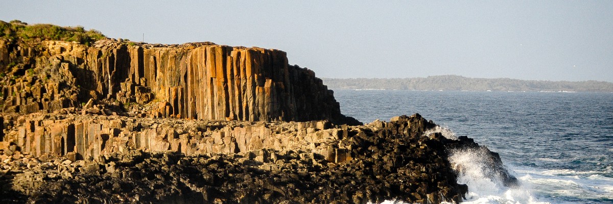
The east-facing (seaward side) columns and top of this buttress have been weathered into rounded, grey, very rough high-friction rock that looks a bit like pumice but is much harder. A geologist may confirm this may be due to saline decomposition of the xenoliths, xenocrysts and phenocrysts in the vesicular latite. Needless to say natural protection abounds, vertically mostly small wires and cams, with larger items on top.
The south-facing rock appears smoother and somewhat less weathered, with the bolted climbs up fused or smaller cracks. Further inland, the columns are hard and less "porous" but actively shattering, and are topped with a horrible mass of loose cream-coloured gravel.
Limit. de l'accès hérité de Bombo Quarry
The Southern areas of the quarry including the Sewerage Treatment Plant (STP) are owned by Sydney Water, with the Eastern area of this leased to Kiama council for public recreational use. The Northern section is owned by the Department of Environment, Industry and Planning, also for recreation use. The bulk portion of the quarry and climbable areas are covered by a State Heritage conservation order (Ref: #177).
While the area is well used by locals and tourists, there is no official opinion on climbing (??), and new routes should be climbed with due discretion and regard for public presence and the State Heritage listing.
Approche
Doux
5-10 minutes
Refer to geo map and and walk to base as for Bombo boulders, then up to a small ledge above an inlet.
For the top, follow the regular detailed signs "to HEADLAND", or scramble up from base via loose eroded footpath.
Descente
Descend from the top to bottom of the headland via a steep loose eroded footpath a short distance west of the buttress (take care), or down easy pillars on the northeast side facing the sea. Step across the inlet below BM if the tide and waves are low!
Éthique hérité de Illawarra and Shoalhaven
Potentiel pour de nouvelles voies
Lots of bolts in this region. Most development has been done after the 1980s.
Historique
Graphique de l'historique des voies
There is only one route in this area described in the 1983 Big B guide: Anzac Walk (17) 20m
"To get to this baby, walk around the reef on the headland looking for a large pillar with a couple of cracks splitting it up the sides; this route is the right crack up the biggest pillar.
- Up the crack, watch out for seagull shit on some of the ledges.
FA: D. Jaws Three, Thomas, Muir & Hill."
From the description, this could be next to Butt Muncher (up the biggest pillar), or in fact be No Pressure (watch out for seagull shit on some of the ledges).
Tags
Planifiez votre voyage
Le saviez-vous ?
Saviez-vous que vous pouvez créer un compte pour enregistrer, suivre et partager vos ascensions ? Des milliers de grimpeurs le font déjà.


Logements à proximité plus Cacher
Partager ceci
Photos Rechercher parmi toutes les photos

Nathan Mas-Stephens et James Manson dans Self Isolation 17 - BB-SelfIsolationForTwo.JPG

Ben Sirmais dans ★★ No Pressure 18 - BB-NoPressure-Ben3.JPG

Butt Muncher Buttress - Bombo-ButtMucherButtress.JPG

Nathan Mas-Stephens dans ★★ No Pressure 18 - BB-NoPressure-Nathan3.JPG
Mer 26 Avr
Regardez ce qu'il se passe à Butt Muncher Buttress.
Get a detailed insight with a timeline showing
- Ticks by climbers like you
- Discussions of the community
- Updates to the index by our users
- and many more things.
Login to see the timeline!