Saison
Résumé
The boulders are located on the traditional lands of the Algonquin people and are situated on MNR managed crownland. Please respect the land and its resources. Follow strict Leave No Trace practices. Be mindful of locals and cottagers along the gravel road: drive slowly! Respect the recommended closures during the fall hunting season. And do not risk a fire at the crags – it’s not worth it!
Description
Wide range of different erratic sizes with some small faces offering bouldering, trad climbing and a few sport routes.
Limit. de l'accès hérité de Ontario
In the more populated areas of Ontario, especially southern and south-western Ontario (within a few hours drive of Toronto) access is often complicated, with many cliffs closed to climbing. The Ontario Alliance of Climbers (OAC) monitors this, and negotiates for access to cliffs, or to avoid closures. They maintain a crag status list at: https://www.ontarioallianceofclimbers.ca/crag-status/
The Ontario Ministry of Natural Resources and Forestry also maintains an online crown land use policy atlas. This can often be used to determine the ownership status of the land on which a cliff is located in Ontario. It can be found at: http://www.giscoeapp.lrc.gov.on.ca/web/MNR/NHLUPS/CLUPA/Viewer/Viewer.html .
Approche
Driving Directions
From Ottawa, follow the directions to the main Calabogie Climbing/Bouldering area. Drive past the parking lot and continue on this road (508). It will eventually turn into Hydro Dam Road and bring you to the dam.
Hang a left onto Mountain Chute Road, cross the bridge and drive up the hill. At the top of the hill you will come to the intersection with Norcan Lake Road (45.1911, -76.90292). The directions below are from this intersection. Reset your trip odometer here if you want to follow the mileage.
This is the track for the drive from the intersection to the trailhead. https://www.alltrails.com/explore/map/drive-f2c3b25
0.0 km - Continue on Mountain Chute Road through the staging area.
0.3 km - Turn left onto Hunt Camp Lane.
4.0 km - Stay right continuing on Hunt Camp Lane.
5.7 km - Turn left, continuing on Hunt Camp Lane.
6.2 km - Turn left, leaving Hunt Camp Lane.
6.5 km - Turn left.
8.1 km - Stay right.
8.6 km - Park where the ATV trail branches right off the main road. (45.14649, -76.93635)
Most of the drive is on a well maintained gravel road. The last 2 km is on a forest service road that is currently in decent condition, with a few rough spots. As of Fall 2023, a regular clearance 2WD vehicle can make the drive.
Expect about a 1/2 hour drive past the main Calabogie parking area.
Approach
This is the track for the hike from the parking to the campsite at Sullivan Lake. https://www.alltrails.com/explore/map/sullivan-lake-59f51fd
You can expect the approach to take around 30 minutes. Most of the approach is along wide, well established ATV trails.
0.0 km - Follow the ATV trail that branches right from the road. This first section is mostly uphill.
0.5 km - Just past the top of the hill, make a sharp left onto another trail. Follow this for 100 meters.
0.6 km - Turn right and follow the obvious trail down the hill.
1 km - A few small boulders near the trail. These are the Goldilocks boulders.
1.5 km - Sullivan Lake will come into view. Don't go there yet. Follow the ATV trail as it turns left.
1.7 km - The lake will come into view again. Do NOT follow the ATV trail as it cuts left again. Instead, head right and down to the main campsite on the shore.
1.8 km - Admire the camp site, then cut left and follow the trail along the shore.
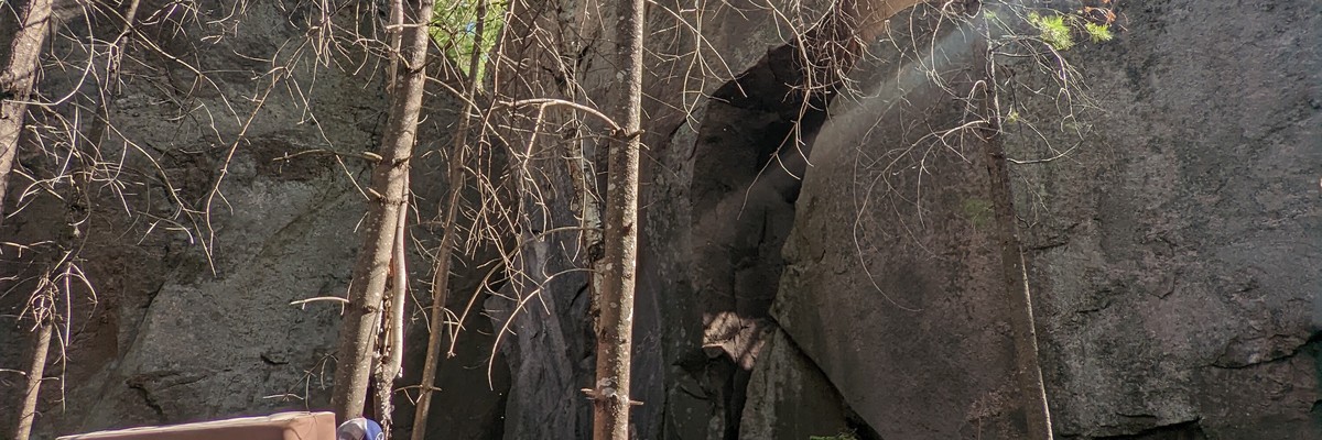
2.0 km - Behold the mega boulder. This is the main area. Follow the trail through this area and up the hill to the Snowshoe Lake boulders.
2.15km - Snowshoe Lake boulders
Où dormir
Crown land camping is found on both Sullivan and Snowshoe Lake
Historique
Graphique de l'historique des voies
Old hangers and tat are found on top of the the mega line. Would love to know who put them up there.
Planifiez votre voyage
Bonjour !
Ici pour la première fois ?
theCrag.com est un guide gratuit pour les sites d'escalade partout dans le monde, édité en collaboration par des grimpeurs passionnés, des bloqueurs et d'autres gens sympathiques.Vous pouvez enregistrer toutes vos ascensions, vous connecter et discuter avec d'autres grimpeurs et bien plus encore...» partez à la découverte, » en savoir plus or » posez-nous une question


Selected Guidebooks plus Cacher
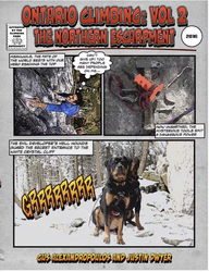
Auteur·e·s: Gus Alexandropoulos, Justin Dwyer
Date: 2016
ISBN: 9780995046610
A comprehensive guidebook to Southern Ontario’s famous climbing area, the Niagara Escarpment. This is the first complete guide to the region in almost 25 years. This volume covers the portion of the Escarpment north of Shelburne including the Beaver Valley area and the Bruce Peninsula. Includes an extensively researched history of climbing in the area, and detailed information on over 1000 rock-climbing routes.
ⓘ
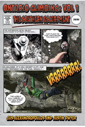
Auteur·e·s: Gus Alexandropoulos, Justin Dwyer
Date: 2016
ISBN: 9780995046603
A comprehensive guidebook to Southern Ontario’s famous climbing area, The Niagara Escarpment. This is the first complete guide to the region in almost 25 years. This volume covers areas close to Toronto, including the popular Milton crags. Includes extensively researched history of climbing in the area, and detailed information on over 1,000 rock climbing routes.
ⓘ
Logements à proximité plus Cacher
Partager ceci
Photos Rechercher parmi toutes les photos

Sullivan Lake - 62CD61DD-B69B-42D2-8884-F14925F9D87E.jpeg

Sullivan Lake - 80E966CC-A383-48E8-9EFA-33AB11E56ECD.jpeg

Sullivan Lake - BC8F5BF8-9210-4796-87E7-09C6F1B35374.jpeg

Sullivan Lake - A9C570FF-1F4E-4E31-9B53-9CE9A00868DE.jpeg
Jeu 4 Mai
Regardez ce qu'il se passe à Sullivan Lake.
Get a detailed insight with a timeline showing
- Ticks by climbers like you
- Discussions of the community
- Updates to the index by our users
- and many more things.
Login to see the timeline!