Saison
Description
The Roggspitze (also known as Rockspitze in the old literature) is a 2747 meter high mountain in the Valluga group in the western part of the Lechtaler Alps, on the border between the Austrian states of Tyrol and Vorarlberg. The name derives from the Romansh Rocca, English rock. The mountain has, especially from the west, a strikingly triangular shape with very steep walls facing south and east. As a result, the Roggspitze has a strong geographic dominance towards the north. The mountain is popular with climbers who find routes up to the UIAA grade VI because of its easy accessibility and its firm Aptychen limestone.
Approche
1-2 heures
From Innsbruck, take the A12 Inntalautobahn to Landeck, then continue on the B316 to St. Anton. Via the Arlbergpass to Vorarlberg and at the turnoff to Lech onto the Flexenstraße (199) to N. Via the Flexenpass to Zürs. Here you can also take the N from the Lechtal (NO) or the Bregenzerwald (NW) via Lech or from the W from Bludenz on the B316 via Klösterle to the Flexenstraße.
From Zürs on the hiking trail towards Stuttgarter Hütte. Ascend either via the hut to the Boschweg or branch off into the Pazüeltal before and from there on minor trails into direction Roggspitze.
Historique
Graphique de l'historique des voies
The peak was first climbed in 1877 by the shepherd Martin Josef Zudrell from the Pazieltal.
Tags
Planifiez votre voyage
Bonjour !
Ici pour la première fois ?
theCrag.com est un guide gratuit pour les sites d'escalade partout dans le monde, édité en collaboration par des grimpeurs passionnés, des bloqueurs et d'autres gens sympathiques.Vous pouvez enregistrer toutes vos ascensions, vous connecter et discuter avec d'autres grimpeurs et bien plus encore...» partez à la découverte, » en savoir plus or » posez-nous une question

Selected Guidebooks plus Cacher
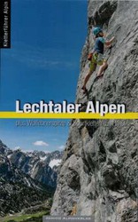
Auteur·e·s: Panico
Date: 2022
Der Kletterführer beschreibt alle Klettermöglichkeiten Lechtaler Alpen - von weiten Runouts in alpiner Abgeschiedenheit bis zu perfekter Sportkletterabsicherung in Talnähe.
ⓘ
Logements à proximité plus Cacher
Partager ceci

Jeu 25 Mai
Regardez ce qu'il se passe à Roggspitze.
Get a detailed insight with a timeline showing
- Ticks by climbers like you
- Discussions of the community
- Updates to the index by our users
- and many more things.
Login to see the timeline!