
Seasonality
Description
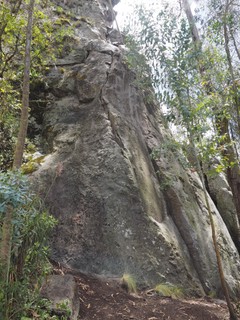
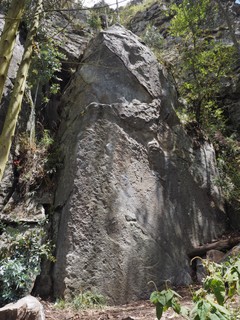
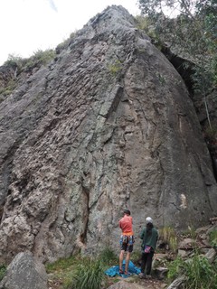
These 2 sectors are at the furthest left of the cliff, looking at it from town. Being 2 of the easiest sectors to access, it can be a popular place on the weekends so a good place to meet some local climbers.
Access issues inherited from Cojitambo
Allowed
Getting to the town Cojitambo is easy but the access trails to the rock can be a little tricky to find.
Approach
Gentle
10-20 min
<5 min
Walking: From the main square, follow the road at the top left of the square that runs parallel to the mountain. After a few hundred meters pass the Cementerio, then take the small road that veers right towards the rock. After about 100m, you will see a sign with a map of trails. Follow the trail that heads past 'El Chorro' and continue for around 500m to 'El Calvario'. Eventually you will see a small house and to the right of that a steep overhanging wall. This is the furthest right part of El Vallecito. follow the trail to the wall and continue along the base of the rock for the rest of the routes in these sectors.
By car: From the main square, follow the road past the Cementerio for about 1km, then turn right. Follow the road as it veers around to the right, then turn right again towards the rock after a few hundred meters. At the end of the road, it's only 100m walk to the rock and the Samborondon Sector.
Plan your Trip
Did you know?
Did you know that you can create an account to record, track and share your climbing ascents? Thousands of climbers are already doing this.


Accommodations nearby more Hide
Share this
Photos Browse all photos
Samborondon & El Vallecito - Vallecito Topo 2.jpg
Samborondon & El Vallecito - Vallecito Topo 1.jpg
Samborondon & El Vallecito - Sambo Topo.jpg
Thu 27 Jul
Check out what is happening in Samborondon & El Vallecito.
Get a detailed insight with a timeline showing
- Ticks by climbers like you
- Discussions of the community
- Updates to the index by our users
- and many more things.
Login to see the timeline!