Seasonality
Description
A small overhung face near the water. This boulder is a part on the slabs where people normally sit and enjoy the river.
When the river level is high the landing area is flooded and debris (mostly big sticks and garbage) is often washed into the landing zone. The landing is more likely dry in Summer and Fall
Access issues inherited from Ottawa Boulders
Tolerated
All areas are on city property with the exception of Conroy pit which is NCC. Ottawa has no official policy on climbing soconsider climbing tolerated. Be prepared for some strange looks and potentially a grumpy citizen telling you off.
Approach
Approach same as 'Hog' but when you are on the slabs that people normally hang out on turn towards the water. There is a crack that is approximately 2 m wide, the moderately overhung face of the crack is boulder.
Tags
Plan your Trip
Hello!
First time here?
theCrag.com is a free guide for rock climbing areas all over the world, collaboratively edited by keen rock climbers, boulderers and other nice folks.You can log all your routes, connect and chat with other climbers and much more...» go exploring, » learn more or » ask us a question


Selected Guidebooks more Hide
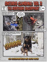
Author(s): Gus Alexandropoulos, Justin Dwyer
Date: 2016
ISBN: 9780995046610
A comprehensive guidebook to Southern Ontario’s famous climbing area, the Niagara Escarpment. This is the first complete guide to the region in almost 25 years. This volume covers the portion of the Escarpment north of Shelburne including the Beaver Valley area and the Bruce Peninsula. Includes an extensively researched history of climbing in the area, and detailed information on over 1000 rock-climbing routes.
ⓘ

Author(s): Gus Alexandropoulos, Justin Dwyer
Date: 2016
ISBN: 9780995046603
A comprehensive guidebook to Southern Ontario’s famous climbing area, The Niagara Escarpment. This is the first complete guide to the region in almost 25 years. This volume covers areas close to Toronto, including the popular Milton crags. Includes extensively researched history of climbing in the area, and detailed information on over 1,000 rock climbing routes.
ⓘ
Accommodations nearby more Hide
Share this
/cd/15/cd1524c438e0bcad716210003b77734057eb3afb)
Thu 27 Apr
Check out what is happening in By the Water.
Get a detailed insight with a timeline showing
- Ticks by climbers like you
- Discussions of the community
- Updates to the index by our users
- and many more things.
Login to see the timeline!