A Crag Guide gives an extensive view of all sub areas and climbs at a point in the index. It shows a snapshot of the index heirachy, up to 300 climbs (or areas) on a single web page. It shows selected comments climbers have made on a recently submitted ascent.
At a minor crag level this should be suitable for printing and taking with you on a climbing trip as an adjunct to your guidebook.
This guide was generated anonymously. Login to show your logged ascents against each route.
Warning
Rock climbing is extremely dangerous and can result in serious injury or death. Users acting on any information directly or indirectly available from this site do so at their own risk.
This guide is compiled from a community of users and is presented without verification that the information is accurate or complete and is subject to system errors. By using this guide you acknowledge that the material described in this document is extremely dangerous, and that the content may be misleading or wrong. In particular there may be misdescriptions of routes, incorrectly drawn topo lines, incorrect difficulty ratings or incorrect or missing protection ratings. This includes both errors from the content and system errors.
Nobody has checked this particlular guide so you cannot rely on it's accuracy like you would a store bought guide.
You should not depend on any information gleaned from this guide for your personal safety.
You must keep this warning with the guide. For more information refer to our:
Usage policy
Contributors
Thanks to the following people who have contributed to this crag guide:
Mark Gamble
Richard Pattison
Jake Forker
Lee Cujes
Nick
Vanessa Wills
Laurence
Terry Svingen
Peatey
Dirk Nouvel
The size of a person's name reflects their Crag Karma, which is their level of contribution. You can help contribute to your local crag by adding descriptions, photos, topos and more.
Table of contents
- 1. West Face 4 in Area
- 2. Index by grade
1. West Face 4 routes in Area
- Summary:
-
Tutti Arrampicata trad
Lat / Long: -26.927359, 152.945189
limitazioni per l'accesso
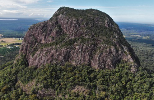
Most 'Glasshouse Mountains' climbing is within the Glass House Mountains National Park. Please respect the environment and other people's enjoyment of it. Access to climbing here is a privilege, not a right.
The 2019 Ngungun track expansion & fortification work is now complete, and the mountain is once again fully open.
etica
Modern climbers establishing new routes have taken great pains to ensure any new routes do not interfere with the historic routes established many decades ago.
Retro-bolting of existing routes is unacceptable!
New routes shall make use of traditional protection where available.
| Route | Grade | Style | Selected ascents | |||||
|---|---|---|---|---|---|---|---|---|
| 1 | Felp | 10 | 200m | |||||
| 2 |
Felp II
FA: 2004 | 13 | 300m | |||||
 |
||||||||
| Route | Grade | Style | Selected ascents | |||||
| 3 |
★★ West Track (Tourist Track)
Tourist Track. Slippery and well worn. From the carpark, follow the NP signage:  ★★ West Track (Tourist Track) 3 - 20230413_115159-sr.jpg up the increasingly steep track, to the intimidating start (colloquially called "Chicken Rock", because many day-trippers choose to turn back at this point). In the V groove, top left corner, the steep start is about a grade 5 or 6 and access here is slightly overhanging:  ★★ West Track (Tourist Track) 3 - Chicken Rock but an easier start can be found down right, about 15m right of a large tree:  David Duffy su ★★ West Track (Tourist Track) 3 - Chicken Rock up the sloping face, on good holds, about grade 3. Once this hurdle has been overcome, the remainder of the climbing then becomes an easy scramble at about grade 0-2, to the summit. | 3 | 340m | |||||
| 4 |
Microtome
The first known technical route on the south west corner of Tibro. This corner is bisected by a scrubby ramp that traverses diagonally up from right to left, starting under a vertical section of the cliff on the south face proper. Below this ramp, a buttress comprised of relatively clean and smooth slabs can be found, and this route takes a direct line up those slabs to end on the scrubby ramp. To find the start of the route, take the usual access track to Slider gully and bushbash around the base of the mountain. Alternatively, it is fairly easy to follow the Trachyte Circuit around the mountain until a low point on the trail with an abundance of ferns. The buttress can vaguely be seen through the shrubbery, so make a beeline through moderately dense bush to the base of the wall.
Descent: One can scramble down to the right, although it is quite vegetated. A faint path also leads up and left, eventually connecting with the Tourist Track and a short descent to ground level. FA: 1973 | 14 | 100m, 3 | |||||
2. Index by grade
| Grade | Stars | Name | Style | Pop | |
|---|---|---|---|---|---|
| 3 | ★★ | West Track (Tourist Track) | 340m | ||
| 10 | Felp | 200m | |||
| 13 | Felp II | 300m | |||
| 14 | Microtome | 100m, 3 |