Stagionalità
Descrizione
Sole al pomeriggio
Riparata dal vento
Bagnata quando piove
Low to medium grades, good pro. great for beginners and top ropes.
Limitazioni per l'accesso
Not permitted
This crag was singled out as closed in the draft GGLMP and is within the CV11 (Cultural Values) SPA. Might be best to climb elsewhere.
Avvicinamento
10-20 minuti
Head S from the Stapylton car park, near rock art site. Until you are just past Mini Castle Crag. Then veer right to grassy creek bed and follow this S for 50m. Then cross the creek bed. Keep going S for another 5 min., in open flat terrain. You will come to Doddery Rock then Mt. Pleasant is another 40m. S.
Alt approach if creek is high - Take right fork of gravel track toward art site, cross creek near the parks vic sign with the photo of firefighters on it. Follow general direction of creek, skirt right around initial denser scrub then back to creek. Obvious outcrops up on your right aren't Mt Pleasant yet, keep going in direction of creek for another 400 or so metres and you should come across Doddery Rock with Mt P up on the hill behind.
Etica ereditato da Grampians
Grampians / Gariwerd access issues have emerged (2019) due to potential risk to the environment and cultural sites. Climbers need to be aware that there are significant Aboriginal sites in the Grampians, especially in cave areas. Please take time to understand the access situation. Leave no trace and climb responsibly.
Please note that due to the fact that the Grampians is a National Park, dogs and other pets are not allowed in the park except in vehicles on sealed roads and in sealed car parks.
===Cliffcare Climber’s Code===
Find out about and observe access restrictions and agreements.
Use existing access tracks to minimise erosion - keep to hard ground & rock surfaces.
Do not disturb nesting birds or other wildlife.
Protect all native vegetation, especially at the base of cliffs. Wire brushing to remove mosses and 'gardening' in cracks and gullies is not permitted. Use slings to protect trees while belaying or abseiling if belay anchors are not provided.
Respect sites of geological, cultural, or other scientific interest. Do NOT develop new climbs in or near Cultural Heritage sites.
Chalk has high visual impact - minimise your use of it. Parks Victoria have requested the use of coloured chalk in Gariwerd.
Minimise the placement of fixed equipment, especially where Trad gear is available. Respect any "no bolting" areas.
Do not leave any rubbish - take it home with you.
Dispose of human waste in a sanitary manner (bury, or even better pack it out). Do not pollute water supplies.
Off-road driving is illegal in Gariwerd.
Keep campsites clean, and do not light campfires outside of official metal fire pits.
For more detailed information visit https://www.cliffcare.org.au/education
Pianifica viaggio
Alcuni contenuti sono stati forniti sotto licenza da: © Australian Climbing Association Queensland (Creative Commons, Attribution, Share-Alike 2.5 AU)
Lo sapevi?
Sai che puoi creare un account per registrare e condividere le tue ascensioni? Migliaia di arrampicatori lo stanno già facendo.


Selected Guidebooks more Nascondi
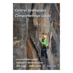
Autore/i: Steve Toal
Data: 2019
The Central Grampians Comprehensive Guide books are the most extensive climbing guide to the Grampians. With two volumes they cover the popular areas but also many of which have never been in print before.
Volume 1 of the Central Grampians guide covers the North and East regions and features over 1400 routes spread over 124 crags. Painstakingly put together by Steve Toal, his guides have now become the go-to for climbers for the area.
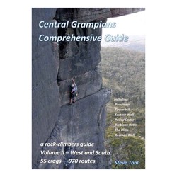
Autore/i: Steve Toal
Data: 2019
The Central Grampians Comprehensive Guide books are the most extensive climbing guide to the Grampians. With two volumes they cover the popular areas but also many of which have never been in print before.
Volume 2 of the Central Grampians guide covers the West and South regions and features over 970 routes spread over 55 crags. Painstakingly put together by Steve Toal, his guides have now become the go-to for climbers for the area.
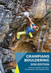
Autore/i: Simon Madden, Ross Taylor, David Peason and Taylor Parsons
Data: 2016
ISBN: 9780646955544
"Australia's premier bouldering destination! The new 2016 Edition Grampians Boulder guide authored by Simon Madden, Ross Taylor, David Peason and Taylor Parsons. It contains more than 1300 problems which is double the original guide. Heaps of new information on established areas as well as the inclusion of plenty of boulders and crags not published before. It also features update idiot proof layout and expanded history and culture notes. Get one and start cranking!"
ⓘ
Alloggi in zona more Nascondi
Condividi questo
Foto Sfoglia tutte le foto
/90/de/90de0bfcf4cf1cfd0a032cca2c3d4dd448b1fbf5)
Mt Pleasant - 20181202_162055.jpg

Stu Dobbie su Whinery Tour 14 - WhineryTour-StuDobie-1stAscent1.jpg

Stu Dobbie su Whinery Tour 14 - WhineryTour-StuDobie-1stAscent2.jpg
Ven 28 Apr
Controlla cosa succede a Mt Pleasant.
Get a detailed insight with a timeline showing
- Ticks by climbers like you
- Discussions of the community
- Updates to the index by our users
- and many more things.
Login to see the timeline!