A Crag Guide gives an extensive view of all sub areas and climbs at a point in the index. It shows a snapshot of the index heirachy, up to 300 climbs (or areas) on a single web page. It shows selected comments climbers have made on a recently submitted ascent.
At a minor crag level this should be suitable for printing and taking with you on a climbing trip as an adjunct to your guidebook.
This guide was generated anonymously. Login to show your logged ascents against each route.
Warning
Rock climbing is extremely dangerous and can result in serious injury or death. Users acting on any information directly or indirectly available from this site do so at their own risk.
This guide is compiled from a community of users and is presented without verification that the information is accurate or complete and is subject to system errors. By using this guide you acknowledge that the material described in this document is extremely dangerous, and that the content may be misleading or wrong. In particular there may be misdescriptions of routes, incorrectly drawn topo lines, incorrect difficulty ratings or incorrect or missing protection ratings. This includes both errors from the content and system errors.
Nobody has checked this particlular guide so you cannot rely on it's accuracy like you would a store bought guide.
You should not depend on any information gleaned from this guide for your personal safety.
You must keep this warning with the guide. For more information refer to our:
Usage policy
Contributors
Thanks to the following people who have contributed to this crag guide:
Neno
Alex Kinsella
Pablo
Stijn Moortgat
Tania Rodriguez
rOckpSy
The size of a person's name reflects their Crag Karma, which is their level of contribution. You can help contribute to your local crag by adding descriptions, photos, topos and more.
Table of contents
- 1.
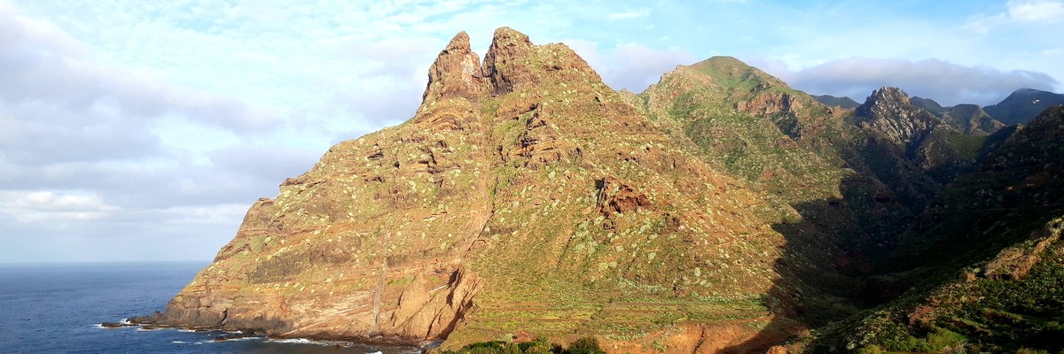
Punta del Hidalgo
7 in Area
- 1.1. Soldadito 5 in Sector
- 2. Index by grade
1. Punta del Hidalgo 7 routes in Area
- Summary:
-
Sport climbing and Trad climbing
Lat / Long: 28.567686, -16.309609
description
access issues
Most places in Tenerife enjoy free access, however, some require permission which can often be obtained in-situ through QR code scanning, such as Guaria near Guia de Isora, and also some places in the Teide National Park.
ethic
Please keep the crags noise free and clean. Take your trash and toilet papers with you. Locals tend to bring dogs to the crag. It is good manners to use your own gear at the anchors for lowering or setting up top-ropes. Use the anchor rings/carabiners only for the final lower-off after cleaning.
 |
||||||||
| Route | Grade | Style | Selected ascents | |||||
|---|---|---|---|---|---|---|---|---|
| 2 |
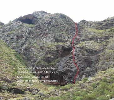
★ El Asalto de los Lajas
Warning Rock: Mojado en invierno Aproximación: por el canal del Tomadero. Se puede dejar coche subiendo el camino del Tabaibal, hay un hueco para 2 coches justo al lado del canal, donde hay unos lavaderos antiguos. Se camina por el canal con precaución hasta cruzar el puente y se continúa por el trozo de canal que sique por el barranco de Bejía. Se pasa por el pozo Brisas de Anaga y se continúa por el fondo del barranco 5 min. hasta ver el Salto de las Lajas, que es una cascada que cuando llueve baja parte del agua del canal de Bejía y lo que recoge el volcán de la rozas(El Morro). A pie de vía se ve un químico que protege un paso de IV. 30min. Largo 1: tiene un paso de V+ que se protege bien en una fisura un poco abierta. Se puede hacer por la derecha un poco más fácil. Continúa con un diedro de IV y III fácil de proteger. R1 tiene un químico y hay un bloque que se le pasa una cinta. 35m. Largo 2: será IV y III y se protege un poco peor, pero hay algún agujero para friends y empotradores. La reunión es un equipamiento de rápel que estaba ahí hace tiempo. 20m. Largo 3: Hay que caminar 50m. hasta el interior de la poza para comenzar el largo 3. Será III y IV, depende de por donde se haga. R3 tiene dos químicos. 35m. Largo 4: tiene un químico a la salida de la reunión, IV, dos químicos en el paso de V+ y un químico en el canalón, IV. El resto se protege bien. R4 tiene dos cáncamos con químico. Retorno: por el canal de Bejía, camino del Homicián y camino del Tabaibal. Se puede rapelar, aunque las cuerdas rozan bastante. 30min. Equipada por Cristóbal y Francisco Méndez, en la primavera de 2018, Aprovechando los ratos libres. FA: Neno & Francisco Méndez, Jul 2018 | 5+ | 140m, 4 | |||||
| 3 |
Este espolón travieso
http://manoloalonso.blogspot.com/2014/05/escalada-en-el-roque-dos-hermanoseste.html | 4+ | 90m | |||||
1.1. Soldadito 5 routes in Sector
- Summary:
-
All Sport climbing
Lat / Long: 28.563186, -16.321649
description
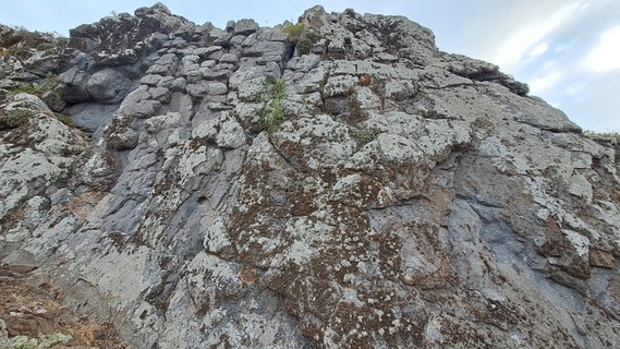
 Pequeñas placas en la montaña de Aguacada.
 Small slab on the Aguacada mountain.
approach
Subir por el Tabaibal al Homicián hasta Chijiniste(carretera estrecha y empinada).
Go up Tabaibal - Homicián - Chijiniste (narrow and steep road).
history
Circa 2000 se equipó la vía el Soldadito. Reequipada en 2023.
"Soldadito" ca. 2000. Rebolted 2023.
 |
||||||||
| Route | Grade | Style | Selected ascents | |||||
|---|---|---|---|---|---|---|---|---|
| 1 |
★★ Cabito Tomatero
FA: Priscila Méndez & Neno, 2023 | 4b | 8m, 3 | |||||
| 2 |
★★ Cabo Chusquero
FA: Priscila Méndez & Neno, 2023 | 4b | 8m, 3 | |||||
| 3 |
Soldadito Marinero
FA: Priscila Méndez & Neno, 2023 | 5c | 5 | |||||
| 4 |
Soldadito
FA: 2000 Maint: Priscila Méndez & Neno, 2023 | 5c | 10m, 5 | |||||
| 5 |
★ Capitán Toopica
Roca descompuesta abajo. Repisa en la mitad. Primera chapa alta debido al estado de la roca. FFA: Neno & Priscila Méndez, 3 Jun 2023 | 6a | 10m, 5 | |||||
2. Index by grade
| Grade | Stars | Name | Style | Pop | Area | |
|---|---|---|---|---|---|---|
| 4b | ★★ | Cabito Tomatero | 8m, 3 | 1.1. Soldadito | ||
| ★★ | Cabo Chusquero | 8m, 3 | 1.1. Soldadito | |||
| 4+ | Este espolón travieso | 90m | 1. Punta del Hidalgo | |||
| 5c | Soldadito | 10m, 5 | 1.1. Soldadito | |||
| Soldadito Marinero | 5 | 1.1. Soldadito | ||||
| 5+ | ★ | El Asalto de los Lajas | 140m, 4 | 1. Punta del Hidalgo | ||
| 6a | ★ | Capitán Toopica | 10m, 5 | 1.1. Soldadito |